Pinpoint Weather: Isolated storms possible Thursday
ROANOKE, Va. (WFXR) — Although much of the severe weather has stayed to the west and south, the chance for hit-or-miss showers and thunderstorms will continue into Thursday for Southwest and Central Virginia.
For Thursday morning, some rain showers are possible with temperatures starting in the 50s and 60s. While much of the area will be mostly dry by midday, a few isolated showers and storms may develop during the afternoon and evening as a cold front passes through. Not everyone will see rain later in the day, but storms could pack a punch. Stronger storms could produce gusty winds and hail, so stay weather-aware.

Highs on Thursday will range from the mid-70s and into the lower 80s. Breezy winds with gusts up to 25 mph are possible.
A few showers are possible on Friday. Otherwise, it will be less humid behind Thursday’s cold front. Winds will be breezy with afternoon temperatures warming up into the cooler 60s and 70s.
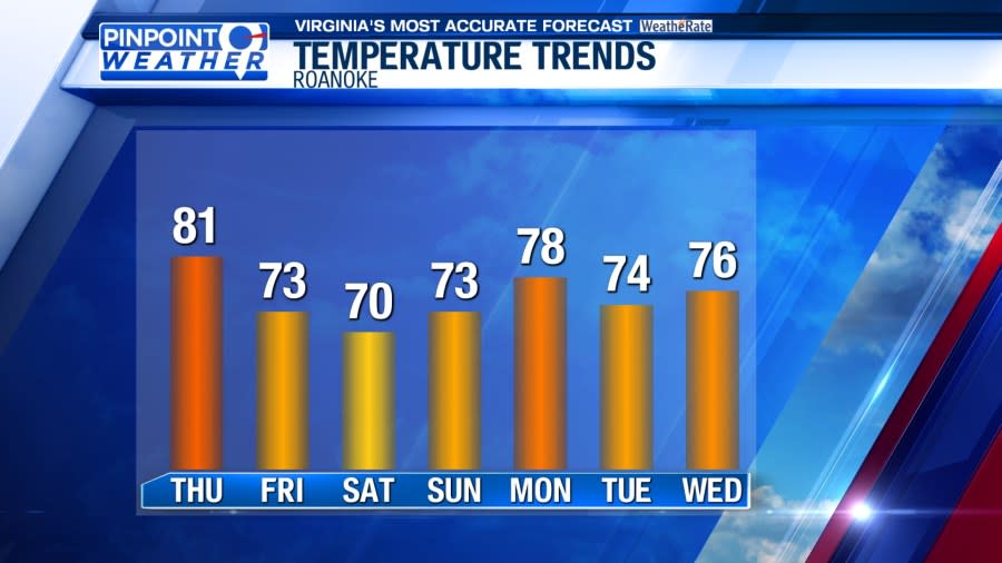
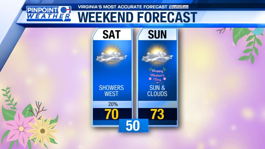
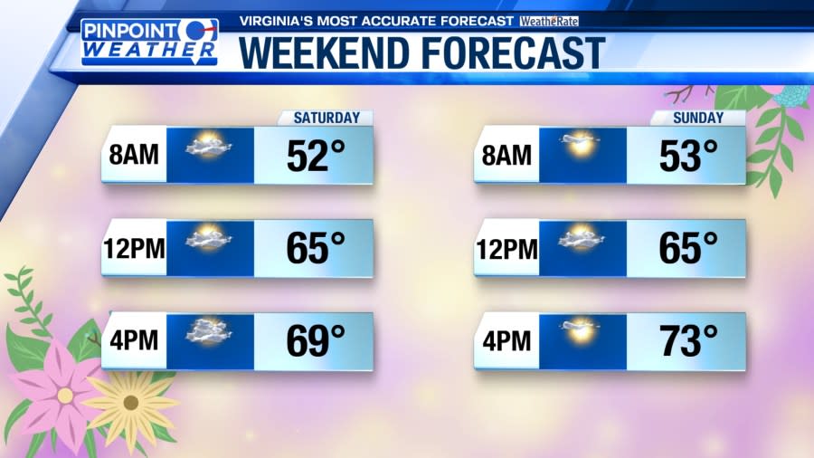
Mother’s Day weekend looks comfortably cool with a mix of sun and clouds overhead. Isolated rain showers cannot be ruled out, but we’re not expecting a washout. Highs will reach the 60s and lower 70s under a mix of sun and clouds.
Monday looks mostly dry and warmer with afternoon highs in the near-average 70s. Scattered rain showers will have the chance to return on Tuesday and Wednesday. Isolated storms may come into the mix.
For the latest news, weather, sports, and streaming video, head to WFXRtv.

