Photos: Summer snow blankets mountains across the Pacific Northwest
The first snow of the season fell across the Pacific Northwest Sunday into Monday as an autumnlike storm swept across the region.
The stage was set for this out-of-season snow at the end of last week due to a dramatic flip in the weather pattern.
"A cold front moved through the Northern Rockies late last week and cool high pressure built in from Canada behind that front," AccuWeather Meteorologist John Feerick said.
Temperatures were slashed by 20 to 30 degrees Fahrenheit in many areas in and around the mountains.
This was followed up by a storm system that brought enough moisture for a little snow to fall, Feerick added.
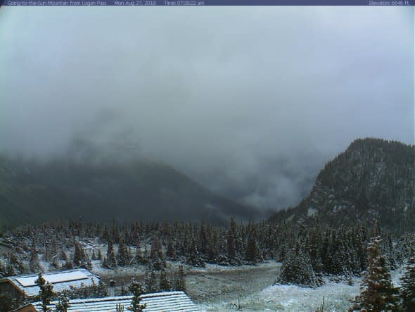
Snow at Logan Pass, Montana, on Monday morning, located around 6,600 feet. (Photo/NPS)
Most of the snow fell across the higher elevations and mountain peaks, including areas of Glacier National Park, Yellowstone National Park and Grand Teton National Park. Snow was also reported across some of the Canadian Rockies.
Accumulations were light with most areas receiving just a coating to an inch or two of snow.
The highest snowfall report came out of Wyoming's Wind River Range with a spot 19 miles northeast of Pinedale, Wyoming, measuring five inches of snow.
The system responsible for the summer snow also helped to rid the region of wildfire smoke that has lingered over the Pacific Northwest for the past several weeks.
While the snow may have come as a surprise to some residents and visitors across the region, it is not here to stay.
"It doesn't look like there's any more threats for snow in the near future," Feerick said.
Early season white-out at Jackson Hole Mountain Resort #Snow pic.twitter.com/G9F0Pf7HN2
— Cory Reppenhagen (@CReppWx) August 27, 2018
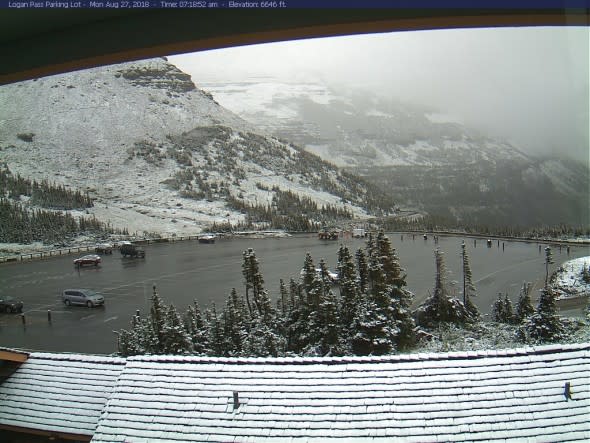
Snow whitens the non-paved surfaces around the Logan Pass parking lot of Glacier National Park (at an elevation of 6,646 feet) in Montana. (Image/United States National Park Service)
The first snow of the season near Cook City, Montana. (Photo/Michael Graef)
A goodbye gift from Yellowstone the first snow of the year! pic.twitter.com/zdZg5krMtn
— PirateLadyVader (@PirateLadyvader) August 27, 2018
Fresh snow on top of the Tetons this morning. Hike postponed until tomorrow. pic.twitter.com/Fz3hp1wiDN
— Jason Davis (@jdavisvu) August 27, 2018
