Photos Show Wall of Fire and Smoke in Iceland's Latest Eruption

A large portion of southwestern Iceland that includes world-famous attractions like the Blue Lagoon has been dealing with volcanic eruptions since late 2023. The eruptions forced the evacuation of the fishing town of Grindavík and have been captured in striking images showing large plumes of smoke and burbling molten rock. At night, the region looks a bit like Mordor, and during the day, the bright orange lava provides a stark contrast to the snow-covered landscape.
According to Iceland’s Meteorological Office, the latest eruption began shortly after 10 p.m. local time on March 17, and the lava flow has since subsided significantly. Photos of the eruption make for some remarkable viewing.
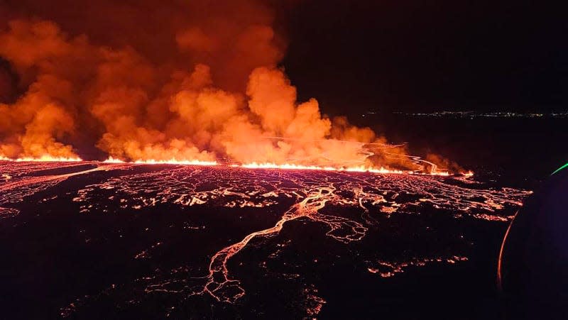
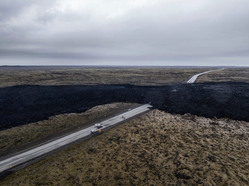
Lava from the air
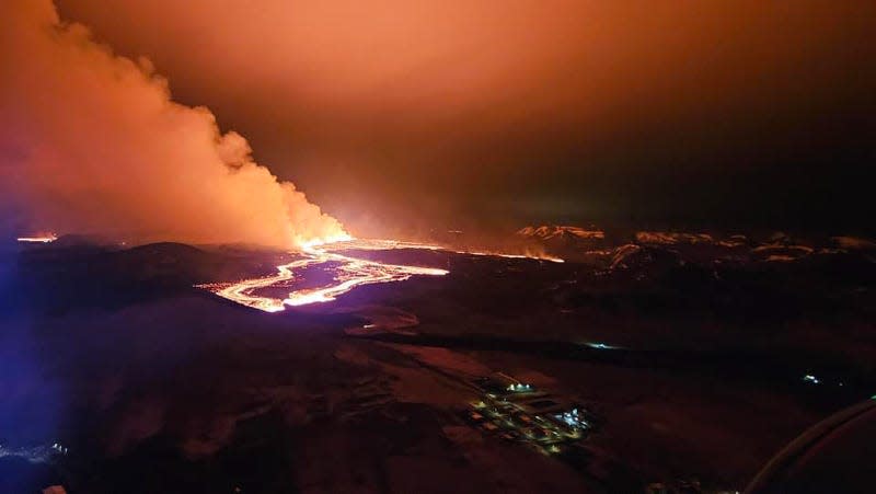
Smoke and lava issue from a crack in the ground near Grindavík, Iceland.
Wall of smoke
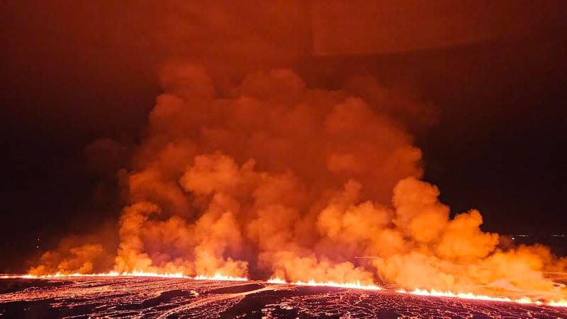
A unique view of the eruption shows a long crevasse spewing lava and smoke.
Smoke plumes and lava
The lava encroaches on a string of lights on the ground, and illuminates the smoke plume above it.
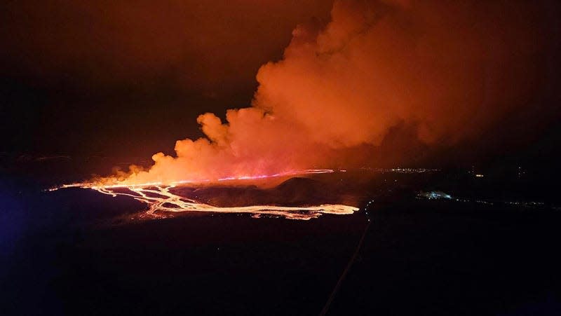
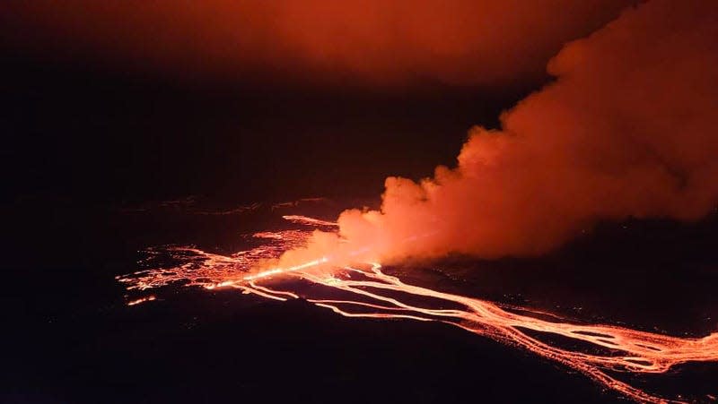
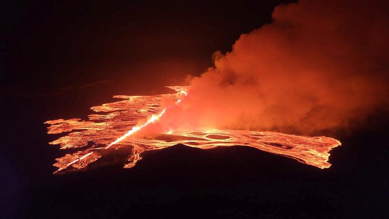
The eruption from above
A nighttime shot of the eruption shows the length of one flow, and several areas where the eruption is more violent.
The eruption covers infrastructure
A network of molten rock pours from the eruption’s source. According to Iceland’s Meteorological Office, the eruption is making some roads impassable and threatening others.
Geometry of the eruption
This view offers a unique vantage point of the lava flows. On one side, the lava is more diffuse, and on the other side of the eruption, the molten rock forms fewer, but thicker, bands across the landscape.
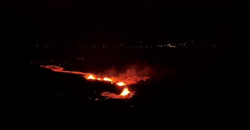
Lava in every direction
Another angle shows lava flowing on the far side of the smoke plume, in line with the main fissure.
Ominous smoke plumes
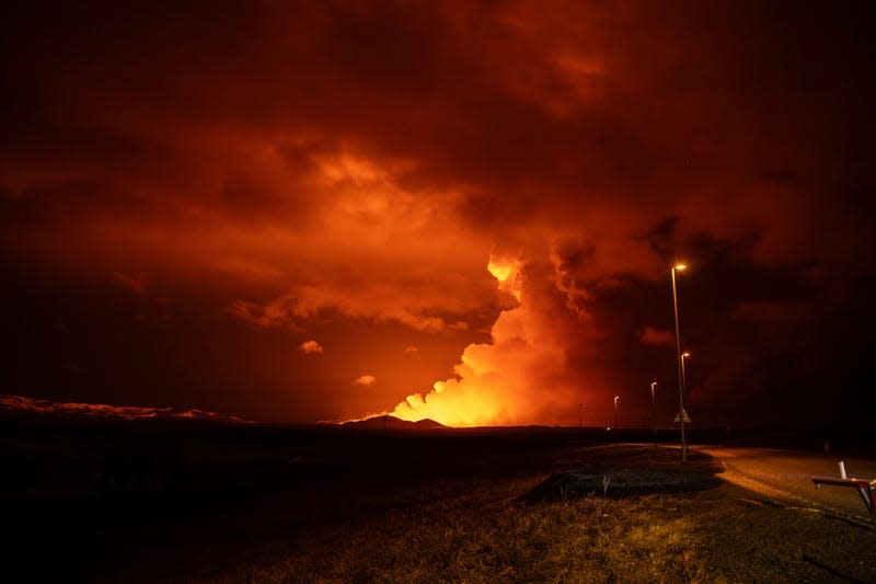
Smoke—illuminated by the lava on the ground—is bright orange in the night landscape between Hagafell and Stóri-Skógfell, Iceland.
Emergency vehicles and road closures
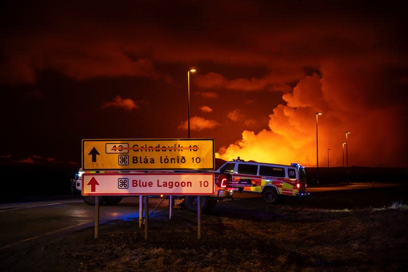
I wouldn’t recommend going to the Blue Lagoon at the moment. The attraction was closed due to the nearby eruption.
Emergency response
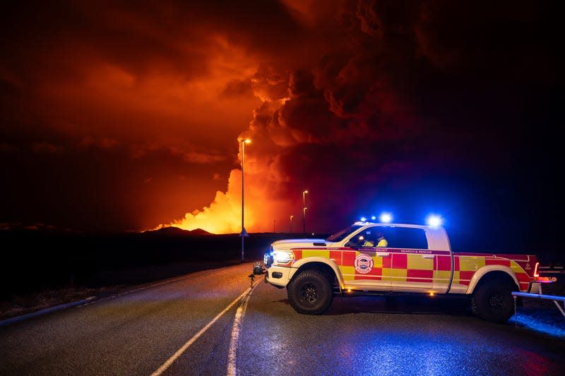
A vehicle sits in the road, with the eruption ongoing in background.
Lava in the road
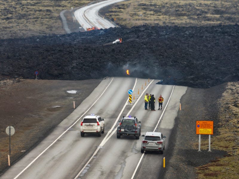
A lava flow straddling Grindavikurvegur, the road that leads to Grindavík.
A sizable lava flow
This daytime shot reveals the scale of the lava flow, which buried a local road.
It makes for good viewing
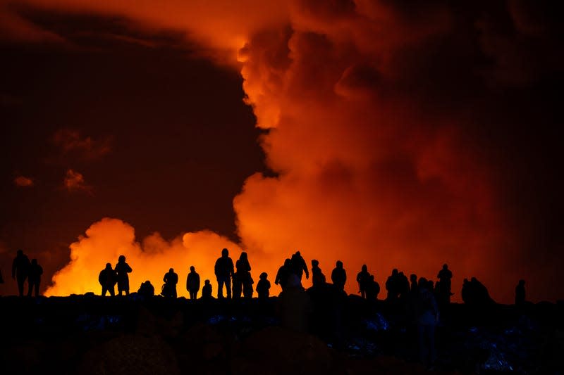
People cluster on a hillside to observe the eruption (in background). The eruption is the fourth in three months in the area.
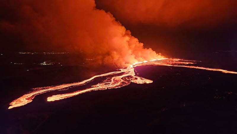
The eruption from above
A final view of the eruption’s scale, provided from a video by Iceland Civil Defense.

