Before and after photos: Harvey's devastating floods are clearly visible from space

Even from space, the flooding disaster caused by Hurricane Harvey is clear as day.
New images taken by DigitalGlobe’s WorldView-2 satellite show the catastrophic flooding in Texas left in the wake of Harvey this week. The new photos are particularly striking when compared with earlier images taken from orbit that show green fields instead of brown, flooded land.
SEE ALSO: Tropical Storm Harvey's mind-blowing stats
"Since Aug. 19, DigitalGlobe’s constellation of five high-resolution imaging satellites has taken 77 images of the Texas coastline, totaling more than 180,000 square kilometers from Corpus Christi to Port Arthur,” DigitalGlobe said in a statement.
"Now that the clouds have parted, the imagery is starting to reveal the vast impact of the flooding across the region."
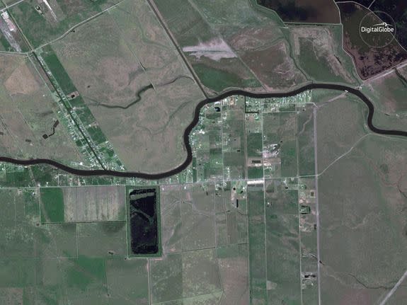
Image: satellite image ©2017 DigitalGlobe
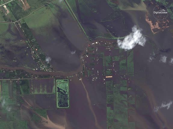
Image: satellite image ©2017 DigitalGlobe
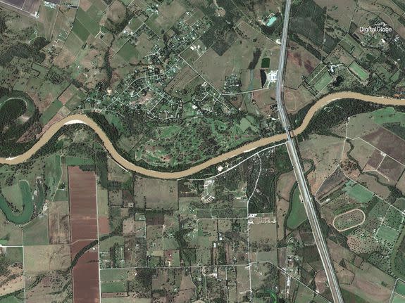
Image: satellite image ©2017 DigitalGlobe
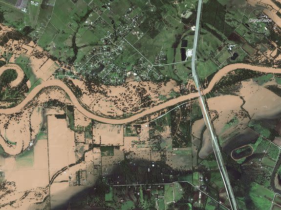
Image: satellite image ©2017 DigitalGlobe
Harvey is a record-setting beast of a storm. The storm, which initially hit land as a Category 4 hurricane but then transitioned into a tenacious tropical storm, is now considered the most extreme rainstorm in recorded U.S. history. Harvey dumped more than 19 trillion gallons of water on Texas in less than a week.
The storm produced 51.88 inches of rain at Cedar Bayou, Texas, beating the all-time state and continental U.S. rainfall records for the heaviest rainfall ever seen in a tropical storm or hurricane.
In addition, Harvey brought 30-inches or more of rain to such a large area that it qualifies as an unprecedented rainfall event since record-keeping began in the U.S. 1895. A staggering 23 locations in Texas saw 40 inches or more of rain. To put this into perspective, some areas saw a year's worth of rain in just 4 days or less.
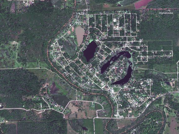
Image: satellite image ©2017 DigitalGlobe
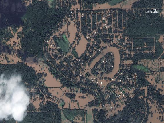
Image: satellite image ©2017 DigitalGlobe
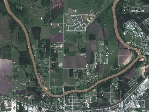
Image: satellite image ©2017 DigitalGlobe
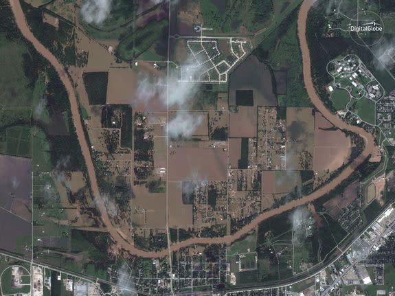
Image: satellite image ©2017 DigitalGlobe
In Beaumont, Texas on Aug. 29, 26.03 inches of rain fell in 24 hours. That obliterated the previous record for the wettest day and even beat that city's all-time monthly rainfall record by nearly 4 inches.
DigitalGlobe is planning to provide their images for recovery efforts. The full impact of the devastation caused by Harvey is only just starting to become clear as the storm moves away from Texas.
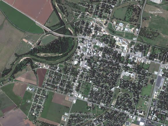
Image: satellite image ©2017 DigitalGlobe
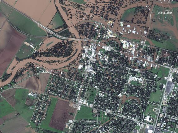
Image: satellite image ©2017 DigitalGlobe
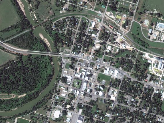
Image: satellite image ©2017 DigitalGlobe
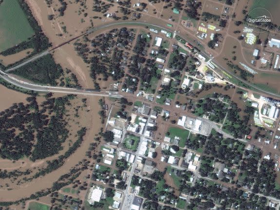
Image: satellite image ©2017 DigitalGlobe
Andrew Freedman contributed reporting to this story.
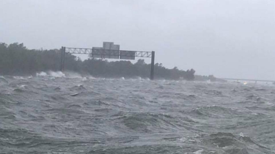
WATCH: Catastrophic floods turn Texas highway into a large body of water with intense waves