Palm Springs to chart new path for north end, including land where COD once planned campus
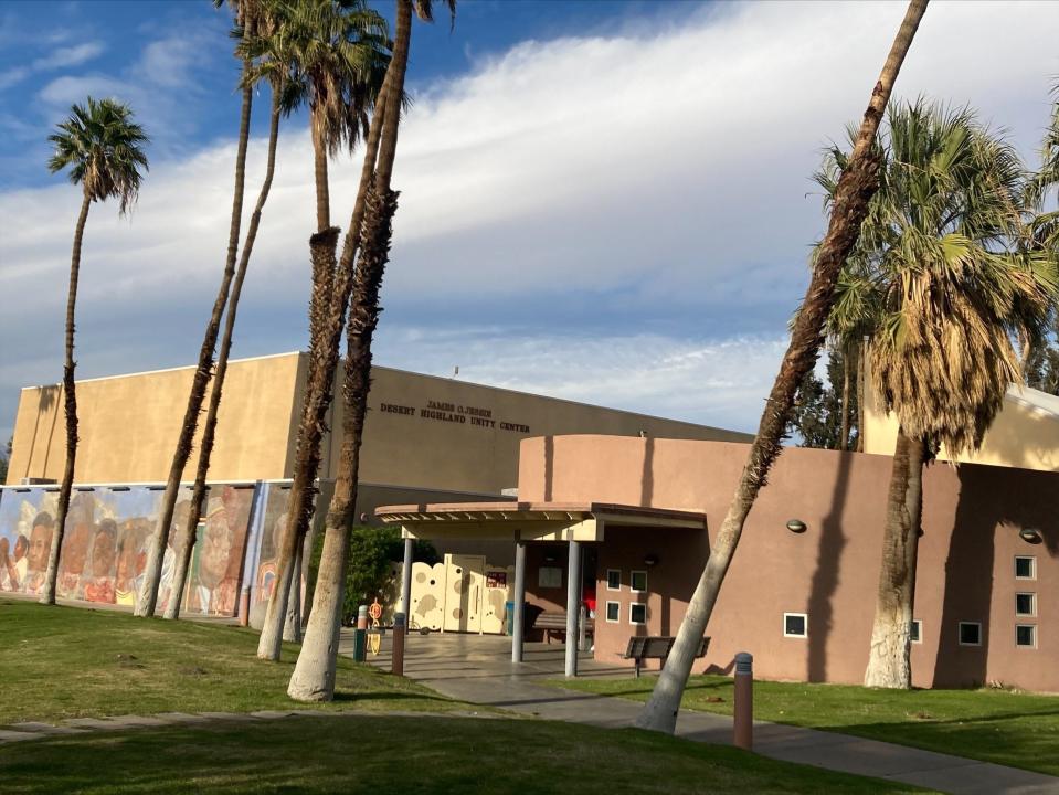
The Palm Springs City Council voted Thursday to start charting the future of a swath of the northern end of the city that includes both a historically Black neighborhood and 119 acres of vacant land that were once the intended site of a College of the Desert campus.
The vote authorized city staff to pay about $250,000 to a Palm Desert land planning and research firm to revise the city’s existing strategic plan for an area including the Desert Highland Gateway Estates neighborhood and nearby areas.
A city staff report says the goal is a plan that "promotes quality and affordable housing and economic development," which have been key issues in lower-income parts of north Palm Springs where residents have long said they need more nearby amenities, including a full-service supermarket.
What is a specific plan?
The purpose of the plan is to create a vision and framework to make sure the future development of the area is responding to residents' needs, City Planning Director Chris Hadwin said. The plans usually include zoning rules that define what can and cannot be built or located in the area and other standards for development, which can sometimes differ from those in other parts of the city.
The plan will also address transportation in the area, including how to promote walkability and alternative forms of transportation.
Where is the area?
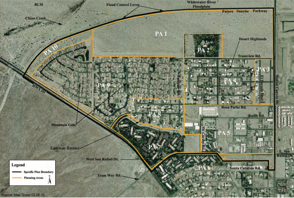
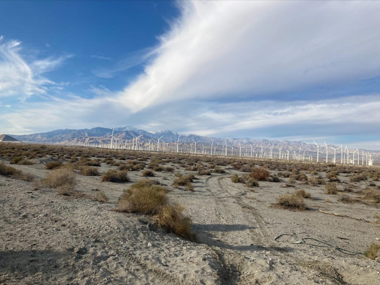
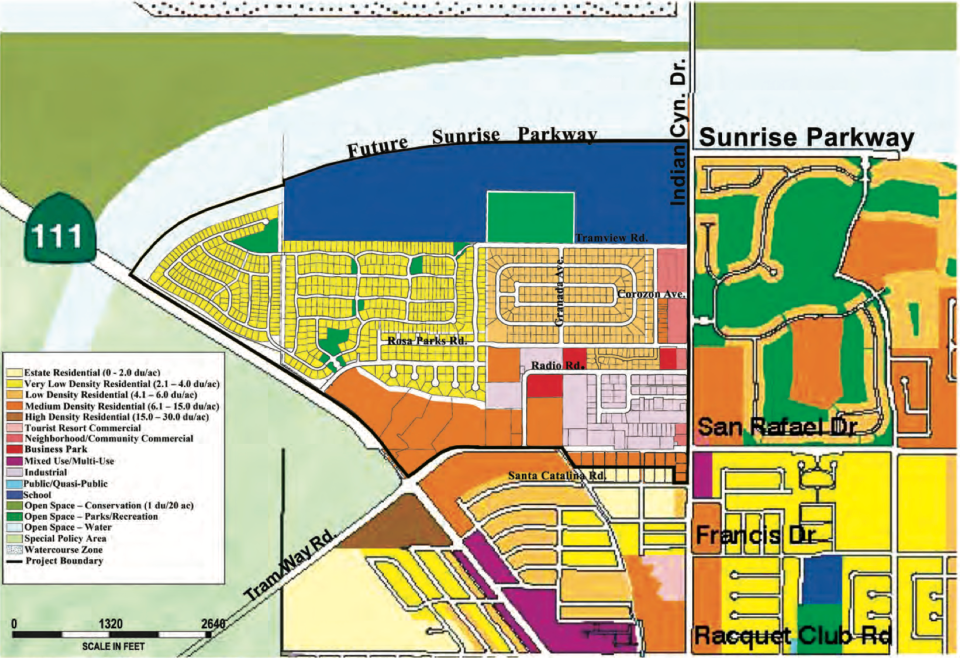
The plan covers an area encompassed by Indian Canyon Drive to the east, the Whitewater Wash to the north, Palm Canyon Drive to the west and San Rafael Drive to the south. A small area on the south side of San Rafael Drive near Indian Canyon Drive that includes a new Tower Market gas station and store and neighboring undeveloped land is also part of the plan.
The area includes the Desert Highland Gateway Estates, Palm Springs Villas II and Mountain Gate residential communities, plus the COD-owned land and an industrial area that is home to the city’s in-progress homeless navigation center.
Why is the city doing this now?
The current plan for the area was approved by the council in 2011, when College of the Desert was planning to build its west Coachella Valley campus on 119 acres of land just north of Desert Highland Gateway Estates near the intersection of Indian Canyon Drive and Tramview Road that were given to the college by the city in 2010.
Hadwin explained Thursday that 2011 plan was largely centered on that planned campus being the basis for development in the neighboring areas. However, that campus was never built after a planned partnership between COD and Southern California Edison fell apart, and COD turned its attention to building the campus on the former mall site near Palm Springs High School.
Hadwin said Tuesday that the plan revision will allow the city to come up with new visions both for what could go on the 119 acres and how the entire area could better serve the needs and interests of both area residents and the larger city.
Hadwin said the process will consider ”how we can sort of remove barriers and attract the right mix of housing, jobs and services to serve that community now and in the future.”
How will residents be involved?
The company the city hired, Terra Nova Planning & Research Inc., will help lead the planning process. Hadwin said it will include the creation of an advisory committee consisting of local community leaders who will help ensure the city is able to garner input from a diverse group of residents. The city will also seek to get input from residents through a mix of surveys, workshops and other efforts.
During the discussion Thursday, Councilmember Christy Holstege asked that the city work to make sure it is truly getting input from a diverse and representative group of residents, which she said has sometimes been a challenge in the past.
What will the plan be called now?
The 2011 plan was called the College Park Specific Plan after the planned COD campus. However, Hadwin said that part of the process would involve coming up with a new name that would better reflect the vision for its future.
How long will the process take?
Hadwin said revising the plan would take about a year and be completed in mid-2025.
What's next for the land owned by COD?
In 2020, College of the Desert entered into an agreement to sell the 119-acre property to a developer that planned to build 500 homes and 350 condos on the site.
However, a city staffer told The Desert Sun in 2021 that the developer could not move forward with those plans because the city placed a deed restriction on the property requiring it to be used for educational purposes when it gave it to College of the Desert. He also said the developer, Watermarke Homes, had approached the city about removing those restrictions.
It is unclear if Watermarke is still seeking to develop the property now, and that question was not addressed by the council Thursday. However, during a public event held by the college in October, College of the Desert President Laura Hope answered a question from a Palm Springs resident by saying negotiations around the property remained in progress and that the college was really hopeful for a good outcome. She did not elaborate.
Hadwin did say Thursday that the deed requiring the site to be used for educational purposes remains in effect and that the specific planning process would help the city determine what kind of uses it would like to see at the site.
It seems a safe bet that housing development will be at least part of the plan for that land, given its size and the widespread belief shared by the council and many residents that Palm Springs is plagued with a housing shortage that has left the city unaffordable to many.
Paul Albani-Burgio covers growth, development and business in the Coachella Valley. Follow him on Twitter at @albaniburgiop and email him at paul.albani-burgio@desertsun.com.
This article originally appeared on Palm Springs Desert Sun: Palm Springs to ponder future of its north side. What to know

