Pacific Crest Trail hikers are dealing with California's historic snow, climate change
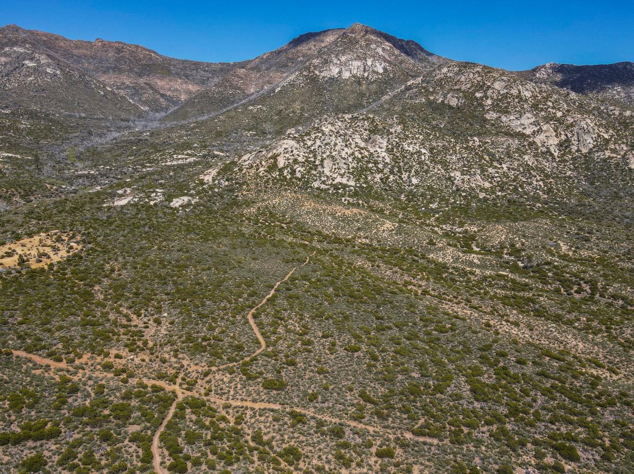
Tommy Slabaugh and a group of fellow northbound Pacific Crest Trail hikers set up camp for the night on May 9 near Apache Peak, located near mile 169 of the 2,650-mile trek in the San Jacinto Mountains.
It was windy, but the sky was clear and precipitation wasn’t in the forecast ― so the group decided to cowboy camp, or sleep out on the ground without a tent or shelter, rather than deal with the struggle of setting up tents and keeping them up overnight during windy conditions. But at some point between 9 p.m. and midnight, it started raining, then later snowing.
A little before midnight, Slabaugh decided to bail. “I was starting to not be able to feel certain parts of my body,” he said of the cold and wet weather.
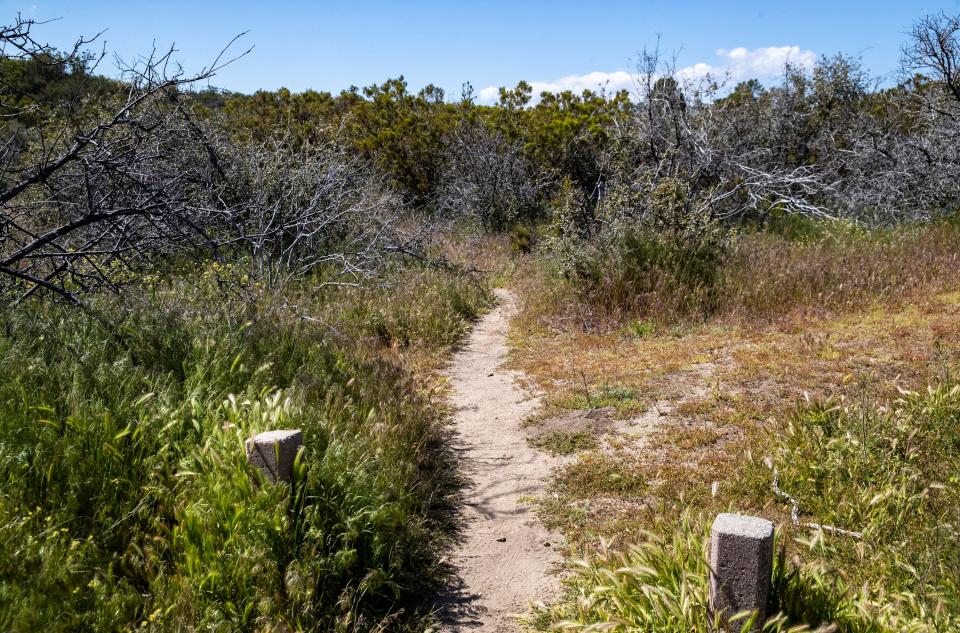
Slabaugh backtracked about a half-mile along the PCT to reach the Spitler Peak Trail, a roughly 5-mile trail that connects with the PCT and leads to starts at Apple Canyon Road, about 6 miles east from Mountain Center. He descended from the PCT via Spitler Peak Trail, turned left onto the road, and hiked a few more miles to set up camp at the lower-elevation Hurkey Creek Campground, just off Highway 74, around 3 a.m.
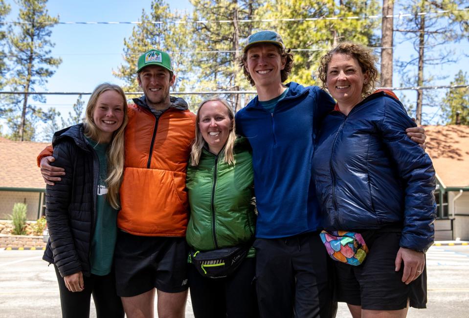
The next morning, waking up near Apache Peak to new snow on the ground and ice on the trees, the rest of the group decided to follow suit and leave the PCT. They’d originally planned to wake up early Wednesday morning and hike about 10 miles further past Apache Peak to Saddle Junction, where they could descend the 2.5-mile Devils Slide Trail to reach Humber Park in the town of Idyllwild, where they planned to take a “zero day” Thursday, or a rest day without hiking.
Instead, with members of the group cold, wet, and reaching the point of “a little hypothermic,” they decided to turn around and also hike back to the Spitler Peak Trail, opting to “take the alternate trail so that we could just get off the the mountain and get down and get warm,” fellow PCT hiker Leonie Short said.
The stretch of the PCT near Apache Peak where they turned around has proven treacherous and even deadly in past years. And while the group says their decision to turn around was driven more by feeling cold and wet than the trail conditions, there's a broader awareness this year of “knowing where the bailout options are and being willing to take them,” said Katharine Schumacher, another hiker in their group.
It's just one example of how this year's experience on the Pacific Crest Trail is being shaped by decisions about when to leave the trail, as California's historic snowpack presents the latest challenge along the storied trail that's increasingly impacted by extreme weather, wildfires and climate change.
San Jacintos are the first serious snow along the trail
PCT hiker Trevor Laher died in March 2020 after slipping on ice and sliding about 600 feet while hiking around the side of Apache Peak, where the PCT is narrowly cut into the side of the mountain with a steep drop-off. The ice was hidden by the layer of fresh snow. In the years since, Trevor’s father Doug Laher has embarked on a campaign for trail safety, calling on hikers to “embrace the alternate” when trail conditions seem unsafe and to consider the Spitler Peak Trail as a “bailout point” when the Apache Peak route looks icy or dangerous.
Trevor notably didn’t have his ice axe and microspikes on the trail while traversing through that section of trail, which has also renewed calls for hikers to have the proper gear, like microspikes, crampons, and ice axes, while traveling through the San Jacintos.
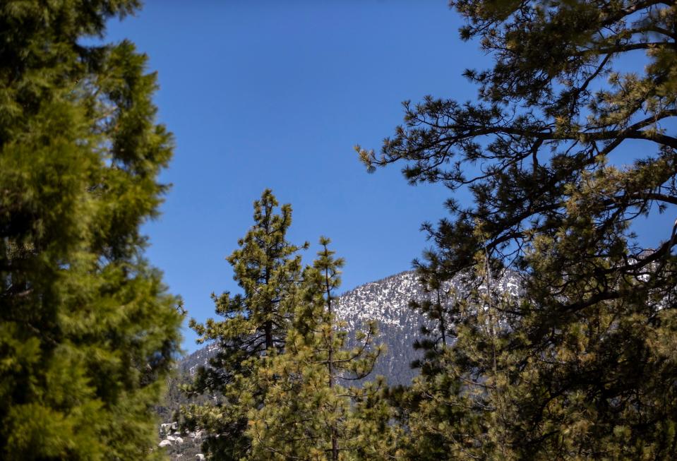
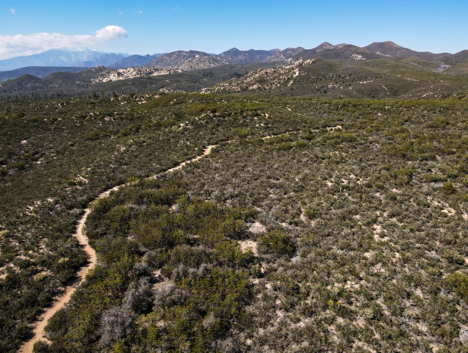
The section of the PCT that runs through the area is notorious for snow and ice, and the San Jacintos are considered the first significant mountain range with such extreme conditions that northbound PCT hikers encounter on their 2,650-mile journey.
In April 2019, there were two rescues within the span of a week of hikers who slipped off the steep and icy trail near Apache Peak. And the day after Laher's death in 2020, two PCT hikers were rescued in the same location after one got stuck in an icy section and the other slipped off the side of the trail and fell about 60 feet.
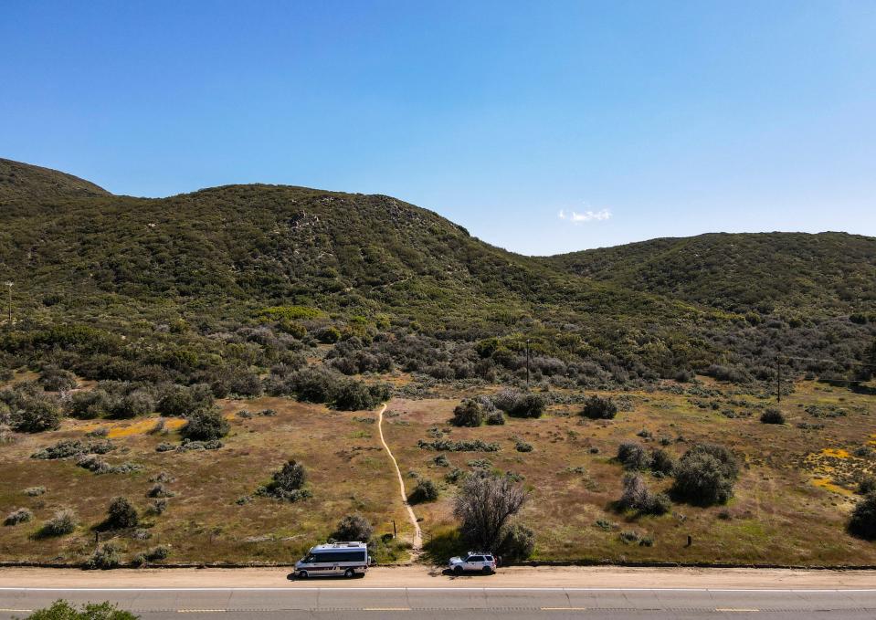
This year, local mountain rescue team Riverside Mountain Rescue Unit took the unusual step in early March of telling Pacific Crest Trail hikers to skip the section San Jacintos entirely, representing a stretch of roughly 60 trail miles from Paradise Valley Cafe on Highway 74 in Mountain Center to Interstate 10 at Cabazon.
"Due to dangerous conditions, it is advised to skip this entire section. If you choose to hike north be prepared to turn around, have a Plan B, or hike later after the snow melts and conditions improve. Don't put yourself or others at risk because you made a bad decision," wrote Riverside Mountain Rescue Unit in a Facebook post on March 1.
Riverside Mountain Rescue Unit President Eric Holden believes most PCT hikers coming through the area earlier in the season heeded this advice and skipped the San Jacintos. Despite the heavy snow totals, the unit has had zero rescues of PCT hikers so far, while the organization typically has completed between three and five rescues by mid-May.
With summer around the corner, Holden says that the area “definitely isn’t as dangerous as it was (in March),” although there’s still on snow on the ground and he still advises that hikers have crampons or microspikes while trekking through the San Jacintos.
When hiker Kyle Pierce reached Paradise Valley Cafe on April 18, he said the mood among hikers shifted as they began thinking about the snowy and icy trek ahead of them.
“Everybody had a look on their face like they were about to go meet a ghost,” Pierce said. “Because of Trevor’s accident it’s a highly discussed spot, it’s the first spot that’s just covered in snow, and it’s known as one of the more dangerous stretches of trail.”
Speaking with The Desert Sun over the phone on May 5, Pierce said he felt comfortable tackling that section with his crampons and a whippet, a ice pick-like attachment added to a trekking pole, but he struggled to find another hiker at Paradise Valley Cafe who also planned to continue onward, with most discussing turning around, using an alternate route, or starting up the trail with plans to turn around if it looked dangerous.
He eventually found one hiking partner who planned on continuing, out of roughly 30 people at Paradise Valley Cafe that day.
“It is dangerous if you have no traction on your feet, I felt like it was doable for me with the right gear and with my ability,” Pierce said.
How climate change is reshaping the PCT
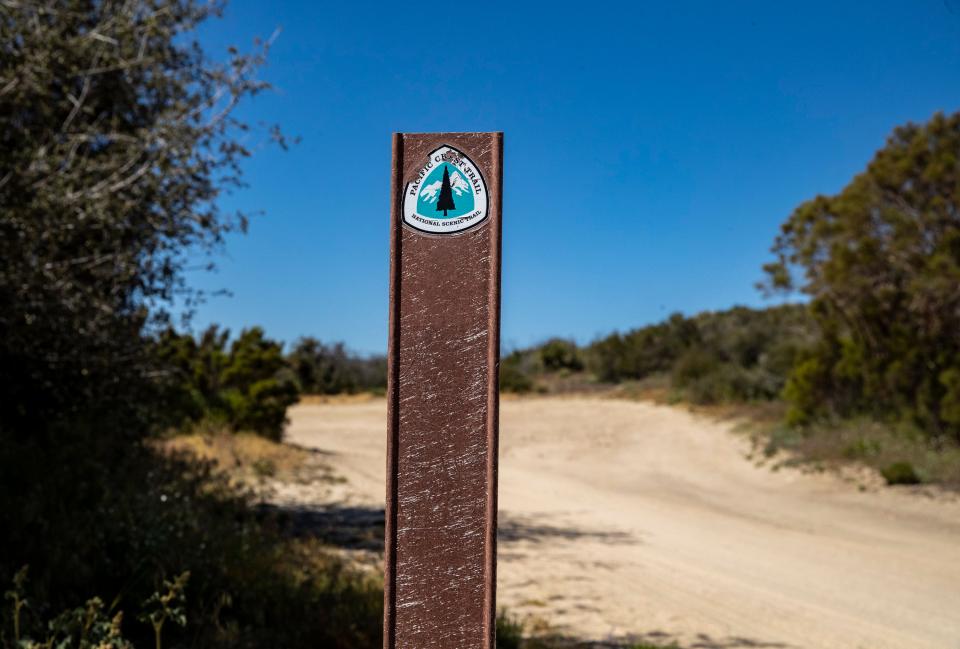
The Pacific Crest Trail spans 2,650 miles from the Mexican border through California, Oregon and Washington before ending at the Canadian border, covering a wide variety of landscapes and symbolizing “everything there is to love—and protect—in the Western United States,” according to the PCTA.
The number of Pacific Crest Trail hikers has dramatically increased in recent years, which many attribute to the release of Cheryl Strayed's book "Wild" in 2012 and the movie with the same title starring Reese Witherspoon released in 2014.
The book and movie chronicle Strayed's 1,100-mile solo journey on the Pacific Crest Trail in 1995 after a divorce and her mother's death. Strayed notoriously embarked on the trail without any previous backpacking experience.
A total of 4,125 northbound thru-hike permits were issued for the Pacific Crest Trail in 2022, up from 988 in 2013, according to the Pacific Crest Trail Association. The total number of permits, which also includes the less-popular southbound route or permits to hike just a section of the trail, was 7,852 in 2022, up from 1,879 in 2013. Just 603 of those permits were for southbound thru-hikes.
Among this year’s class of PCT hikers, there’s a lot of discussion about alternate trail options, skipping sections, and “flip-flopping,” or doing sections of the trail out of order, as California’s historic snowpack represents the latest example of how more extreme weather and other impacts of climate change are reshaping the culture of the storied Pacific Crest Trail.
“The big thing for this year is the Big snow, with a capital B,” said Scott Wilkinson, director of marketing and communications for the Pacific Crest Trail Association. “This is a reflection of the kind of weather extremes that are driven by climate change that we're seeing more of and we're going to continue to see more of over the next few years. . . We've kind of reached a point on the Pacific Crest Trail where I think it's time for people to start reimagining the concept of the PCT experience.”
“There's a good possibility that the days of hiking the PCT from beginning to end are over, and it may very likely be impossible in the not too distant future to be able to do that. It's been almost impossible the last few years, due to wildfires and other extreme weather events, like the big snow that we had this winter,” Wilkinson continued.
This year, it’s the “Big snow.” In past years, drought has made it more difficult to find water sources on the trail, and hikers have dealt with extreme heat as temperatures climb upward. More frequent and intense wildfires in the West, driven by climate change, also have impacted the trail. Last year, the Dixie Fire in Northern California burned approximately 85 miles of the PCT, burning more miles of the trail than “any other fire in memory,” according to the Pacific Crest Trail Association. In August 2021, the U.S. Forest Service closed all of California’s national forests but one due to multiple raging wildfires in the state. Already this year, the Nob Fire near Lytle Creek closed nearly 20 miles of trail for about a week in late April through early May.
“Your best-case scenario (for snow) is the drought years, but then that’s when the fires really get us,” Slabaugh said.
“You’re on your own out there. Be prepared. There are tens of thousands of wildfires every year, and because of drought and our changing climate, they’re growing in number, size, and intensity,” reads guidance from the PCTA on how hikers should react to wildfires. “Fire can move like a freight train – many times faster than you can run. Get away as quickly as you can.”
And even when hikers aren’t escaping an active wildfire or facing stretches of closed trail due to fire, smoke can cause air quality impacts for hikers miles away from the actual fire.
The PCTA now warns that the days of thru-hiking the PCT in one continuous stretch, or a “continuous footpath,” may be over, since hikers are likely to face at least one, if not several, of these threats along the trail each year. Instead, the future of PCT hiking could involve hiking the trail over multiple years, or hiking the trail out of order depending on what sections are available.
“The PCT will always offer a world-class wild and scenic experience for people that want to take advantage of that, what's changing is the order in which you hike the trail, the length, duration, and time of year of your hike. So within all of those variables, we’re looking at a future where people are going to have to mix it up more,” Wilkinson said.
Hikers face snow, drought, wildfires, high temperatures
On the same Tuesday evening that Short and Slabaugh's group was setting up camp near Apache Peak, another group of hikers was celebrating their completion of the San Jacintos with dinner at the In-N-Out in Cabazon, while reflecting on this year’s trail conditions.
“It really felt like one mistake could be it for hours on end,” said Allan Roth, explaining that the group felt very exposed on a steep ridge in the afternoon, when the snow and ice was more slushy and slippery after sitting in the sun all day. It took the group about 10 hours to hike a 5-mile section from Strawberry Junction Campground to Fuller Ridge.
But even with this year’s historic snowpack creating challenging conditions, the group acknowledged that it no longer feels like there’s a perfect time to take on the PCT. Roth was really looking forward to the Sierras, but doubts he'll feel comfortable going through that section this year due to the snow.
“I thought about two things. One, it’s not going to get better. Climate change is going to get worse and there are going to be more fires, it’s going to be more unusual weather. And this was also the right time for me. So am I going to worship at the grail of the continuous footpath, or am I going to pursue a unique experience that’s right for this time in my life?”
Most PCT hikers travel from south to north, which means trying to get through the Southern California desert section before it gets too hot, but starting too early means possibly reaching the Sierra Nevada mountains while the trail is still blanketed in snow. Most northbound thru-hikers start the PCT in mid-April through early May.
“Many people want to start early. Beware,” warns the PCTA. “Snow covers sections of the trail in the spring and early summer. In Southern California, dangerous stretches blanket the trail within the first 200 miles of the border. If you head into the Sierra too early, you’ll face significant snow and stream-crossing obstacles.”
But “late starts also present problems. Southern California can be dangerously hot and your safety may be at risk.”
While timing a PCT thru-hike has always been a bit of an art, extreme weather and wildfires is making planning a PCT thru-hike even more complicated and unpredictable ― and in recent years, nearly impossible.
“I agonized over my start date and it almost felt like there's no perfect start date, because as soon as you eliminate one risk, you bump up into another. Do you want to deal with the snow or deal with the blazing hot desert?” asked Anna Dearybury, another hiker at In-N-Out with Roth last week.
One member of their group was very familiar with these competing threats. Sweet Greens, a hiker from Sydney, Australia who only provided his trail name ― given for his tendency to sprinkle sugar on leafy greens ― attempted the PCT last year. He left the trail dehydrated near Big Bear after struggling to find consistent water during the extreme drought conditions.
Andrew Ormonde had an early start date this year on March 8, a week after the first permits are issued to start the northbound hike. The Upland resident knew it would be a “very, very unusual year” when it started snowing at Disneyland while he was at the amusement park with his family on March 1 before starting the trail, he told The Desert Sun over the phone on May 8.
“Going into this year, I was hoping the trail would help me become more flexible and able to go with the flow, and particularly with starting as early as I did, that lesson has been enforced over and over again,” Ormonde said.
Ormonde first reached Paradise Valley Cafe in late March, just after the U.S. Forest Service lifted its full closure of the entire San Bernardino National Forest in California, including 212 miles of the Pacific Crest Trail, due to public safety concerns following one of the biggest snowfalls in Southern California history. But just because the section of trail was “legally open” didn’t mean it was necessarily safe, said Ormonde, and a closure was still in effect for the Mt. San Jacinto State Park. Ormonde went home to Upland for a week to figure out his next steps, a luxury he acknowledges might be more difficult for hikers that aren’t local to Southern California.
Ormonde and his hiking partner decided to “flip-flop” the trail, completing sections out of order, starting by hiking southbound from near Tehachapi to Acton, then skipping the San Gabriel Mountains and hiking from the Cajon Pass to Big Bear, then from Big Bear on down to Cabazon and the trail’s junction with the I-10. Ormonde then returned to Paradise Valley Cafe to embark on the San Jacintos, completing that section by meeting back up with Cabazon at Interstate 10 on May 3, roughly a month after he first flip-flopped away from that section of trail.
“To have a continuous footpath on the Pacific Crest Trail is probably not really possible now,” Ormonde said.
Instead of intensely focusing on completing the PCT in sequential order, Ormonde is focused on finding joy in smaller moments along the trail, such as paying attention to flowers along the trail and spotting snapdragons, one of his favorite flowers.
More deep snow in store throughout the trail this year
Short and Slaubaugh’s group initially planned on waking up in the morning after their night spent near Apache Peak, then hiking another 10 miles along the PCT to Saddle Junction before taking a rest day in Idyllwild. But after descending the trail early, they spent Thursday discussing their next steps. They decided they probably wouldn’t go back go back to make sure they hit those 10 miles of the PCT, instead restarting the trail at Saddle Junction on Friday as they’d originally planned. Backtracking to the spot where they’d left the trail would complicate their plans, and add an extra 5 miles of uphill hiking just to make sure they saw roughly 10 miles of the PCT.
The group says while some hardcore PCT “purists” might argue that skipping miles means they didn’t fully hike the PCT, they don’t follow that mentality.
“I don't know that those extra 10 miles of the PCT is so spectacularly different from anything else that we've done that we're going to regret missing it, it’s like less than 0.1% of the trail,” said Short. “Our group is not particularly worried about being purists and pushing through, we’re old enough and experienced enough that we don’t care if we have to turn around and go back, if we know that’s the best option for us.”
“We’d rather go back than die,” added Jackson Hawkins.
They’ll need this mentality as they continue northward to the Sierras and other mountain ranges throughout the trail, as once hikers reach the Sierras around mile 700, “from that point all the way to Canada, the next 2,000 miles of trail is underneath several feet of deep snow still, with the exception of only very few relatively short sections,” says Wilkinson. “This is the time to be flexible and creative, and probably think about letting go of this passion for hiking every foot of the trail from one end to another because it's probably not going to happen.”
The group is currently discussing what they’ll do about the Sierras. Hawkins and Slabaugh are thinking that once they reach Kennedy Meadows, considered the gateway to the Sierra Nevada around mile 705 of the PCT, they’ll probably leave California and flip upwards to the northern terminus in Washington, then begin hiking southbound. Other group members are discussing whether they’ll do the same.
“I think the idea of the PCT in previous years has been this classic straight thru-hike north to south or south to north. That is almost never going to happen again, either because of the snow, climate change is causing things to be more extreme, wildfires,” said Short. “I think (future hikers) should be prepared to give up on that dream of a classic PCT.”
This article originally appeared on Palm Springs Desert Sun: Pacific Crest Trail hikers are dealing with snowpack, climate change

