Oregon weather: Heavy rain in valley, major snowfall on Cascade passes over weekend
The wildest weather of the season is expected to hit Oregon beginning Friday and lasting through the weekend, according to the National Weather Service in Portland.
An atmospheric river is forecast to dump 1 to 2 inches of rain in the Willamette Valley and 3 to 5 inches in the mountains while heavy snow piles up on Cascade Range passes.
No significant flooding is expected, as most river levels are currently low, but smaller coastal creeks and urban streams could overflow their banks, meteorologists said. Power outages might also be possible given winds gusting as high as 40 mph, mainly on Friday, with winder conditions in the mountains.
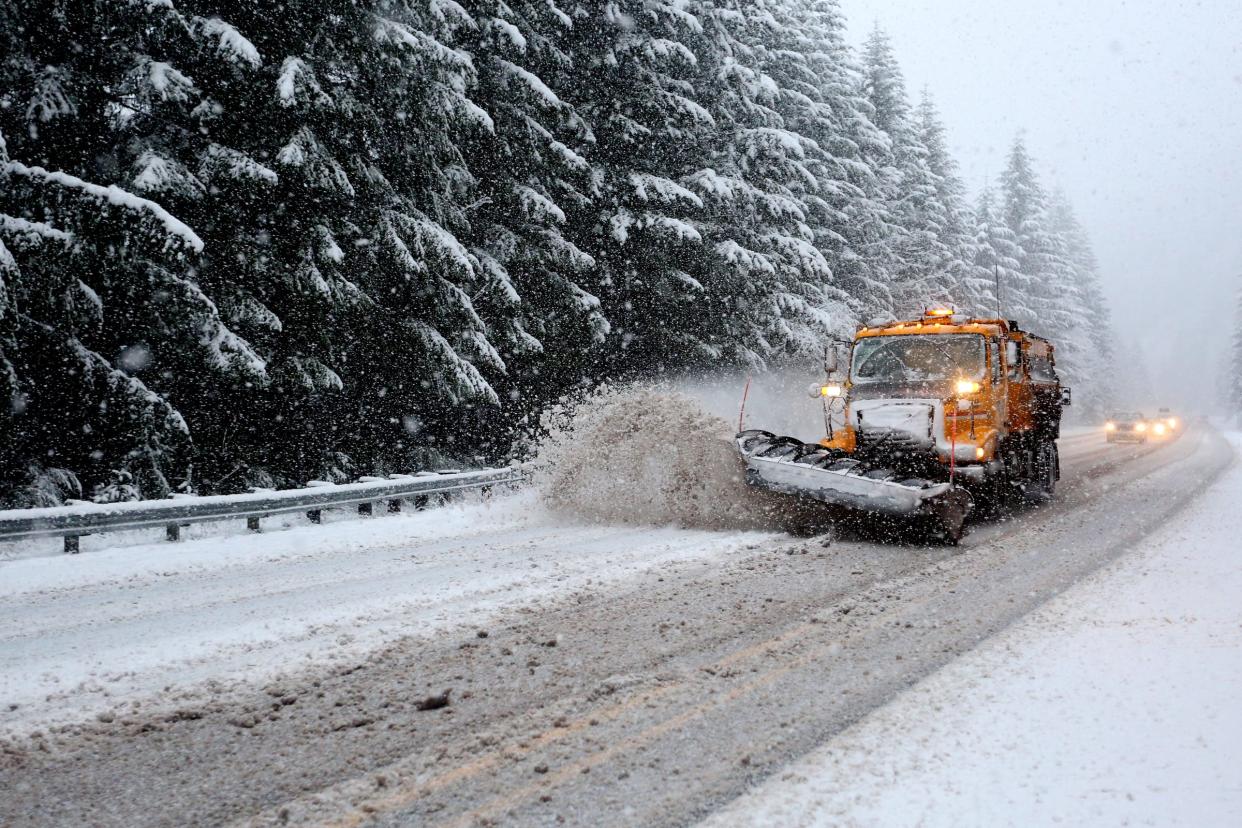
Travel is likely to be hazardous due to periods of major downpours, particularly Friday afternoon, while the heaviest snowfall on mountain passes is expected Sunday morning, meteorologists said.
Snow will be heavy in the Cascade Range, with up to 25 inches forecast for Santiam Pass (Highway 20) and Willamette Pass (Highway 58), while Government Camp could see closer to 17 inches, between Saturday and Wednesday, said meteorologists. The day of heaviest snowfall appears to be late Saturday night and Sunday morning.
"Those who plan on traveling over the Cascade passes should be prepared for winter driving conditions with snow showers," the National Weather Service in Portland said in a statement.
Snowfall will also be possible through the Columbia River Gorge and Interstate 84 and on Coast Range passes late in the weekend and early next week.
Low-elevation snow will be possible in the Cascade Foothills for towns around 1,000 to 1,500 feet next week, potentially dusting towns such as Detroit and maybe even Mill City in the Santiam Canyon.
Snow on the Willamette Valley floor is not anticipated at this point, but could maybe get as low as 800 feet.
The higher Cascade Range elevations could see even more, with 30 to 40 inches possible at locations above 5,500 and 6,000 feet such as Timberline Lodge, giving skiers and snowboarders dreams of an early start to the winter recreation season. Oregon's largest ski areas typically target Thanksgiving for an early opening to the season.
Long-term, the weather is expected to stay active and temperatures expected to stay cool across next week.
“I would expect this to continue — I don’t see us slowing down anytime soon,” NWS meteorologist Briana Muhlestein said
Zach Urness has been an outdoors reporter in Oregon for 15 years and is host of the Explore Oregon Podcast. To support his work, subscribe to the Statesman Journal. Urness is the author of “Best Hikes with Kids: Oregon” and “Hiking Southern Oregon.” He can be reached at zurness@StatesmanJournal.com or 503-399-6801. Find him on Twitter at @ZachsORoutdoors.
This article originally appeared on Salem Statesman Journal: Oregon weather: Rain expected in valley, heavy mountain snow forecast

