Wintry end to these soggy days in Ontario as snow threat returns
A springtime soaker slogging across Ontario will continue into this weekend as additional rounds of rain move across the region. Powerful northwest winds will also pick up later Friday, with gusts up to 80+ km/h peaking through the overnight.
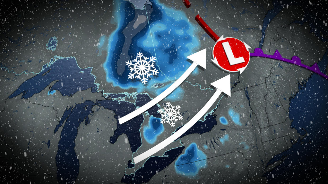
It wouldn’t be a genuine April storm without the lingering threat for winter weather in the mix, either.
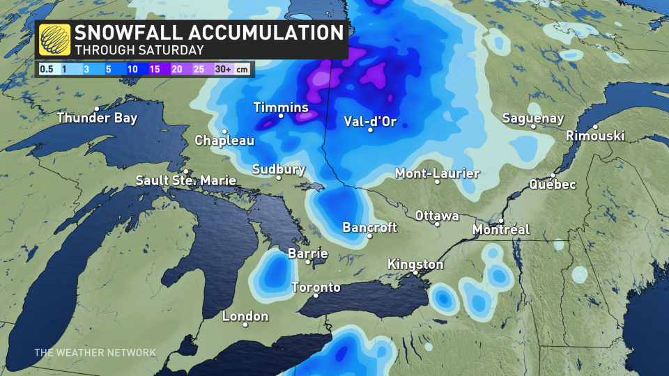
The action will conclude on Saturday with a risk for accumulating snow across northeastern Ontario, where 5-10 cm is expected, and even enough to whiten the ground for southern portions of the province, as well.
MUST SEE: Was that a solar flare? What did we see during the April 8 total solar eclipse?
Friday into Saturday: Rain showers switch to snow by the weekend
A slow-moving Texas low responsible for widespread severe weather south of the border has pumped a fair amount of tropical moisture north of the border.
This stream of atmospheric moisture acts like a reservoir fuelling the heavy rain we saw throughout the day Thursday.
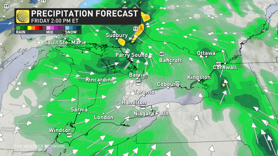
While the worst conditions moved out of southern Ontario late Thursday, we’ll continue dealing with heavier rain along the front in eastern Ontario, followed by scattered showers throughout the day on Friday across the southwest and into the Greater Toronto Area (GTA). An additional 5-10+ mm is expected through Friday.
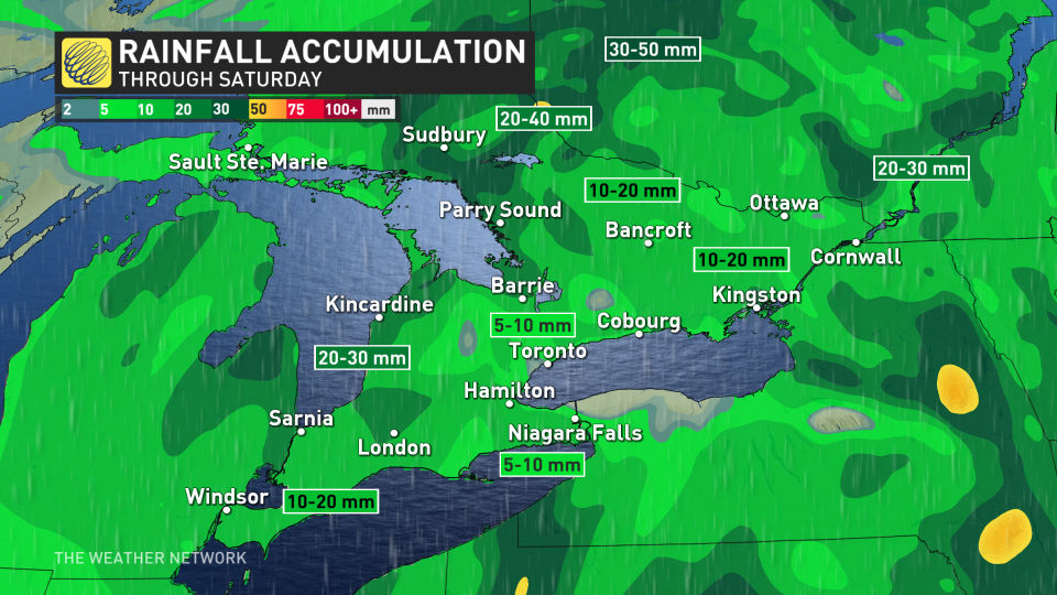
In all, rainfall amounts should land on the order of 30-50 mm by Saturday morning across much of southern Ontario, with locally higher totals possible near the Lake Erie shores. Folks in central and northeastern Ontario will see 50-75 mm of rain from this system.
RELATED: How Texas lows affect our weather in Canada
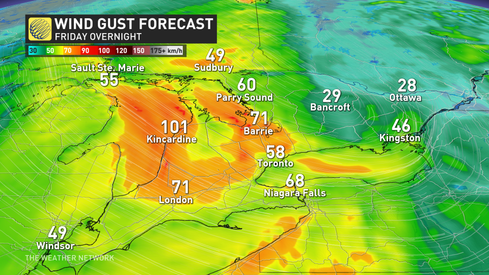
Powerful winds pick up, with gusts up to 100 km/h
Winds will continue to pick up through the day on Friday, with gusts between 50-70 km/h expected across much of the GTA, possibly reaching 60-80 km/h for areas from London to Barrie through the evening hours. Even gustier conditions are expected along the shores of Lake Huron, where wind gusts could reach 100 km/h before easing by Saturday morning.
Strong gusts can throw loose objects or break tree branches, and localized power outages are possible as a result of these winds. Be sure to keep your devices charged throughout the day.
By Saturday, things will take a more wintry spin.
Colder air wrapping behind our departing system will force rain to change over to snow early Saturday morning for northeastern Ontario and the higher terrain of southern Ontario.
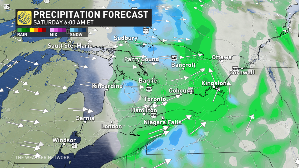
Precipitation will continue into the day Saturday before tapering off through the evening hours.
Snowfall totals of 5-10 cm are expected in the northeast around Timmins, with lower snow totals making this a topic of conversation around Sudbury and into cottage country. Farther south, higher communities along the escarpment may see a dusting of snow from the activity Saturday.
Looking ahead, abundant sunshine and pleasant conditions will take hold for early next week, as temperatures rebound above seasonal. Forecasters expect another dose of cooler weather to arrive heading into the following weekend.
WATCH: What exactly did we see surrounding the sun during eclipse totality?
Check back for all the latest on your forecast and conditions across Ontario.

