Travis, surrounding counties could see severe weather through midnight
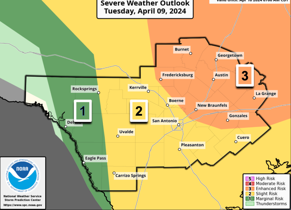
After tornado watches and warnings Tuesday morning, the National Weather Service said Travis County has been placed in a level 3 of 5 severe weather risk, with another round of storms potentially developing through late tonight.
Meteorologists anticipate that large to very large hail could be the main threat, with damaging straight-line winds with gusts up to 70 mph and a "possible" tornado or two. In Austin, meteorologists predict the storms could roll through between 4 p.m. and 11 p.m. and are urging residents to remain weather aware during the severe thunderstorm watch.
The heavy rain could also make local flooding a possibility, the weather service said. It's also possible that storms could form early Wednesday morning, but likely before people begin their morning commute.
Hail was being reported in parts of Austin at about 5 p.m. on Tuesday. The National Weather Service said the storm was moving east through North/Central Austin with "large hail" and "cloud-to-ground lightning."

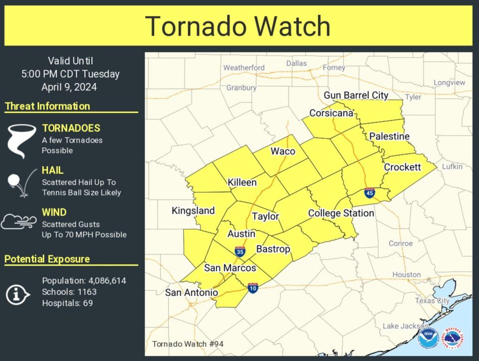
The most severe weather patterns were previously indicated northwest of Austin, with a tornado warning for Burnet and Williamson counties expiring at 10:30 a.m. Paula Yura, a meteorologist with the National Weather Services, previously said the tornado watch for Central Texas would stay in place until 5 p.m. Tuesday due to the severe weather patterns, with the potential for severe storms, including tornadoes, possibly impacting the Austin-area in the afternoon and evening. Earlier this morning, Yura said the radar showed "very good rotation" indicating the likelihood of tornados.
A watch means conditions are favorable for severe weather, whereas a warning means the threat is ongoing or imminent.
This story is developing. Check back for updates.
This article originally appeared on Austin American-Statesman: Travis, surrounding counties could see severe weather through midnight

