Northern California blizzard could be one ‘for the record books,’ climate expert says
The extreme snowstorm looming over Northern California is set to bolster Sierra Nevada’s less-than-ideal snowpack — but it comes with a cost.
A severe weekend winter storm is forecast to bring heavy mountain snow, strong winds and rain to the Sierra Nevada. In a Thursday morning video briefing, Daniel Swain, a climate scientist at the University of California, Los Angeles, said it won’t be an “ordinary storm.”
Blizzard conditions are expected to move in on Thursday and intensify overnight.
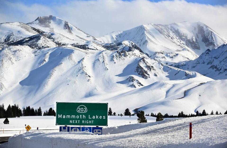
Swain said “almost all” elevations above 3,000 feet will see measurable snow. The Tahoe Basin down lake level will receive at least 3 feet of snow and mountain peaks could see 5 to 10 feet of fresh powder.
Conditions are forecast to peak sometime on Friday before tapering off early next week.
Roads will be affected, power outages are possible and mountain travel is strongly discouraged and likely impossible, the National Weather Service said.
“This will be a legitimate blizzard,” Swain said.
According to the weather service, blizzards produce dangerous storms because they combine wind and low visibility. Heavy snow and cold temperatures, while often accompanied by a blizzard, aren’t required for such events.
The weather service’s blizzard warning remains in effect for the greater Lake Tahoe area through 10 a.m. Sunday as the area prepares for “whiteout conditions” and “near zero visibility.”
“This will be another snowstorm probably for the record books,” Swain said, adding that the Sierra Nevada snowpack could peak above average “in as little as a week.”
What exactly is a blizzard? How is this California snow storm different from the last?
Swain said lower elevations will experience breezy and wet conditions but major flooding is not expected.
California’s snowpack
Last winter’s string of aggressive atmospheric river storms created the deepest snowpack recorded across the Sierra Nevada in at least 40 years.
This winter, although wet, has not seen nearly as much snow.
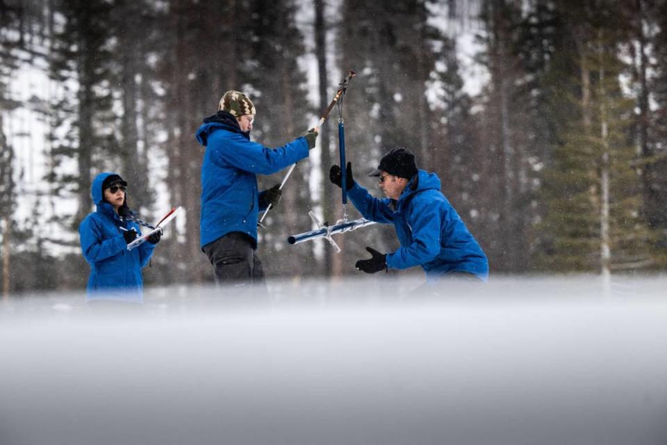
The third snow survey of the water season — which began Oct. 1 — showed “continued improvement” to the state’s snowpack, according to a news release from the California Department of Water Resources.
The snowpack at Phillips Station, west of Lake Tahoe, recorded 47.5 inches of snow depth on Thursday. This is an improvement over January, when surveyors recorded 29 inches.

“We are now in the last month of the traditional snow season and while conditions have dramatically improved since the beginning of the year, March will be critical in determining if we finish above or below average,” Director Karla Nemeth of the state’s water agency said in a news release.
The next and final snow survey is scheduled for April 2.
An end to drought?
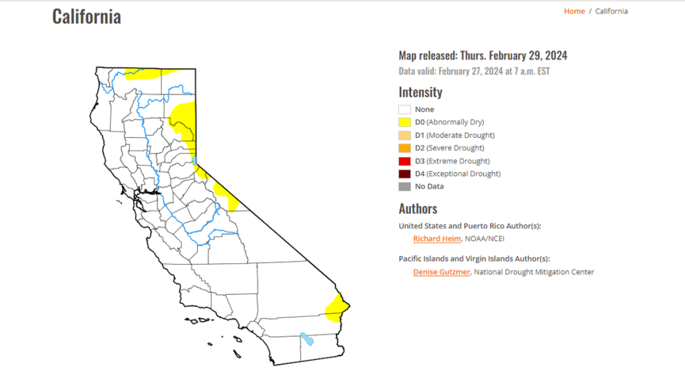
A Thursday update from the U.S. Drought Monitor shows the eastern slopes of California’s Sierra Nevada remain the driest areas of the state.
A weekly map that illustrates drought intensities across the country shows the state’s “abnormally dry” status is at 7%, down from nearly 9.5% earlier this month.
All but one of California’s major reservoirs are at or above the historical average to date.
California is a drought-free state, which is similar to what was monitored in March 2020, according to the U.S. Drought Monitor.
No one has lived in drought conditions in California since November, a significant decrease from roughly 3,000 people in October and about 9,800 people in September.
Approximately 903,000 people remained in drought areas in August.
The update showed 0% of California has “moderate drought,” down from 0.07% on Oct. 10.
Roughly 7% of the state — parts of Siskiyou, Modoc, Lassen, Plumas, Sierra, Nevada, Placer, El Dorado, Alpine, Mono, Inyo, San Bernardino and Riverside counties — remained abnormally dry as of Thursday, according to the U.S. Drought Monitor.
What do you want to know about life in Sacramento? Ask our service journalism team your top-of-mind questions in the module below or email servicejournalists@sacbee.com.

