North Carolina flooding is so severe that rescuers need sonar to locate cars, victims
Flooding is worsening in parts of North Carolina, as water that fell in inland parts of the state and neighboring Virginia slowly pushes southeastward toward the Atlantic Ocean. More than 1,000 people still need rescuing as rivers crest at their highest recorded levels in multiple locations.
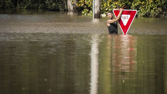
In the flooded town of Lumberton, where the Lumber River has occupied the entire town, located about 35 miles south of Fayetteville, rescue workers have been using sonar equipment to locate cars, and bodies, lying within the murky waters.
SEE ALSO: North Carolina flooding proves we need a new way of rating hurricanes
Rescuers from as far away as New York are trying to rescue people who were trapped when then river burst its banks, and the flooding there and in other locations is expected to remain severe through the weekend.
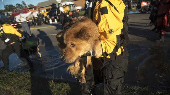
Image: Mike Spencer/AP
The Lumber River crested 4 feet above its record level Sunday in Lumberton and was forecast to remain above the record until next Sunday.
Hurricane Matthew killed more than 500 people in Haiti and at least 26 in the U.S. — more than half of them in North Carolina. At least three people were missing. In addition to the 16 storm-related deaths in North Carolina, there were five in Florida and three each in Georgia and South Carolina.
Rainfall records were smashed in several states, as the storm dumped the equivalent of 13.6 trillion gallons of water on the Southeast, according to the National Weather Service and WeatherBell Analytics meteorologist Ryan Maue.
The full extent of the disaster in North Carolina is not yet clear, but it is likely that this event — which occurred due to the interaction among Hurricane Matthew, a warmer than average Atlantic Ocean, and a frontal system that was stealthily draped across the eastern seaboard.
When the costs are tallied, it is possible that this event will rank as worse than the benchmark flood in North Carolina, caused by Hurricane Floyd in 1999. Thirty five people died during that event, which caused $3 billion in damage.
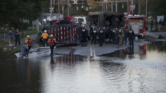
Image: Mike Spencer/AP
North Carolina Gov. Pat McCrory said thousands of animals drowned so far as a result of this storm — mostly chickens on poultry farms — and he was deciding on rules for disposing of the carcasses.
Interstate 95 — the north-south highway along the East Coast — was closed in Lumberton and engineers could not predict when it would reopen.
Flood projections show that river crests will flood portions of East Carolina University in Greenville, as well as the airport there.
The flooding caused by up to 17 inches of rain in under 24 hours was even worse because it fell in an area that had seen heavy rainfall in September, which made the land less capable of absorbing the water.
The Associated Press contributed reporting.
Correction: A previous version of this post incorrectly stated the location of East Carolina University. It is based in Greenville.
