No tornado, but ‘stay vigilant:’ City of Ovid officials

- Oops!Something went wrong.Please try again later.
LANSING, Mich. (WLNS) — Officials in Ovid, Clinton County, say a tornado siren on Friday was precautionary and not a drill.
However, “[according to the National Weather Service] there’s not enough momentum for a tornado to touch the ground,” city officials said in a social media post on Friday afternoon.
Still, they said, it’s a good indication to take precautions for potential weather events.
“Stay vigilant!” officials said in the post.
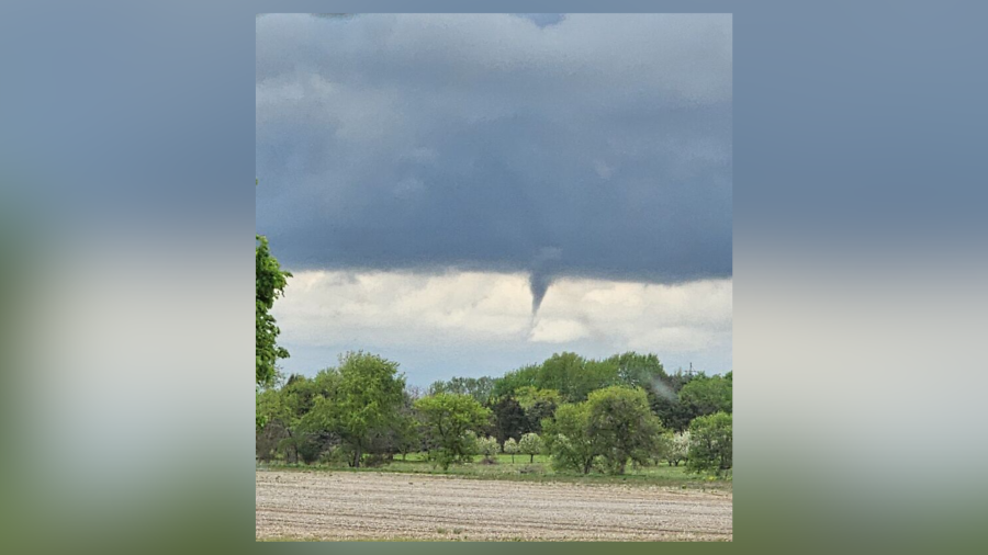
Ingham County Emergency Management posted on its Facebook page after 2 p.m. Friday that “a brief ‘cold air funnel’ was spotted over Clinton County with a line of showers moving ahead of a front this afternoon. This activity should be in Ingham County shortly.”
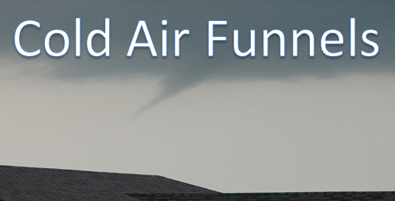
Though a “cold air funnel” can look a bit like a tornado, “these are NOT tornadoes and RARELY touch the ground, and in those very few cases where they do, the winds are under 50 mph,” the agency said in its post.
For the latest news, weather, sports, and streaming video, head to WLNS 6 News.

