These natural disasters pose the biggest risk to Whatcom County, according to FEMA
The Federal Emergency Management Association creates a map of its National Risk Index, a measure of how vulnerable each area in the country is to different types of natural disasters.
The risk index calculates the amount of damage a potential natural disaster would cause, so a densely-populated area would have a higher risk index score than an emptier area, even if the two had identical chances of a natural disaster occurring.
With an estimated annual loss of $42.3 million, Whatcom County’s overall risk of natural disaster was deemed by FEMA to be “relatively moderate,” the third highest of its five risk designations. However, its overall risk is still higher than 90% of all counties in the U.S., and 74% of the counties in Washington.
FEMA broke down the score by type of natural disaster. Here are the ones that the Bellingham area is most at risk for.
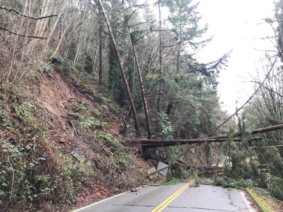
Landslide risk in Bellingham
Whatcom County earned a “relatively high” grade for landslide risk, the second-highest designation, while ranking in the 96th percentile nationally. With a perfect storm (pun possibly intended) of rainy weather and a landscape that’s full of mountains and hills, that should come as no surprise. The area has a history of landslides, although FEMA deemed neighboring counties Skagit, Snohomish and Okanogan to be at higher risk. The economic impact of landslides was less alarming – FEMA expects them to account for just $358,000 a year in damage in the county.
Avalanche risk in Bellingham
Whatcom County’s avalanche risk was also classified as “relatively high,” and it ranked it the 88th percentile nationally. This should come as no surprise either, with Mount Baker being one of the snowiest places in the world. Just two weeks ago, there were reports of several avalanches in the area. The average expected loss from an avalanche is $1-million, according to FEMA.
Volcanic activity risk in Bellingham
With an expected annual financial impact of $4.4-million, the only other type of natural disaster that Whatcom County has a “relatively high” risk of experiencing is volcanic activity. Mount Baker is an active volcano, although it hasn’t had an eruption that produced lava in 6,700 years. Lahars – fast flows of mud and volcanic debris – and flank collapses still pose risks to the area though, as they can occur without a full-scale eruption.
Earthquake risk in Bellingham
Whatcom County ranked in the 97th percentile nationally for earthquake risk, and is expected to lose $35-million annually in earthquake damage. But before you drop, cover and hold, you should know that it only received a “relatively moderate” risk designation in that category, with a 0.546% chance of a serious earthquake occurring in a year.
So essentially, Whatcom County has a much higher risk for an earthquake than the vast majority of counties, but that still doesn’t mean a devastating earthquake is likely. But in the event that one does hit, FEMA estimates that the county is vulnerable to $2.7-trillion worth of damage.
What about the lowest-risk categories?
Whatcom County’s risk of strong wind, wildfire, hail, drought and tornado damage were all given the “very low” designation. Its hail and strong wind risk were among the lowest in the country, ranking in the second and third percentiles, respectively. You also don’t have to worry about a hurricane hitting anytime soon – FEMA said hurricanes were “not applicable” to Whatcom County.
How the risk index is calculated
FEMA calculates the NRI by taking the expected economic loss from natural disasters in a given year and multiplying it by a “community risk factor.” It gets that number by weighing how vulnerable a community is to disaster against how prepared the community is to recover if a disaster hits.

