National Hurricane Center watching 2 tropical waves in Atlantic
And just like that, the National Hurricane Center's tropical outlook map is empty of disturbances.
After watching an area of low pressure off the coast of Florida for a couple of days, the outlook now shows nothing is expected over the next seven days.
Forecasters are watching a couple of tropical waves in the eastern Atlantic.
The National Hurricane Center also noted that ash from the Popocatepetl Volcano in Mexico is moving into the southwest Gulf of Mexico.
Active volcanoes: Volcanoes are erupting, spewing ash on these three continents
Florida may not catch a break: AccuWeather issues 2023 hurricane season forecast, predicting 11-15 named storms
WMO officially retires Ian name: There will never be another hurricane named Ian
Here's the latest update from the NHC as of 8 a.m. May 23:
What's out there and where are they?
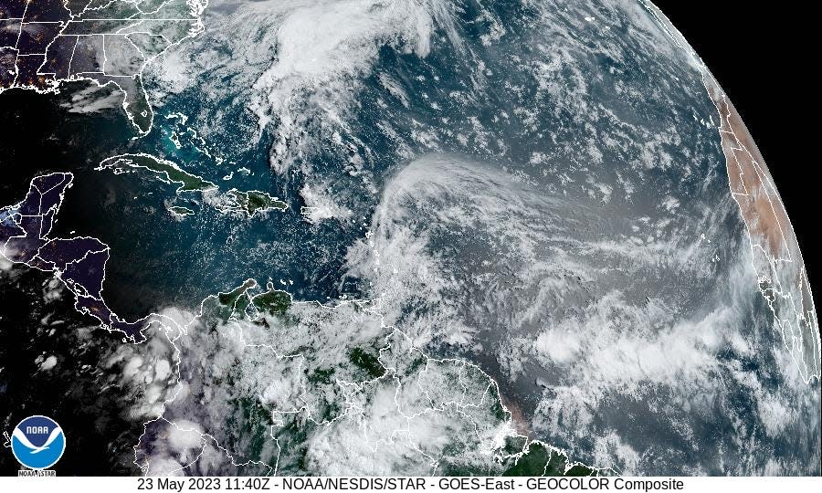
Tropical wave 1: A tropical wave is located south-southwest of Cabo Verde. It's moving west at 11 mph.
Tropical wave 2: Another tropical wave is located far to the east of Trinidad and Tobago. It also is moving west at 11 mph.
What's the forecast for the Gulf of Mexico, Caribbean Sea, tropical Atlantic?
Gulf of Mexico: The forecast calls for a system of high pressure dominating the basin through the week, bringing with it gentle winds and slight seas. A cold front is forecast to move south through the eastern Gulf late Wednesday through Thursday.
Caribbean Sea: A system of low pressure is expected to develop over Central Florida Wednesday night and move slowly northeast through Saturday. This is forecast to affect the central and western Caribbean through Saturday, bringing light to gentle winds to the region.
Atlantic: The system expected to move off Florida into the Atlantic Thursday could bring locally strong northeast winds and a large northeast swell across Northeast Florida offshore waters starting Thursday night. Gale-force northeast winds are possible late Friday.
Who is likely to be impacted?
It's too early at this time to determine if there will be any impact to the U.S. from the tropical waves.
Forecasters urge all residents to continue monitoring the tropics and to always be prepared since conditions can and do change rapidly.
Weather watches and warnings issued for your area
If you can't see any local weather warnings here, you'll need to open this story in a web browser.
When is the Atlantic hurricane season?
The Atlantic hurricane season runs from June 1 through Nov. 30.
When is the peak of hurricane season?
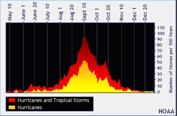
The peak of the season is Sept. 10, with the most activity happening between mid-August and mid-October, according to the Hurricane Center.
Tropical forecast over the next seven days
Excessive rainfall forecast
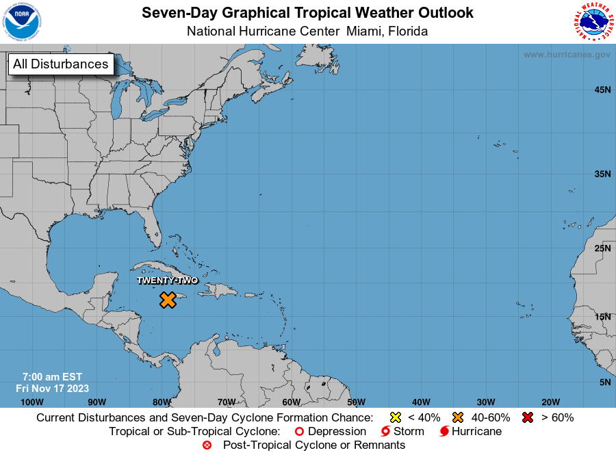
What's out there?
Systems currently being monitored by the National Hurricane Center.
What's next?
We will continue to update our tropical weather coverage daily. Download your local site's app to ensure you're always connected to the news. And look at our special subscription offers here.
This article originally appeared on Naples Daily News: Tropics watch: NHC tracking 2 tropical waves in Atlantic

