More Tri-Cities snow! Could it set another record? I-84 in Oregon closes, again
Flowers are blooming and spring break is past, but another late spring snow fell on the Tri-Cities on Thursday morning and shut down Interstate 84 from just east of Pendleton to near Baker City.
“Really??? Can we just fast forward two weeks to May?” Trooper Chris Thorson of the Washington State Patrol posted to Twitter, between updates on an a closure of Interstate 82 and a crash near Sunnyside.
It was the second freak snowfall in a week.
On Monday, about 2 inches of snow coated the Tri-Cities, but on Thursday much of the snow was melting as quickly as it hit the ground.
If enough snow sticks to be measured at National Weather Services sites, it will set a new late snow record for the Tri-Cities, beating the record set Monday for the latest day in the spring with measurable snowfall.
The previous record for the Tri-Cities was 1 inch on March 13, 1950, the weather service said. Earlier in the week it reported that the record for late snowfall in Kennewick was set on April 1, 1935.
The Benton County Sheriff’s Office warned Thursday morning that the roads in the Prosser area were very slick and asked drivers to slow down.
I-82 closed westbound between Selah and Ellensburg mid morning to clear spun out semi trucks. A detour was available on Highway 821 through the Yakima Canyon.
Around 8 a.m. a car rolled on the interstate near Sunnyside. The adult and four children were not seriously injured.
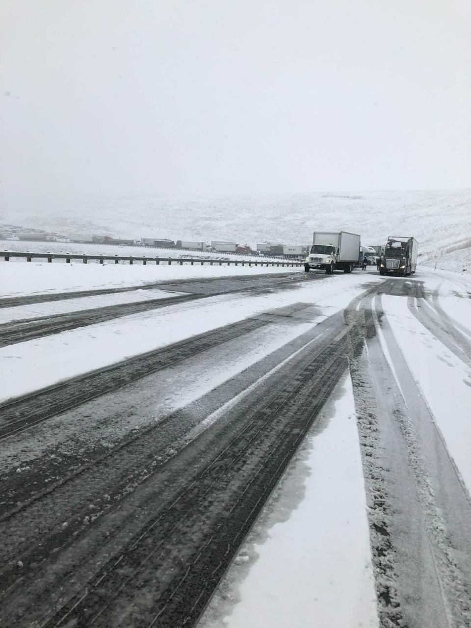
I-84 closes near Pendleton
Interstate 84 was closed about 8:30 a.m. Thursday due to snow and ice on the roadway and unchained trucks blocking interstate lanes on Cabbage Hill just east of Pendleton.
Around 10 a.m. eastbound lanes reopened and westbound lanes reopened shortly after that.
Westbound truck traffic had been stopped at Ontario because of the limited parking available in La Grande and Baker City.
But a fiery crash around 12:30 p.m. caused the eastbound lanes to close again, this time from LaGrande to Ontario, for about two and a half hours.
The Oregon Department of Transportation reported that vehicles in the crash were on fire.
The closure was extended at about 1 p.m. to include eastbound traffic from six miles east of Pendleton to Ontario. Some residents of La Grande and Baker City were being allowed to travel home.
Travelers from the Tri-Cities heading west over the Cascade Mountains were having better luck.
Snow and slush was reported on Interstate 90 at Snoqualmie Pass Thursday morning, but no chains were required.
However, a closure was planned for westbound lanes at 1 p.m. near the summit for avalanche control work. The Washington state Department of Transportation warned that the closure could last several hours in a worst case scenario, but wrapped it up in about 20 minutes.
White, Stevens and Blewett passes also were open Thursday, with trucks required to have chains on Blewett Pass.
Easter weekend forecast
Temperatures in the Tri-Cities should start to warm some from the high of 49 forecast for Thursday.
But not before the low was forecast to drop to 30 degrees Thursday night, the only low that should be below freezing in the next seven days, according to the weather service.
A rainy Saturday is forecast followed by a mostly sunny Easter with a high of 59.

Highs should be back in the 60s for the next work week with the temperature warming to 66 on Wednesday, according to the early forecast.
Travelers on I-84 through Oregon can expect a slight chance of snow Friday but Saturday could be a tougher travel day with up to 3 inches of snow and patches of fog forecast at Meacham about 30 miles east of Pendleton.
Sunday should be warm and partly sunny.
Interstate 90 travelers could see some rain or snow Friday, but less than a half inch of precipitation is forecast.
Saturday 1 to 3 inches of snow are forecast with another 1 to 2 inches Saturday night.
Sunday a slight chance of rain is forecast, followed by possible rain or snow that night.

