Monday Outlook: Cloudy, upper 70 temps in Charlotte

CHARLOTTE, N.C. (QUEEN CITY NEWS) – Monday will be a bit of a transition day as we get the work week started. Temperatures have dipped into the low 60s and 50s around the Queen City while mountain counties sit in the upper 30s and 40s!
Click here to see our latest Pinpoint Weather forecast! 🌤️🌦️
Winds will be light as clouds slowly build throughout the day. Partly cloudy skies will become mostly cloudy as highs aim for the upper 70s and land near normal for this time of year.
Moisture will be increasing today as a low-pressure system tracks east across our Gulf states. The resulting warm front will also increase rain chances later Monday into Tuesday morning.
Overnight lows will dip into the 60s before rebounding into the mid-70s on Tuesday. Rain likely will impact your morning commute with pockets of heavy rain pushing north towards the I-40 corridor.
Tuesday afternoon can also host an isolated thunderstorm or two so be sure to keep an eye out for some rumbles of thunder through the peak heating hours of the day. Wednesday will hold on to rain chances with low 80s returning for mid-week.

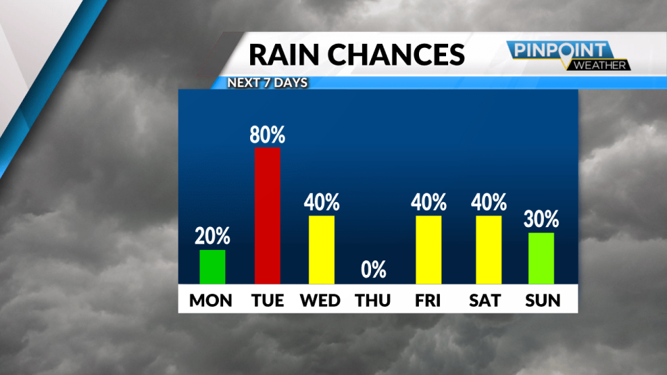
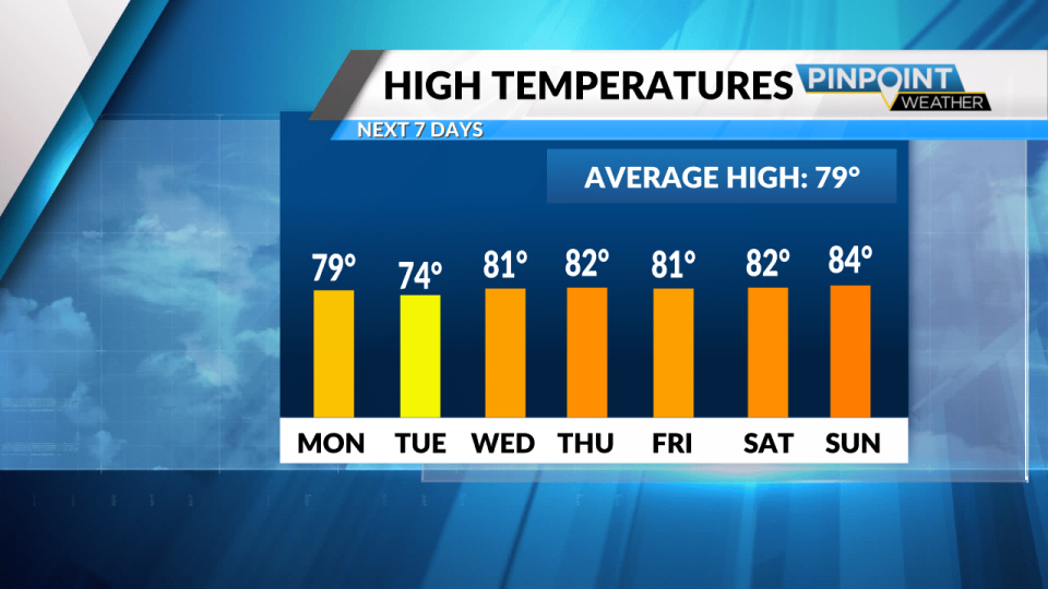
Thursday will be a winner with highs in the low 80s and mostly sunny skies. We’ll catch a break in the rain chances on Thursday before showers return heading into the end of the workweek.
We’ll see 80s and intermittent storm chances linger as we head into the weekend.
Today: Warm with Light Winds & Increasing Clouds. High: 79.
Tonight: Mostly Cloudy & Mild. Low: 62.
For the latest news, weather, sports, and streaming video, head to Queen City News.

