'Reports of a tornado' touchdown in Clark and Marathon counties, National Weather Service says
Tens of thousands are without electricity as tornado warnings were issued in central Wisconsin on Tuesday evening as a storm will continue to track east across the state into the night.
The National Weather Service office in Green Bay said there were "reports of a tornado near Unity" in Clark and Marathon counties.
Elsewhere, the weather service office in Milwaukee said at about 7 p.m. that a "strong rotation" was seen on radar crossing the Wisconsin River near Spring Green. The weather service is typically not able to confirm tornadoes until the following day.
All tornado warnings were expired as of 9:30 p.m., although the storm system will continue to linger until midnight.
A combined total of the utility providers in Wisconsin shows that nearly 60,000 residents are without power as of 10:15 p.m. across the state.
Many Wisconsin counties are under a tornado watch until midnight. A tornado watch means conditions exist for tornadoes to form, while a tornado warning means one was spotted in the area or on radar.
The counties include Adams, Brown, Calumet, Chippewa, Clark, Columbia, Dane, Dodge, Door, Eau Claire, Fond du Lac, Green, Iowa, Lafayette, Jackson, Jefferson, Juneau, Kewaunee, Langlade, Lincoln, Manitowoc, Marathon, Marinette, Menominee, Monroe, Oconto, Outagamie, Portage, Rock, Sauk, Shawano, Taylor, Walworth, Washington, Waukesha, Waupaca, Waushara, Winnebago and Wood.
It is stormy in downtown Madison. pic.twitter.com/YbN94649m7
— Jessie Opoien (@jessieopie) May 22, 2024
Three rounds of storm systems passed through the state and brought damaging winds as high as 60 to 80 miles per hour.
The National Weather Service is forecasting that the latter system, which began around 6 p.m., will be the most severe, particularly in the southwestern corner of the state. That storm will begin as isolated storms and bring a high threat of tornadoes and large hail, before merging and sweeping across the eastern portions of the state, like Milwaukee, and bring strong wind gusts.

“Then the evening, that’s when the big show is expected,” said Marcia Cronce, a meteorologist at the Milwaukee-Sullivan office of the NWS. “If they’re strong enough, they could do that high-end damage.”
The NWS is forecasting the southwest corner of the state at the highest risk of severe weather, at a four out of five rating, which the organization describes as widespread severe storms likely. In that corner of the state, near Mineral Point and Lone Rock, the NWS rates their chances of a tornado between 15% to 29%.
Severe storms are expected today, especially in the evening. Storms are also possible in the morning and afternoon. A widespread severe weather event could occur this evening between 6 and 10 PM with damaging winds, large hail, and tornadoes. Have a way to receive warnings. pic.twitter.com/VH4S1PvjPN
— NWS Milwaukee (@NWSMilwaukee) May 21, 2024
Central and eastern Wisconsin are at what’s called an enhanced risk, or three out of five rating, with numerous severe storms possible. The other, weaker systems were forecasted to occur earlier in the day, with an initial system passing through the state in the morning.
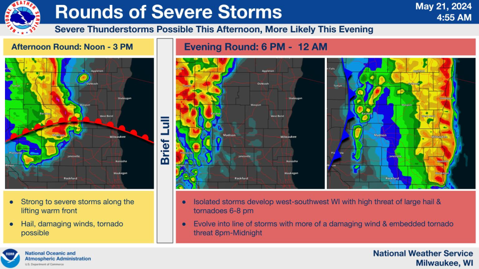
That system had a smaller potential of bringing severe conditions, but the NWS said that hail, damaging winds and a tornado were still possible as a warm front moves through the area.
People should be prepared for the evening storm, which brings the highest chance of severe weather, she said.
Cronce emphasized that it’s important to have multiple ways to receive weather warnings — especially with the storm arriving at night in Milwaukee — and make various preparations like putting away lawn furniture or charging battery packs ahead of possible power outages.
Milwaukee weather forecast
Milwaukee is at a three out of five risk rating for severe weather, a bump from Monday's two out of five rating.
The evening storms were expected to develop as individual storms around 6 to 8 p.m. west of Madison before they “race” toward Milwaukee and reach shoreline counties around 9 to 10 p.m. As the system develops, the individual storms will congeal into a line system and bring high winds.
Those winds have a chance of reaching over 74 miles per hour, potentially downing trees.
“Milwaukee might not have any active weather until the main line of storms come through this evening,” Cronce said. “Well inland areas, Madison, have a chance for basically three rounds of thunderstorms today.”
“The biggest chance for the strongest storms is well to (the) west, like southwest of Madison, so Milwaukee might miss out on the really good stuff,” Cronce added.
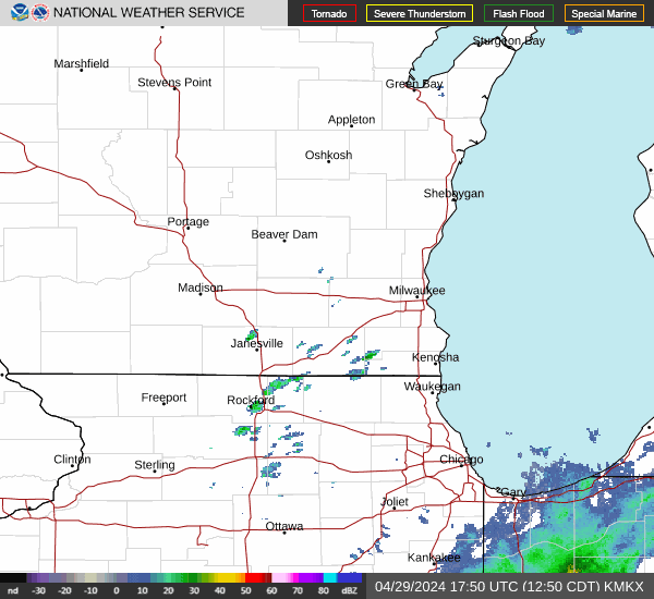
Wisconsin weather radar
Wisconsin weather warnings
This article originally appeared on Milwaukee Journal Sentinel: Reports of Tornado touchdown in Clark and Marathon counties

