These maps are cool, if you like viewing details of every dirt road ever
Australia has a lot of roads. A helluva a lot. But you've never quite seen them like this before.
These posters somehow manage to squeeze in Australia's 500,000 dirt tracks, roads and highways with the finest of details.
It's a creation of geography student Robbi Bishop-Taylor, who resides in Sydney, Australia. He's currently completing his PhD in Geospatial Science at the University of New South Wales, looking into how Australia's geography affects how wetland species move around the country's Outback.
"I've always been fascinated by how humans influence and interact with the natural world, and how the patterns and structure of our landscapes shape the world we live in," he told Mashable via email.
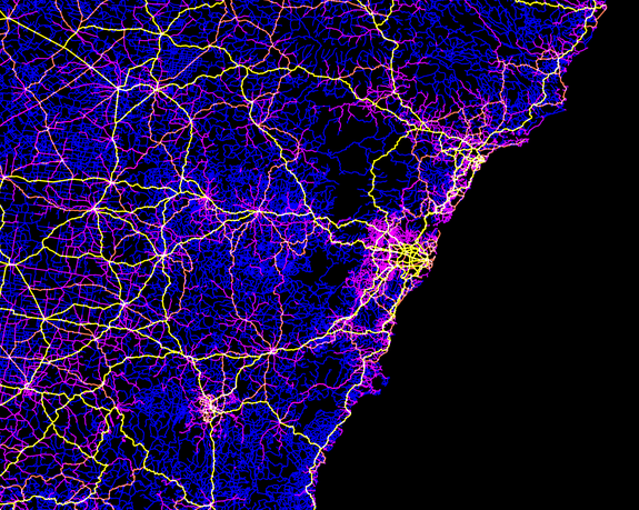
Image: robbi bishop-taylor
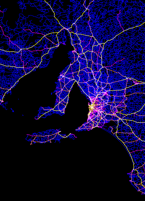
Image: ROBBI BISHOP-TAYLOR
The maps were produced with an open source Geographic Information System (GIS) called QGIS, used to analyse and map out large geographic datasets. The roads data came freely available topographic mapping datasets from Geoscience Australia, which is the same data that's used to make regular paper maps.
But of course Bishop-Taylor has put his own artistic spin on the data, using different coloured lines to illustrate the 500,000 different types of roads.
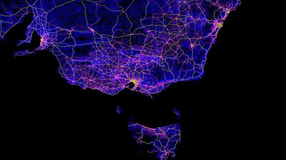
Narrow dark blue lines are unsealed dirt tracks, while pink and orange means minor sealed and unsealed roads. Thick yellow and white lines illustrate major roads and dual carriageway highways.
"The maps make it very clear how much humans have altered our natural environment; see in particular the intense colours along our east coast, and around Perth in the south-west," he explains.
"These areas also contain many of our most threatened species, which makes scientific research focused on how humans impact on our natural environments especially important."
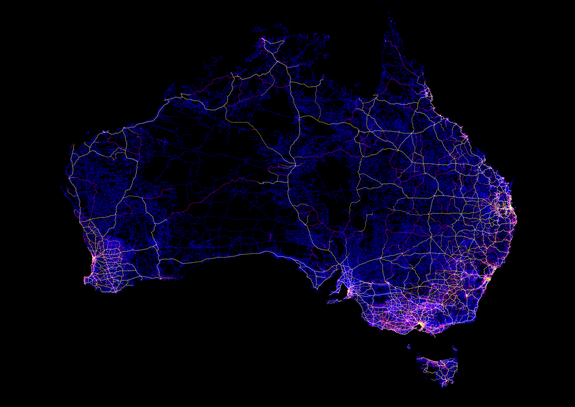
Image: ROBBI BISHOP-TAYLOR
At the moment Bishop-Taylor is finishing up his PhD, with most of the maps he is making going directly into two scientific papers that is currently in production.
"After that, I'll hopefully have time to put my mind to new poster maps," he said.
