
A Map Of Gatlinburg's Destruction
A day after wind gusts of nearly 90 mph rushed flames of wildfires through the town of Gatlinburg, Tennessee and the nearby Great Smoky Mountains, a dour portrait of the aftermath began to emerge. At least three people were confirmed dead and many more were missing. Hundreds of scorched homes were left behind. Local businesses in the popular tourist destination had been destroyed by the flames.
The fires forced more than 14,000 residents and tourists to evacuate the area Monday and early Tuesday as the blaze spread quickly and with little warning. They left behind a well-known town with a central tourist district mostly intact but surrounded by areas that a volunteer firefighter there likened to “the apocalypse.”
Some of the town’s best known destinations were spared by the fires, which are part of several blazes in the region that have sparked up in the last month. Those destinations include the Dollywood theme park and resort, which was evacuated but was not damaged, Dolly Parton confirmed Tuesday. Ripley’s Aquarium of the Smokies, which had also been evacuated as a precaution, was also left intact, officials announced Tuesday. A team of marine biologists and life support experts were reportedly tending to the 10,518 animals that were left behind during the evacuation.
Extended drought conditions in the region have led this month to the fire near Gatlinburg and also a 25,000 acre fire that spread from Georgia to North Carolina and another 28,000 acre fire in north Georgia.

A Nov. 14 satellite image of the region and the various forest fires at the time. Photo: NASA
The drought encompasses the entire southeastern United States, according to a drought monitor kept up by the University of Nebraska-Lincoln. There has been little or no rainfall in some areas in the past six months. That dry spell has hurt farmers there and created increasingly dangerous conditions that can lead to devastating fires like those this week.
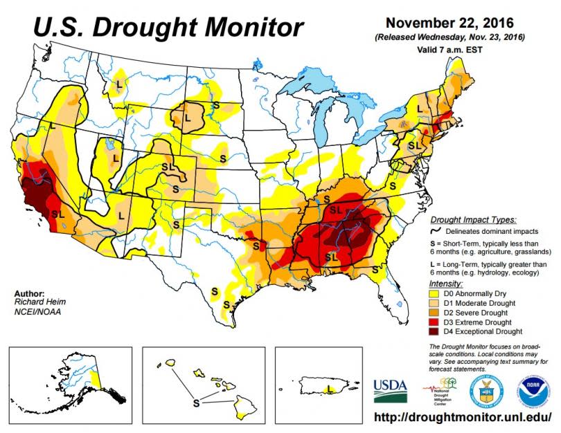
A map of drought conditions in the United States as of Nov. 22, 2016. Photo: University of Nebraska-Lincoln
Related Articles

