How many atmospheric rivers drenched the West Coast this winter? Hint: It's a big number
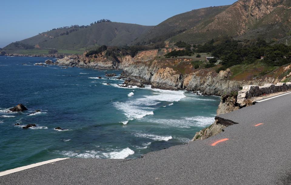
Emergency and cleanup crews were hard at work in California this winter as record rainfall battered the state, causing landslides, flooded homes, and cars rushing away in the water. Crops throughout the central valley of California were submerged in water, and traffic delays in central and northern parts of the state grew due to heavy flooding.
Southern California was hit especially hard, with a state of emergency declared in San Diego. Many areas of Nevada endured ice and snow, leading cars to slide out of control and off the road.
Parts of Washington and Oregon experienced flooding and landslides. At least two bodies were found in a swollen waterway in Oregon after extreme rains let loose on the state.
So, what caused these torrential downpours and extreme winter conditions on the West Coast this winter?
Atmospheric rivers. More than 50, it turns out, drenching the West Coast like buckets in a fire brigade.
What are atmospheric rivers?
Atmospheric rivers are long regions of water vapor in the atmosphere, much like a river in the sky. According to scientists at NASA, atmospheric rivers can move more water than the Amazon River holds — twice over.
These airspace rivers vary in size and strength, and like hurricanes, are sorted in categories based on the severity of the storm. The amount of water vapor carried in these rivers can produce extreme rain and snowfall, as it did for the West Coast.
Atmospheric rivers: Here's how they affect Arizona's weather
Data from the Center for Western Weather and Water Extremes shows that water year 2024 (October through March) brought an astounding 51 atmospheric rivers to the West Coast. California's first three months started slow, with 18 (12 weak, 6 moderate), but storms from January through March pummeled the northern part of the state with 25 (14 weak, 9 moderate, 2 strong).
The strongest such system to hit the Golden State was Feb. 4-6. Downtown Los Angeles recorded 8.51 inches of rain, that brought intense flooding, mud and landslides, and left behind downed power lines, trees and devastation in its wake.
Do atmospheric rivers flow through Arizona?
Although weather systems frequently move from California to Arizona, desert dwellers can typically expect less rain and overall weaker systems.
Phoenix doesn’t get the same storms and rain totals as much of Southern California simply because of the topography, according to Matt Salerno, a meteorologist at the National Weather Service in Phoenix.
“Just due to the fact that we have mountainous terrain around the city, and we are in a low spot of the Valley, the clouds and rain tend to form around us,” Salerno told The Republic in February. “As the winds start blowing from the south, those clouds and precipitation move away from the Valley up towards the mountains.”
Atmospheric rivers are not all bad news: While they can bring flood risks and landslides, they can also provide drought relief and much-needed water supply.
Scientists at the National Oceanic and Atmospheric Administration say atmospheric rivers are a key factor in the global water cycle and are intimately linked to both water supply and flood risks, particularly in the Western U.S.
California alone is responsible for growing nearly three-quarters of the country’s fruits and nuts and one-third of its vegetables, according to the California Department of Food and Agriculture, so water supply on the West Coast is of national concern: If there's not enough water, there's not enough food.
Just a few of these rivers can bring about 30-50% of annual precipitation on the West Coast, according to NOAA, and have been found to be stronger and more frequent during strong El Niño years like this one.
Because of the back-to-back wet winters, California's reservoir levels look promising as the state heads into the dry season.
Caralin Nunes writes about weather and related topics for The Arizona Republic and azcentral.com. Email her with story tips at caralin.nunes@arizonarepublic.com.
You can support environmental journalism in Arizona by subscribing to azcentral today.
This article originally appeared on Arizona Republic: Atmospheric rivers drench the West Coast, fueled by El Niño
