
Can We Know Where an Earthquake Will Hit Next?
Earthquakes happen every day in the United States. Usually, they’re small—sometimes unnoticeable. One such magnitude 5.8 earthquake happened on Friday off the coast of Northern California. Early reports indicate that there is only a small chance of any fatalities or damage. But there will always be another earthquake in the United States. And eventually, there will be one that causes damage.
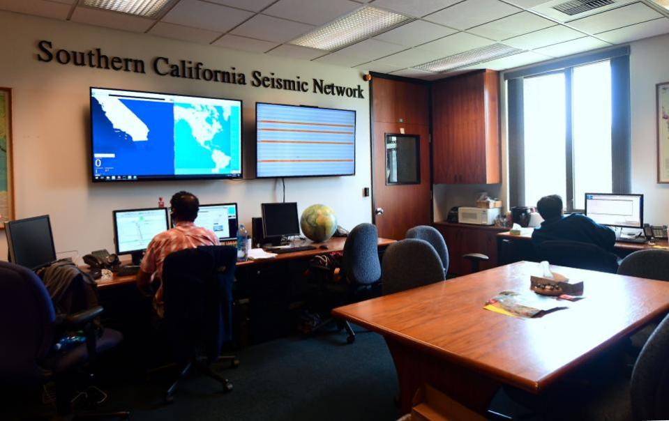
Though it's not possible to say exactly where the next big earthquake will happen, scientists at the United States Geological Survey do try to figure out where one could happen.
"Given the current level of the science, we can't make predictions about specific earthquakes," USGS seismologist Chuck Mueller told Newsweek. However, Mueller and his colleagues can look at the patterns of past earthquakes and the Earth's fault lines to get a sense of what to expect in the future.
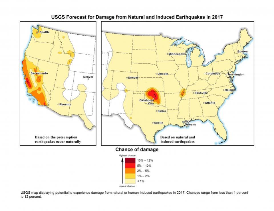
Cities around Monterey Bay in California, which include Santa Cruz and Salinas, have some of the highest chances of seeing damage from an earthquake in 2017, according to recent USGS estimates. (If this year doesn’t bring a major earthquake to the region, people living in San Francisco are still very likely to experience one sometime before 2032.)
But north of Oklahoma City is also another hotspot, possibly due to wastewater fluids being injected back into the ground at local fracking operations.
Information provided by engineers and scientists like Mueller at the USGS influence building codes to help cities prepare for possible earthquake damage. But estimating a dollar figure for possible earthquake damage is FEMA’s job.
That agency measures earthquake risk for an area based on three components. The first, vulnerability, is based on how well the buildings have been earthquake-proofed. Another hazard is how likely there is to be an earthquake there. How many people live in an area determines exposure. So while the hazard on the West Coast is higher than it is in major East Coast cities, New York and Boston are more vulnerable than San Francisco.
On average, earthquakes could cause $6.1 billion in damage to buildings and the economy across the country each year according to the agency’s most recent estimated annual earthquake losses report. (Though the figure is higher than the last estimate in 2008, the real dollar value has declined since then due to inflation.)
Hotspots of estimated damage include California, unsurprisingly. The state accounts for over half of that $6.1 billion estimate; the West Coast as a whole is responsible for 73 percent of the estimate.
But an earthquake in the New Madrid Seismic Zone, which covers states including Oklahoma, Illinois, Mississippi, and Tennessee, could also do a significant amount of damage. The estimated damage for states in that region is nearly $500 million—the third-highest amount.
For the lowest chance of feeling the next big earthquake—or any earthquake at all—the USGS's website would suggest heading to North Dakota or Florida.
Related Articles

