What we know about each of the 11 tornadoes that hit Kentucky this week
The National Weather Service has confirmed that at least 11 tornadoes touched down across Kentucky during Tuesday’s severe storm outbreak.
The confirmed tornadoes were in Anderson, Bourbon, Clark, Boyd, Henry, Jessamine, Jefferson, Mason, McCracken and Nelson counties. The NWS said nine of the tornadoes were an EF-1 tornado and two were an EF-2 tornado.
The NWS also confirmed straight-line wind damage in Fayette, Mercer, Spencer and Woodford counties.
More damage assessment surveys are planned for Thursday in Fayette and Woodford counties, according to the NWS. Damage assessments are ongoing in Bourbon, Clark, Henry, Jefferson and Oldham counties.
12pm EDT update: we have survey crews in Fayette and Jefferson counties today. We have update our confirmed tornadoes and ratings since this morning. pic.twitter.com/NK3rCUPIwf
— NWS Louisville (@NWSLouisville) April 4, 2024
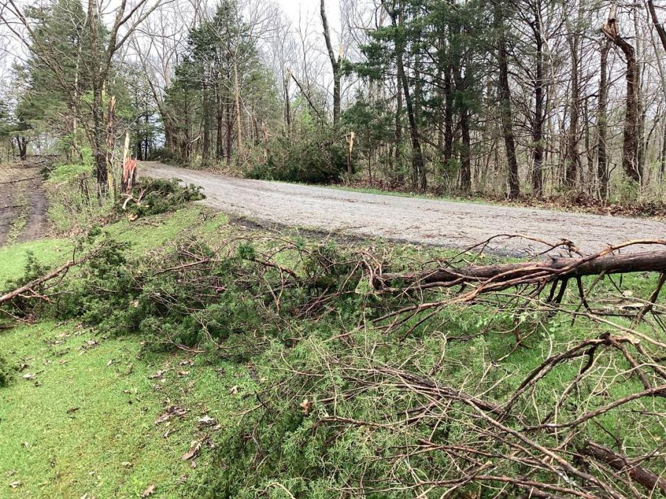
Anderson County
Anderson County was hit with an EF-1 tornado that reached maximum wind speeds of 95 miles per hour, according to the NWS. The tornado touched down in the southwestern part of the county off Mays Road and traveled roughly two miles.
Two barns lost large sections of their roofs in the storm. The NWS said metal sheeting and insulation from the barns were thrown up to 300 yards away.
The tornado had a maximum width of 150 yards, according to the NWS. It picked up off the ground in a grove of trees halfway between Baxter Ridge and Puncheon Creek roads.
Bourbon County
The tornado in Bourbon County reached maximum wind speeds of 105 miles per hour south of Paris, according to the NWS. The tornado traveled roughly 13.4 miles and crossed into Clark County. It had a maximum width of 100 yards.
The weather event started off with three funnels that merged into one tornado, the NWS said. Damage reports were taken in the Bethlehem, Clintonville and Winchester road areas of Bourbon County.
The most extensive damage in Bourbon County happened at Hidden Rose Farm, which is home to the University of Kentucky Dressage Team. The NWS said an open arena structure almost completely collapsed and multiple trailers were flipped.
Six horses were injured at the farm, two of which had to go to a hospital, according to the NWS.
A barn on Paris Road in Clark County was demolished by the tornado, the NWS said. The tornado also damaged a large, new barn in the Wades Mill area before lifting.
Boyd County
Two different tornadoes were confirmed in Boyd County. The NWS said an EF-2 tornado touched down near Long Branch and an EF-1 struck near the Boyd and Greenup county line.
The EF-2 tornado topped out at 120 miles per hour and had a maximum width of 350 yards, according to the NWS. It caused significant tree damage and blew the roof off a home.
The EF-1 tornado hit wind speeds of 110 miles per hour and had a maximum width of 250 yards, according to the NWS. It traveled just over one mile in Ashland.
The tornado touched down along Daniels Fork Road and continued across KY 5. The NWS said the most significant damage occurred on Rose Road, where a trailer was flipped over and several homes and structures were significantly damaged.
We were able to accomplish several damage surveys today in Lawrence County, Ohio and Boyd and Greenup County in KY for the damage that occurred yesterday morning. Find more details including damage pictures at https://t.co/ZTu0dlEIWc. pic.twitter.com/7JK9bFZHCS
— NWS Charleston, WV (@NWSCharlestonWV) April 3, 2024
Boyd County residents who suffered damage from the storms are encouraged to report it to the Ashland-Boyd County-Cattlesburg Emergency Management Agency.
Clark County
The second tornado in Clark County was an EF-1 tornado with peak wind speeds of 100 miles per hour, according to the NWS. Damage was reported in the Combs Ferry Road area roughly five miles southwest of Winchester.
Residents in the area reported a set of second story windows popping off of homes and doors being thrown open as the tornado passed, the NWS said. Security camera footage captured the tornado passing through a yard and snapping a row of trees.
Henry County
The NWS said an EF-1 tornado with wind speeds up to 110 miles per hour impacted the Jericho community of Henry County. There were damage reports near Lake Jericho Road, Bates Lane, Jackson Road and S. Property Road.
Some damage was reported at Henry County High School, where a hoop barn and greenhouse were damaged, according to Henry County Public Schools.
People who sustained damage to a barn are encouraged to document the damage to the New Castle Farm Service Agency at 502-845-2820 or email KYNEWCASTL-FSA@ONE.USDA.GOV.


Jessamine County
An EF-1 tornado with a maximum width of 150 yards and 110 mile per hour winds speeds touched down in Jessamine County near US 27, according to the NWS. The tornado traveled less than a half-mile and caused significant damage in the Park Central Industrial Park.
The NWS said many buildings in the industrial park had roofs torn apart, doors blown out and wall panels peeled off of buildings. Surrounding buildings were impaled by boards and drywall.
Three vehicles were flipped over and a heavy travel-trailer was moved 20 yards in a nearby car lot, according to the NWS.
People who suffered storm damage in Jessamine County are encouraged to report it to the emergency management agency at ema@jessamineco.com or 859-813-0362.
Jefferson County
NWS surveyors determined an EF-2 tornado with peak wind speeds of 120 miles per hour impacted the Beachland Beach area of Prospect in Jefferson County. The NWS said multiple trees were uprooted near the Hunting Creek Country Club.
A tornado also damaged parts of Jeffersonville in Indiana. The NWS said it was likely the same tornado that damaged Prospect but damage assessments are ongoing.
Survey team has also confirmed tornado damage in Jeffersonville, IN (EF-0, 80 mph) and Prospect, KY (EF-1, 105 mph). These are preliminary findings, and we still have yet to determine whether it is from a single tornado or more than one. #inwx #kywx
— NWS Louisville (@NWSLouisville) April 3, 2024
Mason County
An EF-1 tornado touched down in Mason County near the Minerva community, according to the NWS. The tornado picked up near the Ohio River.
The NWS said damage assessments are ongoing and will likely continue for several days.
McCracken County
An EF-1 tornado with peak wind speeds of 90 miles per hour touched down shortly after 5 a.m. near the Kevil community of McCracken County Tuesday, according to the NWS. The tornado traveled just over a half-mile and had a maximum width of 50 yards.
A house had a portion of its roof removed and roughly a dozen trees had large limbs torn down.
Nelson County
The EF-1 tornado in Nelson County reached maximum wind speeds of 95 miles per hour, according to the NWS. It had a maximum width of 125 yards and traveled roughly five miles.
The tornado touched down between Maude Cooksey and Hagan lanes. The NWS said the tornado reached maximum intensity along Prather Ridge Road, where multiple trees were uprooted and topped.
The tornado uplifted two outbuildings along Love Ridge Road, the NWS said. Ten barns along Hahn Ridge Road suffered extensive roof damage and parts of the barn were blown up to a half-mile downwind.
A barndominion on KY 62 and Hahn Ridge Road was significantly damaged and thrown several hundred yards, according to the NWS. Multiple boards also were thrown up to 300 yards downwind.

