January thaw to bring ice, snow, fog and flooding risk in central, eastern US


After a reinforcing wave of Arctic air invaded much of the central and eastern United States this weekend, the tide will soon turn on the weather maps. A January thaw is approaching for many areas east of the Rockies. However, as temperatures trend upward, moisture and storms will lead to areas of snow, ice, heavy rain and fog -- all of which can lead to travel problems, AccuWeather meteorologists warn.
"The greatest wintry concern for this week will be for travelers in the Midwest and Northeast," AccuWeather Meteorologist Dean DeVore said.
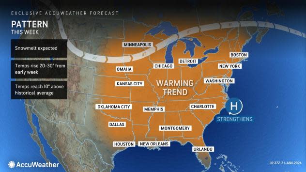
Temperatures will trend upward substantially next week from the pit of the cold this weekend. In some locations, temperatures will trend 20-30 degrees Fahrenheit higher over the course of 24-hours.
 |
Following low temperatures in the single digits Sunday morning in Chicago, temperatures can reach at least the 30s each day from Monday to at least Wednesday. Similarly, following a low around 20 F Saturday night in New York City, highs in the 40s are upcoming by Monday. Portions of the South Central and Southeast states will climb well into the 50s and 60s.
However, the upcoming pattern will have some issues as the cold air will linger in some locations across the north and on various surfaces where the air temperature can rise.
"With the ground likely starting well below 32 F and in areas where snow-packed roads and sidewalks remain, any moisture from fog or rain can cause sheets of clear ice to develop," DeVore said.
 |
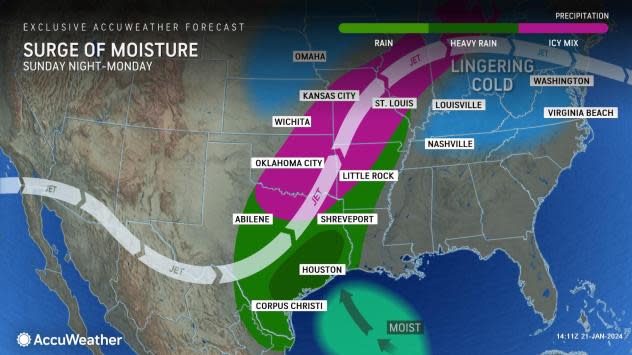
Some of the first ice-related problems will continue to develop over parts of the southern Plains and part of the Mississippi Valley into Monday. This is when the first batch of moisture will encounter cold ground.
The first several hours of the rain can freeze and build on exposed surfaces from northern Texas to Illinois. Motorists on area roadways may encounter dangerous conditions. It may take until later Monday for the ground to warm up in Missouri and until Monday night for conditions to improve in much of Illinois. The greatest chance of enough of a buildup of ice to bring down trees and power lines will be in and around the Ozark Mountains from Sunday night to Monday morning.
 |
Ice may not be the only problem for the southern Plains and the lower part of the Mississippi Valley.
"Our data suggests that part of the zone from central and eastern Texas to western Tennessee may pick up 4-6 inches of rain and locally 8 inches next week," AccuWeather Senior Meteorologist Joe Lundberg said, adding, "That's enough rain to trigger urban and flash flooding even in drought areas, but it may also push some of the secondary river levels up significantly."
 |
Farther to the north, the effects of the cold ground combined with cold air putting up more resistance will lead to more wintry troubles.
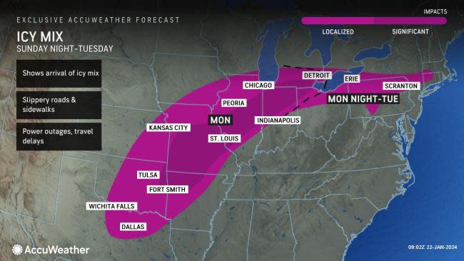
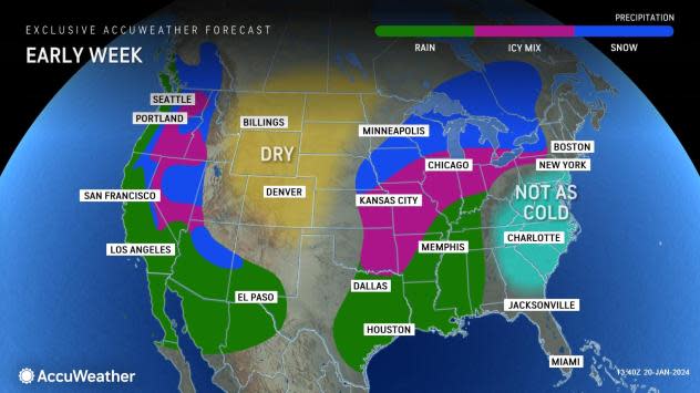
The same initial surge of moisture will lead to areas of rain, ice and snow from the Upper Midwest to the Northeast from Monday night to Wednesday. Localized pockets of ice are forecast to impact locations from northeast Texas to Michigan and Pennsylvania, while significant icing can occur Sunday night from southeast Oklahoma into far northeastern Ohio.
Most of the wintry precipitation in the Northeast will likely be near and north of Interstate 80, but pockets of ice are possible farther south through the Appalachians. The icy mixture can result in slippery roads and sidewalks, travel disruptions and power outages across the region.
 |
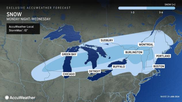
To complicate matters in the Northeast, a small push of cold air from the Arctic will race across southern Canada during the first half of next week. This is why the warming trend may end as wintry precipitation falls from Michigan to upstate New York and New England.
Several inches of snow will fall on the northern tier of the Great Lakes and into the Northeast from Monday night to Wednesday.
 |
But even in areas along the Ohio River and the Interstate 95 corridor of the mid-Atlantic, the action of milder and more moist air flowing over cold ground will produce fog, low clouds and even "ground sweat," which can dampen the ground even if it is not raining. The fog may slow travel on the highways and at the airports. Due to the drizzle or condensation, patches of ice may develop on colder, untreated surfaces.
Areas of fog, drizzle and patchy rain may also create travel problems in the Southeast.
 |
The magnitude and duration of the cold air have caused some ice to form on area streams, rivers and lakes in the Midwest and Northeast. The upcoming thaw will cause some of that ice to break up.
"Because the ice did not get all that thick in most places, the risk of ice jams will be low and generally limited to small streams and secondary rivers," Lundberg said. "In New England, any ice-jam flooding should pale compared to the magnitude of the coastal flooding and runoff from storms earlier this winter."
Want next-level safety, ad-free? Unlock advanced, hyperlocal severe weather alerts when you subscribe to Premium+ on the AccuWeather app. AccuWeather Alerts™ are prompted by our expert meteorologists who monitor and analyze dangerous weather risks 24/7 to keep you and your family safer.
