Hurricane tracker: Tropical Storm Harold makes landfall in Texas. Follow its path.
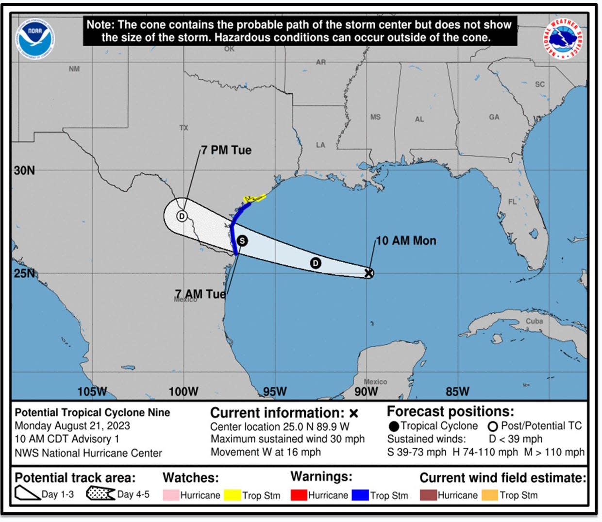
Tropical Storm Harold made landfall Tuesday morning on a barrier island off the coast of Texas.
The storm brings heavy rains, strong winds and the threat of tornadoes and flash flooding.
Harold, dubbed “Potential Tropical Cyclone Nine" until reaching tropical storm strength early Tuesday, could slam South Texas with up to 7 inches of rain into Wednesday, said Richard Pasch, a senior meteorologist with the National Hurricane Center. A "couple" tornadoes are possible across south Texas through the afternoon, he said.
AccuWeather said some localized areas could see a foot of rain.
Relief from the heat coming this week? Depends on the Gulf storm. Here's what we know
Here's how to track the tropical storms:
Track Tropical Storm Harold's path
Track the Tropical Storm Harold Spaghetti Models
Track Tropical Storm Harold rainfall levels in southern Texas
Track storms in the Atlantic Ocean
Elsewhere in the Atlantic Basin, Tropical Storm Franklin was forecast to hit the island of Hispaniola − shared by the Dominican Republic and Haiti − later Tuesday and into Wednesday.
The U.S. territory of Puerto Rico was also forecast to feel the effects of Franklin, mainly in the form of heavy rain and flash flooding. Franklin is expected to produce rainfall amounts of up to 6 inches across Puerto Rico through the middle of the week.
Meanwhile, far out in the Atlantic Ocean, Tropical Storm Emily dissipated into a remnant low Monday morning, while Tropical Storm Gert was likely to dissipate "at any time," the hurricane center predicted.
− Weather and climate reporter for USA TODAY Doyle Rice and Rewrite chief for USA Today John Bacon contributed to this report.
This article originally appeared on Oklahoman: Hurricane tracker: Tropical Storm Harold makes landfall in Texas

