Hurricane Hermine may pummel Mid-Atlantic coast over Labor Day weekend
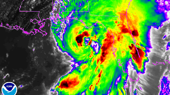
Hurricane Hermine is going to find itself boxed in once it swirls across Florida and the Carolinas during the next two days.
Hemmed in by a blocking pattern across Canada — with an area of high pressure across Quebec and a stalled low over the Canadian Maritimes — the storm is likely to make little northeastward progress for several days.
SEE ALSO: NASA flies over 3 hurricanes in one day and makes amazing time-lapse video
Instead it may spin around, wobbling like a drunken figure skater, about 250 to 350 miles east of Delaware.
Computer model projections vary regarding how long and far the storm stalls offshore, but it's becoming clear that it will be able to tap into the abundant energy of the Gulf Stream ocean current, and potentially transition from a hybrid "post-tropical storm" back into a more tropical system.
More importantly, perhaps, is that it's becoming evident that major impacts from this storm may be in store for areas hit hard by Hurricane Sandy just four years ago.
As of 5 p.m. ET on Thursday, tropical storm watches were hoisted for the Maryland, Delaware and New Jersey coast all the way north to Sandy Hook, N.J.
Even if the impacts don't turn out to be seriously damaging, Hurricane Hermine is going to ruin many beach vacations for Labor Day weekend, which is traditionally the last weekend of the summer and a critical tourism period.
High winds, dangerous waves and coastal flooding may be a hazard from Virginia north to Massachusetts, depending on the storm's exact path and intensity.
Some of the more dire computer model projections show Hermine intensifying back into a powerful hurricane off the Mid-Atlantic and bringing hurricane-force winds to New Jersey, potentially northward to near or over New York City, too.
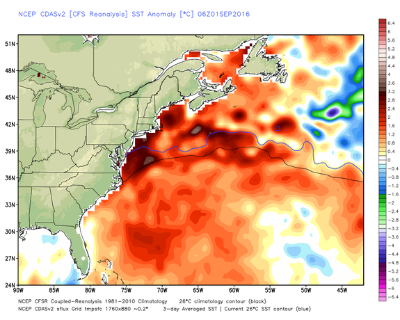
Image: weatherbell analytics
Tropical storm watches have been issued for all of the New Jersey coast south of Sandy Hook, all of Delaware, Maryland and Virginia as of 5 p.m. ET.
The forecast details will become more clear as the storm moves up the coast.
Warm water to fuel the storm
One of the reasons that the storm may re-intensify once it emerges to the southeast of New Jersey is that ocean temperatures along the Mid-Atlantic coast are extraordinarily warm for this time of year.
In fact, the ocean has been so warm that mass fish kills have been reported in New Jersey.
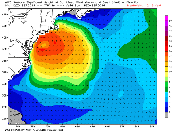
Image: noaa via weatherbell analytics
Some of the warm waters are due to natural variability, while human-caused global warming may also be playing a role, especially considering the worldwide record ocean temperatures set during 2015 and 2016 so far.
Of course, ocean temperatures aren't the only determining factor for how intense a storm can get and whether a hurricane can maintain its tropical characteristics or morph into a different type of storm.
Upper level winds and air temperatures also play a major role, and it is likely that the storm will take on the appearance of a powerful nor'easter for at least part of its trek up, near and around the eastern seaboard.
