Hurricane Dorian on track to slam Atlantic Canada
As Hurricane Dorian wreaks havoc across the U.S., Atlantic Canada is bracing for a storm to hit the area this weekend.
According to the Canadian Hurricane Centre, Dorian is expected to hit Nova Scotia around 3 p.m. local time on Saturday, moving into Newfoundland on Sunday. Maximum wind speeds are expected to be between 85km/h to 150km/h, weakening as it moves up through Newfoundland.
“Severe winds and rainfall will have major impacts for southeastern New Brunswick, Prince Edward Island, Nova Scotia, Western Newfoundland, and the Quebec Lower North Shore,” Environment Canada said in a public advisory.
“There will also be large waves, especially for the Atlantic coasts of Nova Scotia and Newfoundland and eastern portions of the Gulf of St. Lawrence.”

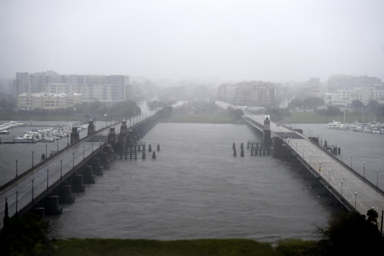
Brett Anderson, senior meteorologist with AccuWeather, expects the strongest winds to be across coastal areas of Nova Scotia on Saturday evening and night.
“It’s going to be moving along, that’s the good news, it’s not going to stall like it did across the Bahamas,” Anderson told Yahoo Canada. “It’s going to be moving at a fairly quick pace.”
Rainfall is also expected to be “significant” in the area, with the highest amounts likely hitting Nova Scotia and the Gulf of St. Lawrence.
“The highest rainfall amounts are likely for Nova Scotia, Prince Edward Island, and the Gulf of St. Lawrence region where 50 to 100 mm is expected,” Environment Canada predicts. “Forecast guidance is also suggesting a swath in excess of 150 mm north and west of Dorian's track.”
According to Anderson, Dorian will produce a particularly large amount of rain across the western two thirds of Nova Scotia, Prince Edward Island and extreme southeastern New Brunswick.
“Certainly flash flooding a concern for some areas,” Anderson said. “It’s going to be very, very stormy...Saturday evening through Saturday night across those areas.”
As it moves into Newfoundland, rainfall amounts are expected to die down. Anderson estimates that between 25 mm to 50 mm of rain will hit the area on Sunday.
“The most populated area of Newfoundland, St. John’s, they’ll be farthest away from the track so the impacts there are not going to be all that much,” Anderson said. “Nothing out of the ordinary there.”
Despite all the damage Dorian has caused at this point, Anderson says the storm that will hit Atlantic Canada won’t be completely unfamiliar to people in the region.
“It’s not like a storm we haven’t seen before,” Anderson said. “We get storms like this from time to time...I think they should be able to recover fairly quickly from this.”
But AccuWeather’s meteorologist still says individuals in the region should be prepared for localized power outages, tree damage and storm surge into some coastal areas, especially across southeastern Nova Scotia.
Hurricanes bring dangerous winds, heavy rainfall, storm surge, and the potential for flooding. If a hurricane or tropical storm is predicted:#NSStorm #Dorian pic.twitter.com/wA2ck2zHJm
— Nova Scotia EMO (@nsemo) September 5, 2019
Nova Scotia's Emergency Management Office is encouraging people in the province to prepare an emergency kit with food, water, medication and supplies for at least 72 hours, remove loose outdoor objects and move any important items from basements to an area as high as possible.
On Thursday, officials confirmed that Alishia Sabrina Liolli, a 27-year-old from Ontario, was among the 20 victims who died during the storm in the Bahamas.
The Canadian government is now recommending that people avoid all non-essential travel to the U.S. east coast, from Savannah River, in South Carolina, to the border of North Carolina and Virginia, due to Dorian.
Air Canada has also advised travellers of potential flight delays or cancellations across the Maritimes, due to Dorian.

