Hawaii bracing for flooding as atmospheric river unfolds


Another out-of-season storm will continue to affect Hawaii and is likely to deliver much heavier rain than the first, as an atmospheric river will be involved, AccuWeather meteorologists warn.
A storm locally called a Kona Low, which is a storm in the middle levels of the atmosphere, brought rounds of rain to parts of the islands from late last week to Mother's Day weekend. Up to several inches of rain brought localized flooding to Oahu and Kauai.
Earlier this spring, another Kona Low brought tremendous rainfall and flooding to part of the island chain. In a matter of hours, the storm unleashed rainfall equal to seven times that of the entire month of April in Lihue, Hawaii, and five to 10 times the April historical average on the island of Kauai. Honolulu received two times the April average from the storm in mid-April.
 |
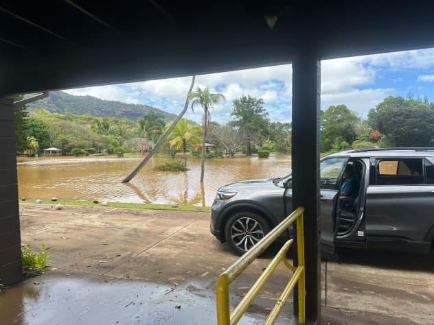
This photo provided by Kauai County, Hawaii, shows the flooded Wailua River area near Smith’s Tropical Paradise, in Kauai County, Hawaii, Friday, April 12, 2024, when heavy rainfall caused flooding. (Courtesy of Kauai County, Hawaii via AP) |
"Kona Lows are more common during the late fall through the early spring, so the one from this past weekend is a bit out of season," AccuWeather Senior Meteorologist Brett Anderson said. "This is typically the dry time of the year around Hawaii before trade wind showers and tropical downpours ramp up."
As if one Kona Low was not enough, a bigger one will continue to affect the islands through much of the weekend.
"A very powerful Kona Low will bring rounds of flooding rain to portions of Hawaii into Sunday," AccuWeather Meteorologist Alex DaSilva said.
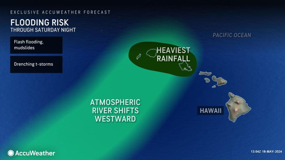
"While the heaviest rainfall is forecast to occur from Maui to Ni'ihau along the south- and west-facing mountainsides, the Big Island can still see periods of rain, especially in the higher terrain," DaSilva explained. Heavy rain on these sides of the islands is atypical, as the northeast trade winds tend to bring soaking rains on the northern and eastern sides and slopes.
A long plume of moisture, called an atmospheric river, will extend from near the equator northward through the islands for the remainder of this weekend. This firehose of rain will tend to shift from day to day. Depending on the intensity and persistence of that atmospheric river, rainfall could be excessive.
As of late Saturday, Honolulu had picked up nearly 5 inches of rain since late last week from the setup, with more on the way.
"Localized areas in the higher terrain in some of the islands could receive rainfall amounts over 10 inches, which could cause life-threatening flash flooding and mudslides," DaSilva said.
 |
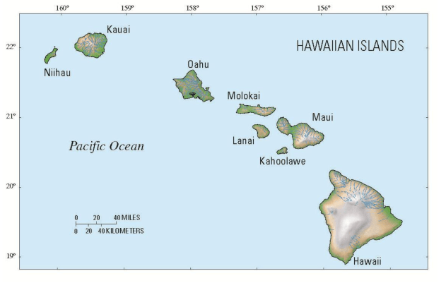
Map of Hawaiian Islands. (United States Geological Survey/USGS) |
Winds can be very strong in the higher elevations as well.
"Because this Kona Low is forecast to be more powerful than what is typical, it will bring strong winds, especially over the higher elevations," DaSilva added. "Along with triggering large swells from the northwest that can create overwash along the coast with dangerous rip currents through the weekend."
The most concentrated plume of moisture associated with the atmospheric river will tend to shift farther to the west over the weekend, so the worst conditions may be limited to Oahu, Kauai and Ni'ihau.
 |
Oahu will be hit by both rounds of rain through Saturday night.
However, because the plume may broaden as it shifts, showers can still be scattered about the islands this weekend, and localized heavy rainfall with flash flooding may continue.
The Kona Low itself may wander farther to the west and weaken in the upcoming week, allowing the rain to move west of the more populated islands in Hawaii.
Want next-level safety, ad-free? Unlock advanced, hyperlocal severe weather alerts when you subscribe to Premium+ on the AccuWeather app. AccuWeather Alerts™ are prompted by our expert meteorologists who monitor and analyze dangerous weather risks 24/7 to keep you and your family safer.
