Will hail, damaging winds hit the Dallas-Fort Worth area this week? Here’s what to know
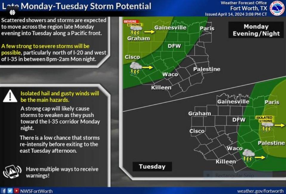
Isolated hail and damaging winds are expected back in the Dallas-Fort Worth area as early as Monday night, the National Weather Service Fort Worth office reports.
A dryline forming in Big Country, just west of the Metroplex, will begin to move east later today. The intensity of the thunderstorms that are likely to form in this system will depend on how quickly the cap over the region dissipates. This cap is why North Texas enjoyed a warm and relatively clear Sunday afternoon with highs in the 80s.
“The greatest potential for a few strong to severe thunderstorms will fall between 8 p.m.-2 a.m. Monday night, predominantly along/north of I-20 and west of I-35. Isolated hail and damaging winds will be the primary hazards,” Fort Worth meteorologist Miles Langfeld wrote on the NWS website.
It is very likely that the storms approaching Dallas-Fort Worth Monday — just west of the I-35 corridor — will weaken because of a strong cap hanging over the area. A cap is a layer of relatively warm air high in the atmosphere which suppresses or delays the development of thunderstorm even in the presence of extreme instability.
⚡ More trending stories:
→Snakes are crawling out of hibernation in Texas. Check the toilet before taking a seat.
→In Texas, set your thermostat at 80 when it's 100 degrees, expert says.
→Groceries at this national chain are the cheapest, study finds.
Early last week, threats of large hail and even possible tornadoes pressured event organizers in Texas communities large and small to make decisions on whether to continue with their plans for the total solar eclipse or cancel.
The storms moving across North Texas overnight Monday are likely to stall east of the Metroplex but any chances it could find a second wind will happen east of the our forecast area.
“This system is not expected to be a heavy rain or flood producer, with most areas likely seeing less than 0.25” of rain,” according to Fort Worth meteorologist Matt Stalley.
Thunderstorm activity will finally move off to the east by Tuesday afternoon as drier air arrives to North Texas, Stalley wrote on the NWS website.
“This will lead to a warmer and rain-free midweek period, with highs climbing into the 80s and even lower 90s by Wednesday,” he wrote.

