Gusty winds accompany scattered showers and possible t-storms; temps to drop

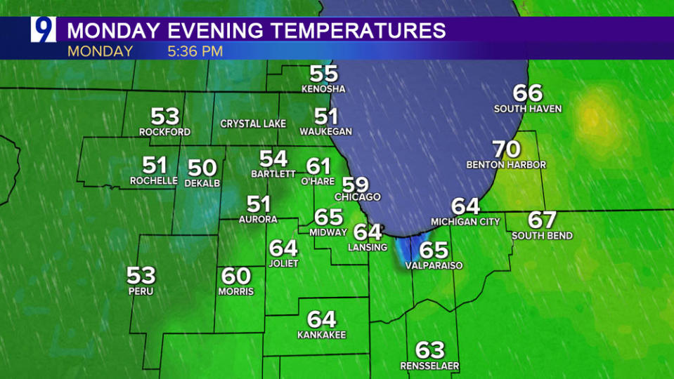
Monday’s gusty southerly winds ahead of strong spring storm push temperatures into the 60s for parts of the area, significantly warmer than Sunday afternoon
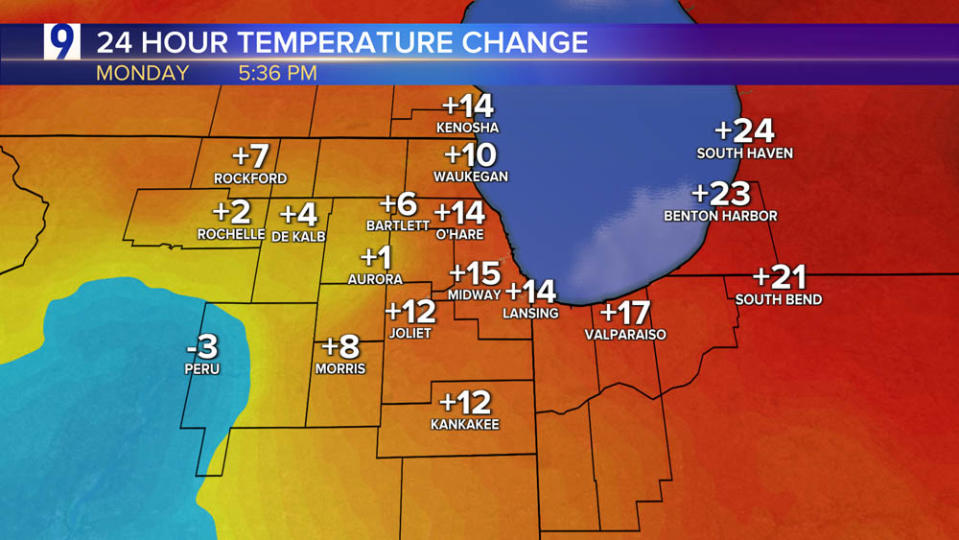
Monday 5 pm temperatures How much warmer than same time Sunday?
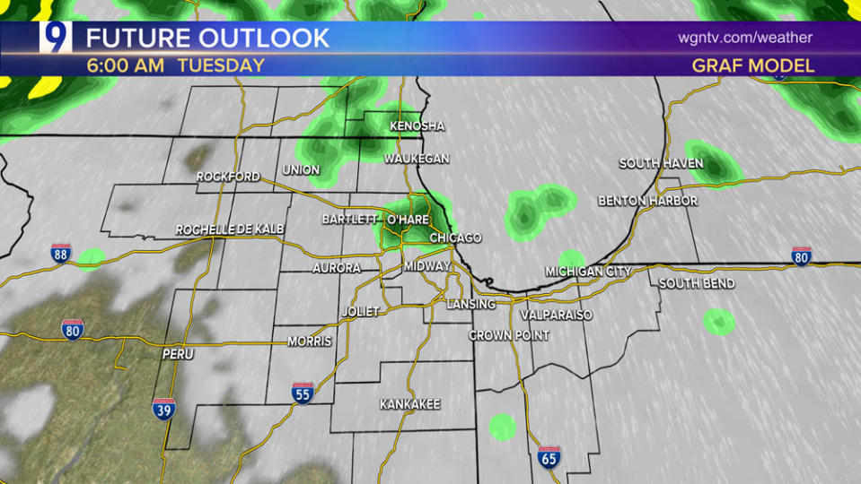
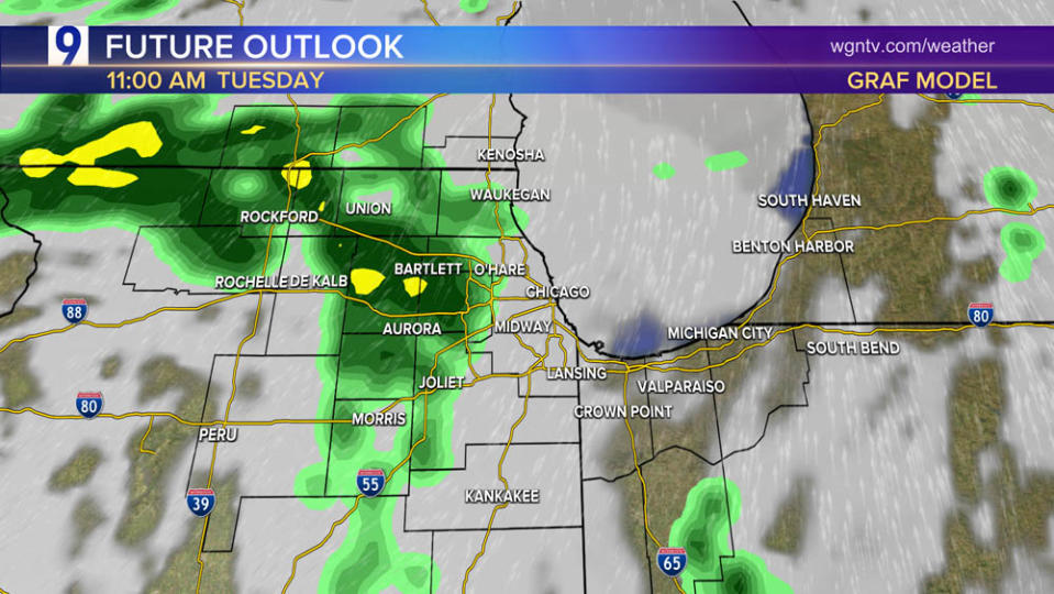
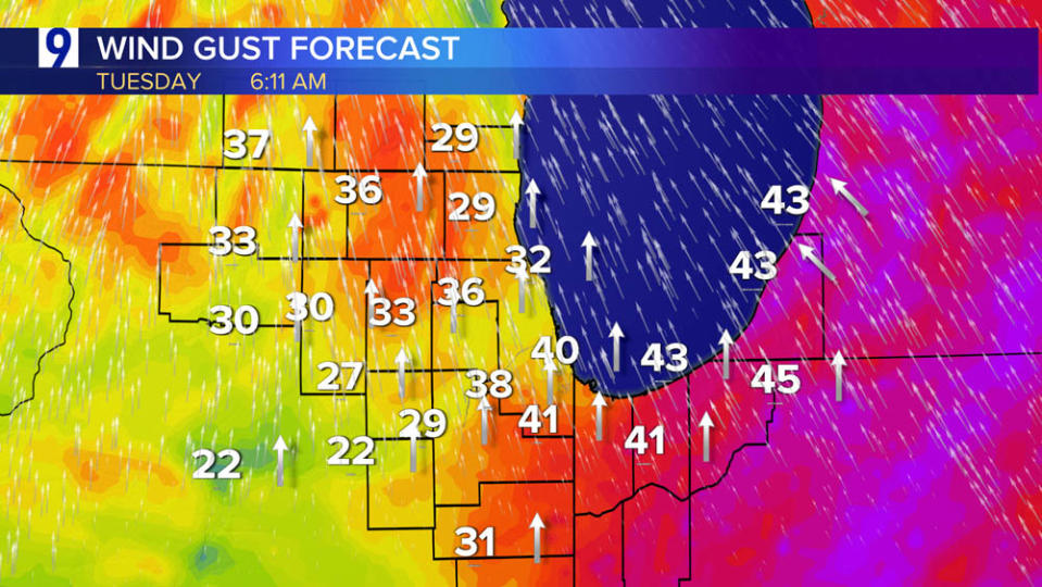
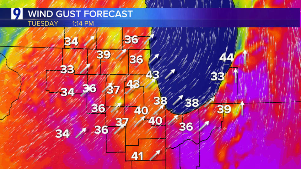
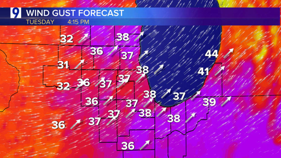
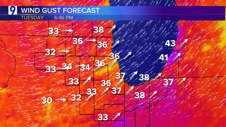
Period of gusty winds to accompany Tuesday’s scattered showers and possible thunderstorms
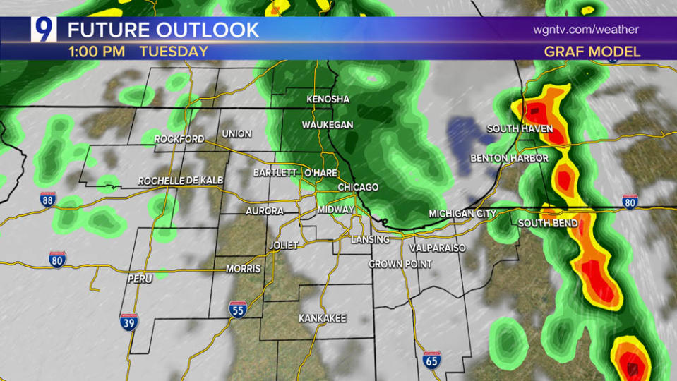
Tuesday’s Chicago Area Severe Weather Outlook
The timing if it happens would be late morning until early/mid afternoon before the cold frontal passage. Marginal risk—level 1 of 5 on the severe risk scale—for strong or isolated severe thunderstorms. Threats: Damaging gusts and perhaps a brief tornado or two.


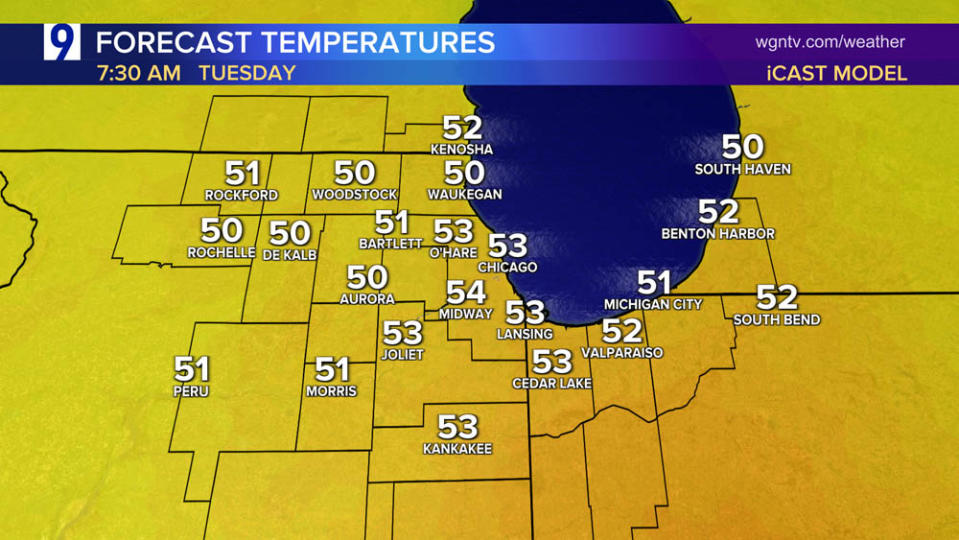
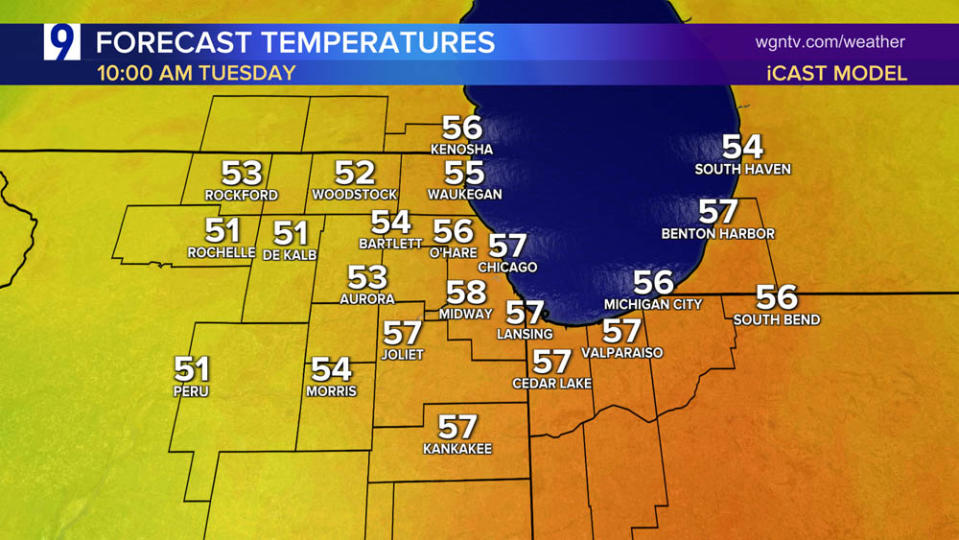
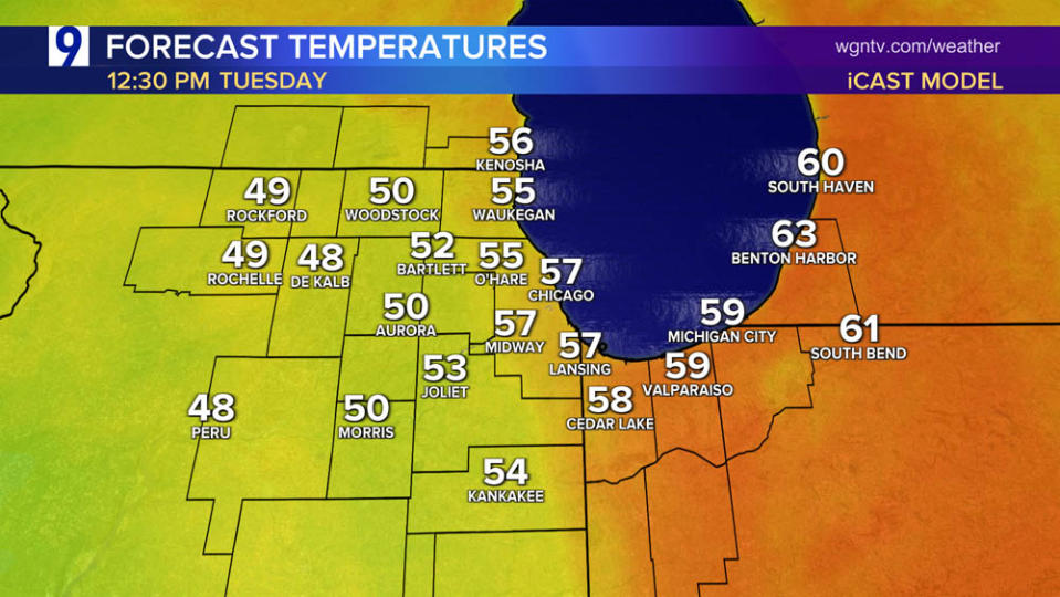
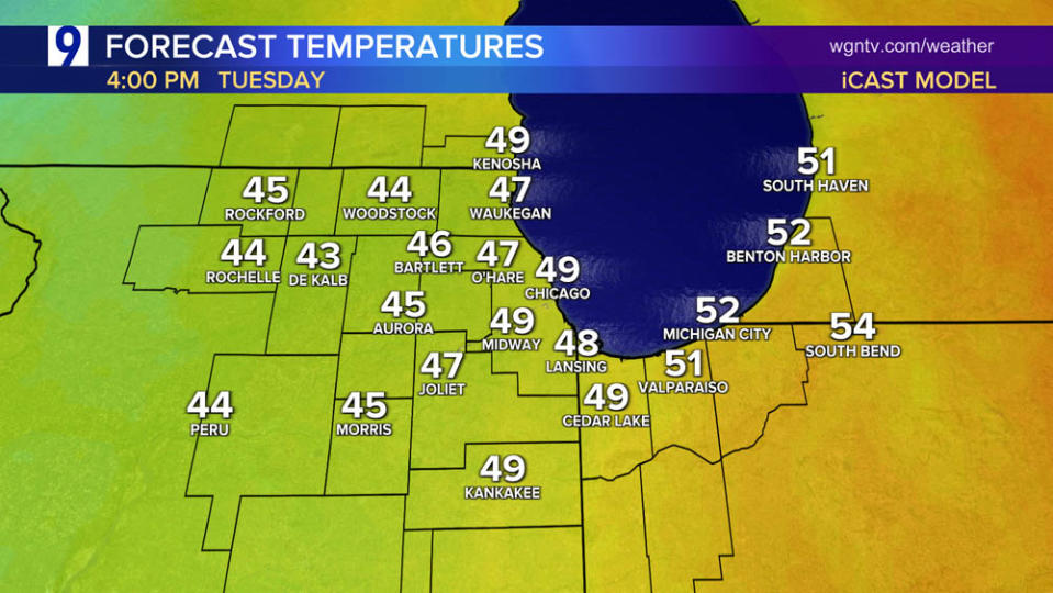
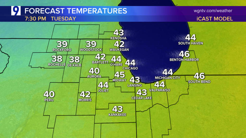
Tuesday’s Temperature Drop
Temps will be mild for the first half of the day and peaking near 60 degrees, then temperatures fall through the 40s by evening:
Multi-faceted spring storm to produce blizzard conditions on one side with windy, potentially severe storms on its warm side

Classic Spring storm places Chicago in its “warm sector” bringing noticeably milder temperatures while wintry chill and snow impact the western Plains and Rockies
Monday highs approach 70 in parts of northwest Indiana

Temperatures warmed 15+ degrees over Sunday into the 60s


It may be the second week of Spring, but U.S. snowpack has doubled since last month with 32.7% of the country under a covering of snow

Heavy late-season snowstorm across the Upper Midwest
Snowfall totals through Monday:

As of 10 pm Monday, many areas to the west and north of Chicago have picked up more than a half inch of rainfall with precipitation continuing.


For the latest news, weather, sports, and streaming video, head to WGN-TV.

