Gray wolves map shows growing movement across Colorado
DENVER (KDVR) — Colorado Parks and Wildlife shared its second collared gray wolf movement map on Wednesday, showing that the tracked wolves have moved farther into Rio Blanco County and also east toward Boulder County.
The agency also shared that one of the 12 wolves released into Colorado has a malfunctioning collar. A second collar is partially functional, but researchers worry it may not be functional soon. Because of this, the watershed map of where the wolves have traveled is only based on information from the functional collars.
After wolf-dog causes stir in Douglas County, its family aims to educate
CPW said it viewed the wolf whose collar entirely failed from an airplane and confirmed it was traveling with another wolf that still had a functioning collar. CPW also confirmed the wolf with a non-functioning collar is alive.
CPW also confirmed that all wolves released in Colorado in late 2023 are still alive and that no ranchers have reported livestock depredation from wolves.
This map shows collared gray wolf activity recorded by CPW from Feb. 28 to March 25, 2024. (Courtesy Colorado Parks and Wildlife) This map shows collared gray wolf activity recorded by CPW from Dec. 18, 2023 to Jan. 22, 2024. (Courtesy Colorado Parks and Wildlife) A map provided by CPW shows the proposed locations for wolf reintroduction in Colorado
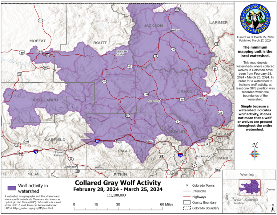
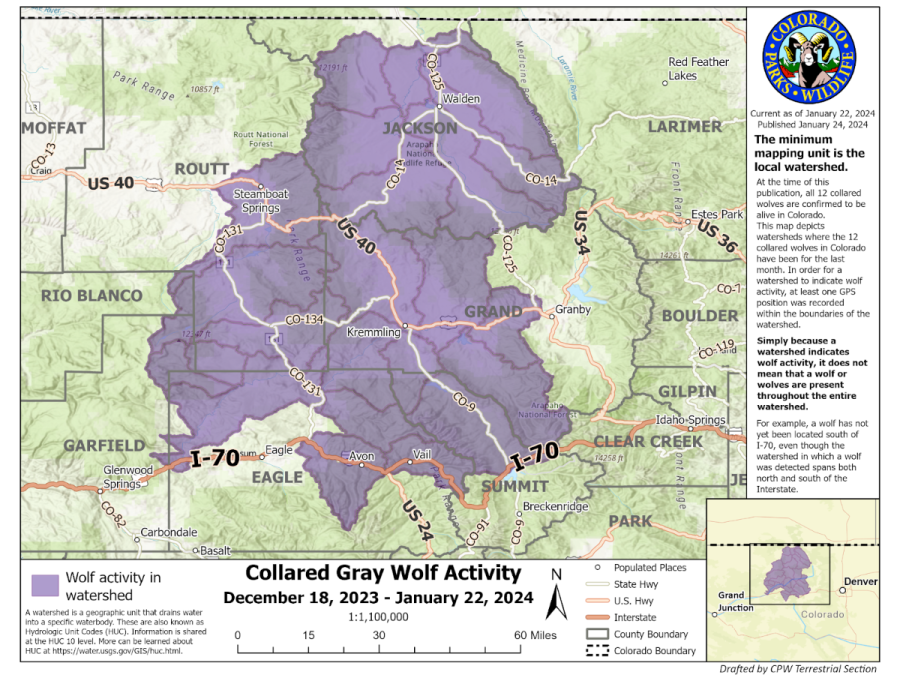
The maps only show the watersheds that the wolves’ GPS data has placed them in from Feb. 28-March 25, a measure intended to protect the wolves from tourists, hunters or the general public. The collars send CPW packets of information showing the last four GPS locations recorded.
According to the map, at least one wolf has entered new watersheds in Rio Blanco that drop into northern Garfield County, as well as a watershed that spreads south of Interstate 70 in Eagle County.
It also appears that wolf activity has been traced to a watershed that spans past Highway 40 to the edge of Boulder County.
FOX31 Newsletters: Sign up to get breaking news sent to your inbox
The watershed map releases were introduced to ease tensions between CPW and livestock producers in the state and to warn recreationists when they may be traveling in wolf territory. CPW also released a guide on living in wolf country.
For the latest news, weather, sports, and streaming video, head to FOX31 Denver.
