How GPS Changed the Way We Think About Our Planet
Iceland is breaking apart.
While the country's 333,000 people, millions of puffins, and influx of tourists live in harmony, the rock underneath them is slowly separating. That's because this Nordic island nation is being cut in half by a serpentine oceanic ridge, called the Mid-Atlantic Ridge, as it snakes its way through the Atlantic Ocean and cuts up the Eurasian and North American tectonic plates.
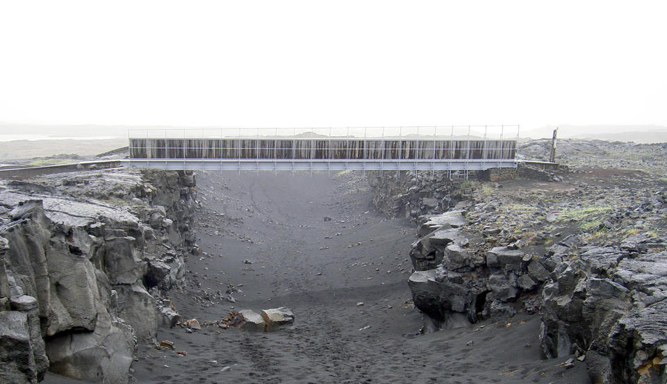
This slow divorce is hidden in plain sight, seen in scars that dot the country. But the most striking example lies at the edge of the Reykjanes peninsula where a footbridge visually displays this growing fissure between the two continental plates-at a small but noticeable 2.5 centimeters (about an inch) a year.
How do we know it's moving at this crushingly slow speed? The same technology you use to navigate while driving.
Today, we think of GPS as a directionally challenged motorist's best friend, but in the field of geodesy, GPS is something much more. "We are learning the direction of the plates' movement, how (they are) interacting with volcanic systems, and the retreating of glaciers," says Benedikt G. Ófeigsson, GPS specialist in the Icelandic Meteorological Office. "(But) the main insight we are gaining is that the (Earth's) crust is really dynamic."
Ridicule and Redemption

To understand how GPS revolutionized Earth science in just 30 years, you need to know the low-tech ways scientists used to study the Earth for centuries. For centuries, scientists hypothesized that the continents were moving. In the 16th century, Flemish cartographer and creator of the first modern world atlas, Abraham Ortelius, theorized that natural phenomena like earthquakes and floods had torn the Americas away from Europe and Africa.
It would be a couple more centuries for German meteorologist Alfred Wegener, who first proposed the "theory of continental drift" in 1912, to begin fashioning our modern understanding of what's happening under our feet. Wegener's hypothesis concluded that all the continents were once joined together in one large landmass known as a "supercontinent," but millions of years ago it broke apart and the continents slowly drifted to their present-day locations.

Like many forward-thinking scientists, Wegener was ridiculed for his ideas at the time. His German colleagues said he was having "delirious ravings" and that he was sick with "moving crust disease and wandering pole plague." Today, however, we know that Wegener was much closer to the truth than any of his doubtful contemporaries. But to find the evidence to back up his theories, the world would have to go to war.
Roger Revelle, the U.S. Navy's chief oceanographer, called the mid-20th century "One of the greatest periods of exploration of the Earth...every time you went to sea, you made unexpected discoveries...nothing that we expected was true. Everything we didn't expect was true."
It was during World War II, while searching for submarine hiding spots, that the U.S. military discovered a seafloor filled with vast oceanic ridges and deep trenches. In the 1950s, scientists went back into these trenches with magnetometers and realized that these ridges at the bottom of the seafloor were paralleled by matching magnetized "stripes" that were made up of iron-rich basalt. Because these stripes of basalt are magnetized, millions of years of changes in the Earth's magnetic fields essentially recorded how the continents moved.
"Nothing that we expected was true. Everything we didn't expect was true."
Soon after, an explosion in oceanic exploration helped flesh out the theory of seafloor spreading, eventually leading to the landmark 1963 paper that vindicated Wegener's original theory-with one major adjustment. It was actually large portions of the Earth's crust, or plates, that had broken apart rather than individual continents. Their movement through the mantle over millions of years was like sheets of ice gliding on a lake, and where these plates meet are called "plate boundaries," filled with seismic activity and volcanic eruptions.
This is the theory of plate tectonics. But this formulated theory was only the beginning, now scientists needed to find a way to accurately measure the entire planet to see if they were right.
Sizing Up Earth

Until the early 1970s, scientists used rudimentary methods to measure these newly discovered plates. One of them was optical triangulation, setting up two vertical points and measuring the horizontal angle between them from a third point. Although a sound method, it wasn't exactly cutting edge and was likely the same method used by George Washington when surveying land in Virginia around the mid-1700s.
Other methods, which were equally outdated, were also unsuccessful at measuring granular movement over large distances, says Chuck Meertens, director of geodetic data services UNAVCO, a consortium that aids geoscience research and education across the globe. "You could confirm the fact that the San Andreas was moving, but [you] certainly didn't know what it was doing on any scale."
Scientists needed all-new tools, and eventually they arrived as the NASA-tested technology Very Long Baseline Interferometry (VLBI), a kind of proto-GPS that determined Earth's orientation in space by measuring the time difference it takes for a radio wave emitted by a distant space quasar to arrive at different spots on a global network of Earth-based antennas. By making measurements of signals from a number of different quasars they can precisely determine the position of these antennas.
This was extremely valuable information for geoscientists, because by measuring position changes year to year, they could determine plate movements across continental scales. Still, it came with its own limitations. While these measurements were precise, there were less than a dozen of these antennas scattered across the globe limiting the amount of data collected. Also these immobile antennas weighed several tons.
Luckily, scientists soon found a better way.
The Success of GPS
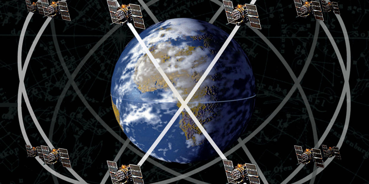
Developed by the military for tracking subs and launching nuclear weapons, GPS is a network of satellites, equipped with an atomic clock, a computer, and a radio, orbiting Earth approximately every 12 hours.
But even the process of creating GPS was a huge scientific breakthrough due to Einstein's Theory of General Relativity. Because of a slight warp in spacetime between Earth's orbit and the surface, engineers used Einstein's theory to help take in account for the slight variations between the function of time in space and on Earth. Without it, GPS would snowball into an inaccurate mess within only a few minutes.
Founded in 1984, UNAVCO became one of the first organizations to acquire GPS commercial receivers for geoscience research. At the time, they each cost about $300,000.
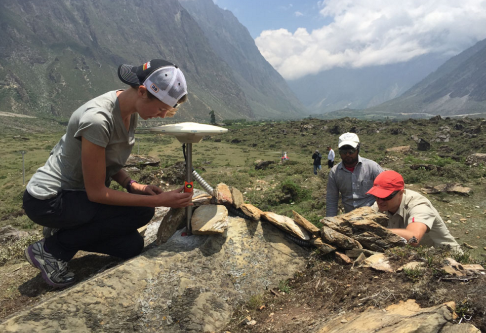
On the ground, receivers detect radio signals from at least four of these satellites at all times to precisely locate its position. The data received are measurements of satellite-receiver-travel time and can be processed to obtain a ground station's exact longitude and latitude. Geodesy research uses these anchored GPS stations that can determine location down to a millimeter.
Our phones actually use the exact same satellites as the military and geodesy research sites. The only difference is that while they use multiple frequencies, civilian GPS use only one.
Not much separates GPS from its VLBI predecessor except for one clear advantage. Equipment can be transported wherever researchers want, leading to a proliferation of permanent GPS sites. "With GPS, we didn't have trailers full of stuff," says Meertens. "We had two really heavy suitcases, a couple of car batteries and an antenna...it was 250 pounds of stuff, but certainly better than a trailer."
The way I now look at the world is that it's this giant, pulsating thing.
Today, 31 GPS satellites orbit Earth emitting data to over 1,100 permanent UNAVCO-operated GPS research sites in the U.S., many of which reside along the North America-Pacific plate boundary called the Plate Boundary Observatory. It's this proliferation of data over the past three decades that has completely changed what we know about when, why, and how the Earth moves.
Researchers like Jessica Murray, a research geophysicist at the United States Geological Survey (USGS) can study newly discovered phenomena called "episodic tremors" and "slow slip events," because of the near-ubiquitous presence of permanent GPS stations. In subduction zones, or the area where two tectonic plates collide, GPS measurements have shown that fault lines can move without causing seismic activity. In other words, the Earth below us is moving but we can't feel it. What does this mean? Murray says the answer is up for debate.
"Is it actually increasing seismic hazard because movements in that place are putting strain on neighboring parts of the fault," says Murray, "Or is it actually relieving stress without actually having an earthquake? There's still a lot we need to learn about it."

Other examples are even more strange. In a plate boundary that stretches from Vancouver Island to Northern California, GPS measurements show that the continental plate is generally pushing east. But then something weird happens. "Almost like clockwork, every 14 months, the whole plate sort of rebounds back to the west," Meertens told Popular Mechanics. "And it's happening on a scale of state-sized dimensions...People don't totally understand it yet."
What Moves You?
Despite some unanswered questions, in GPS's short lifetime we've learned that the Earth's tectonic plates-from Iceland to Oregon-are constantly moving, shifting, and adjusting.
Every single day, Iceland experiences earthquakes of varying scales, and in the southern part of the country, Mount Helka could be on the verge of eruption. The steady evolution of not only the preciseness of GPS but also the nearly real-time speed in which the information can be delivered even has the potential to save lives.
"The way I now look at the world is that it's this giant, pulsating thing," Meertens says. "It's amazing."
Because of GPS, the slightest movements can be detected instantaneously and folded into early-warning systems. "With GPS there is no guessing," As Meertens says. "This is what happened and we can tell you right away." Combined with the near-instant mass communications and for the first time in human history we're moving quicker than the Earth.
You Might Also Like

