Google Maps Unveils Views of Everest

Those unwilling to face the altitude sickness, crevasses and avalanches of Mount Everest can still explore the world's highest mountain from home.
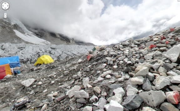
Google Maps has unveiled stunning, panoramic imagery from some of the highest, most remote places on Earth, including the 18,192-foot-high (5,545 meters) Mount Everest base camp. (Everest's peak is at an altitude of 29,035 feet, or 8,850 meters)
Previous exploration-themed additions to maps on Google Earth have included views of the topography of the ocean floor and Google street-view looks of the Amazon rainforest.
The maps now include 360-degree views of four of the seven summits, the highest peaks on all seven continents. Users can virtually hike snow-covered Mount Elbrus, the highest peak in Europe, hang out at the Plaza Argentina base camp at Aconcagua, the highest peak in the Andes Mountains, and walk amid the clouds at the base camp for the world's tallest peak.
The new imagery also allows users to climb 19,341 feet (5,895 m) to Mount Kilimanjaro's Uhuru, the highest point in Africa. Mount Kilimanjaro is actually a stratovolcano that formed about a million years ago from layers and layers of volcanic ash, lava, pumice and tephra.
To capture the photos, the team used a lightweight camera and tripod with a fish-eye lens.
In 2011, the Google Maps team spent 12 days, hiked more than 70 miles (113 kilometers) and reached an altitude of 18,192 feet at the Everest base camp. As part of the process, they faced earthquakes, flash floods and mudslides, Sara Pelosi, a manager at the company, wrote on Google's lat-long blog.
The images can be viewed in Google Maps on iPhones or Android phones.
Follow Tia Ghose on Twitter @tiaghose. Follow us @OAPlanet, Facebook or Google+. Original article on LiveScience's OurAmazingPlanet.
Copyright 2013 LiveScience, a TechMediaNetwork company. All rights reserved. This material may not be published, broadcast, rewritten or redistributed.
