Get ready, Canada: Powerful winter storm to blast every province from Ontario to P.E.I.
Many in Ontario and Quebec have seen reports of a storm with significant snowfall on the way for the weekend, but those predictions may not be telling the whole story.
The provinces are still being closely monitored for their storm pattern, with small changes expected to cause significant shifts in snowfall across the region with over 60 cm of snow expected on the American side of the border, just south of Lake Ontario.
According to Doug Gillham, meteorologist with The Weather Network, “the best model in the world” had very little snow projected in Toronto for the weekend, just a couple of centimeters, while all the other models had a high-impact storm for the whole 401 corridor with 20 to 30 cm expected.
The latest updates to the models have now put the predictions closer together but it’s still a “tricky forecast” for weather experts to nail down, with large ranges in snowfall across short distances.
Band of lake effect flurries continues to drift north thru Toronto & east GTA. Just a dusting for most, but very fluffy flakes that can readily add up to 1-3 cm where flurries are most persistent – but very little substance to the snow (easy to brush off car etc.) pic.twitter.com/uGwOYSZNDA
— Doug Gillham (@gtaweather1) January 17, 2019
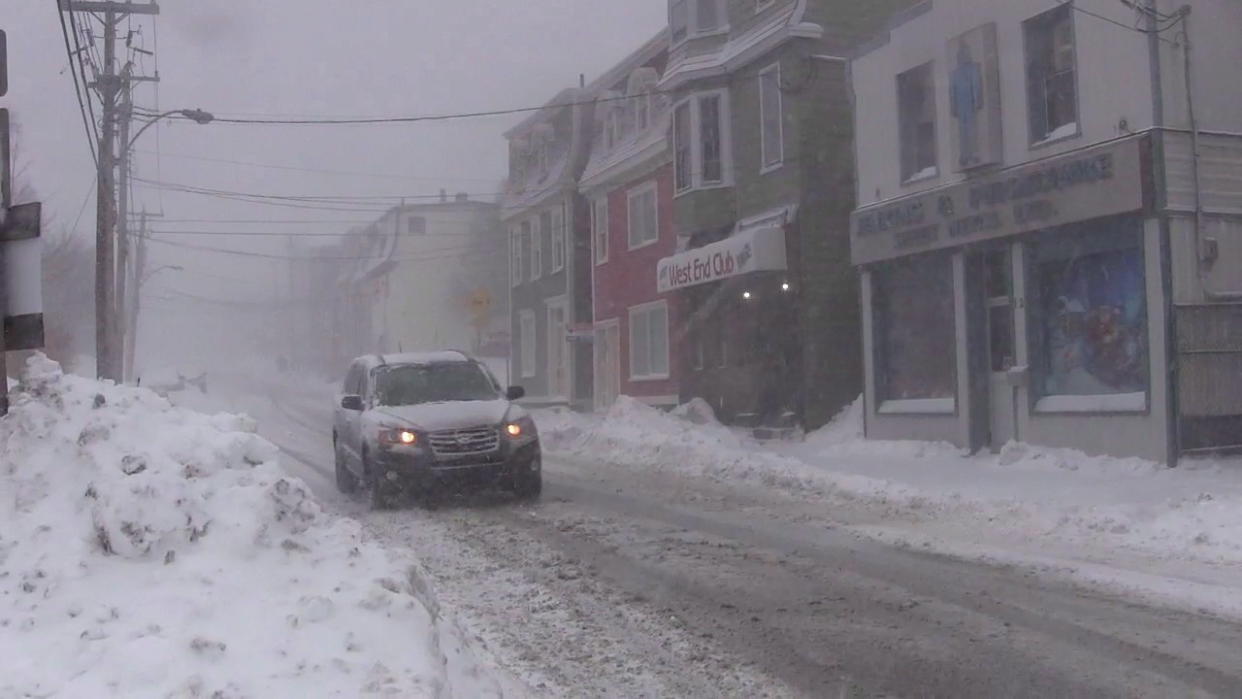
Ontario
According to Gillham, the latest update has increased the snow amounts for the 401 corridor, with a threat for impact on travel. Generally, 5 to 15 cm is expected to fall across much of the 401.
Windsor is expected to see 10 to 20 cm, 10 to 15 cm for the Oakville, Burlington area, and 15 to 30 cm is expected in Niagara. The highest impact of the storm will be seen around the west-end of Lake Ontario and Niagara, Oakville to Fort Erie.
Moving into the city of Toronto, more snow is expected to fall near Lake Ontario, with lesser amounts expected to move north towards Highway 407. The Weather Network predicts about 5 to 10 cm of snow near the lake and 10 to 15 cm for the west GTA. The Kingston area could see near 20 cm of snow, while the Ottawa region will likely only see 5 to 10 cm.
“We are on the northern edge of the storm where there is a sharp boundary,” Gillham said. “…With the northern edge (of the storm) being so close to the 401, any subtle shift north versus south for those areas has a big impact.”
For Toronto, Saturday afternoon through the evening will be the height of the storm, diminishing in the overnight, but the Niagara storm will continue to go through the night.
On Sunday, a band of lake effect snow off Lake Huron and Georgian Bay will be present, with difficult travel between London and Sarnia, and London and Windsor, with a squall coming in off Lake Huron.
Gillham said another key point for people in the region to be aware of is the blowing and drifting snow. He identifies that it will be “light and fluffy,” not particularly difficult to lift and move.
“Not much liquid can produce a decent amount of snow and that’s why you can get large ranges too,” Gillham said. “You don’t have to get that much more liquid and you’ve added five more centimeters of snow.”
In addition to the questions around snowfall, the weather expert says the “big story” across the region is the frigid temperatures.
“It’s going to be unusually cold with this storm and that makes road treatments not nearly as effective,” Gillham said. “We’ll also have strong and gusty northeast winds, adding a bitter windchill causing extensive blowing and drifting snow where the snow occurs.”
North of Toronto, highs on Sunday will not reach -15 C and moving into cottage country, highs will be around -15 C to 20 C, dipping into the -30s with windchills.
Quebec
Gillham expects Montreal will see more snow than Toronto, but just like Ontario, a subtle shift in the storm pattern from the U.S. can significantly impact the amount of snowfall in the province.
North of the city, snow amounts are expected to be around 10 to 15 cm, quickly increasing to 15 to 25 cm southeast of the city, with 30 cm projected in the eastern townships.
“The storm peaks Saturday night into Sunday with a sharp range in accumulations north of the city, up towards Mount Tremblant, versus the eastern townships,” Gillham said.
Still unsettled here in Bonavista tonight at 11:10PM. Very windy. #nlwx #ShareYourWeather #StormHour pic.twitter.com/vu730JHbbK
— Mark Gray (@MarkGray3) January 16, 2019
Maritimes
The biggest weather story in the country might end up being Atlantic Canada, particularly around New Brunswick.
“Uncertain on (calling) it an ‘ice storm’, where that heaviest freezing rain will be, but high confidence on a high-impact storm for them,” Gillham said.
As we head into Sunday, snow still develops across the Maritimes, changing to rain across the south. Nova Scotia is expected to see heavy rain while New Brunswick will see large amounts of snow. The Weather Network is forecasting 30 to 60 cm of snow, with over 60 cm expected in some areas.
“Highest impacts will the Fredericton, the Miramichi area, really all of central and northern New Brunswick highly impacted,” Gillham said. “We’re going to have to watch to see if we reach blizzard criteria in some places.”
Gillham identities that one of the biggest areas of concern is freezing rain across St. John, Moncton and P.E.I, including Charlottetown.
“This is an exceptionally moisture-laden system that’s running into Arctic air…the models are putting out staggering amounts of freezing rain,” Gillham said.
There is also a risks that people in the area could be without power for an extended period of time, as a result of the storm, with temperatures dipping below freezing on Monday.
“Sunday’s the day that’s highly impacted, Saturday’s the calm before the storm for them,” Gillham said. “This is the day when it probably is a good call to go out and get groceries, and just plan on not travelling Sunday.”
Gillham is confident that schools will be closed on Monday across New Brunswick.
In an opposing weather story, Gander, Nfld. could see record high temperatures on Monday at a high of 9 C, with the current record sitting at 8.9 C.
“For Newfoundland, many areas will start off with some snow and ice but warm air really quickly takes over and most of Newfoundland is going to see a change over to rain,” Gillham said.
The exception of this warm-up is the far northern areas of the province, the Northern Peninsula. This area will continue to see snow and ice, with the possibility of significant amounts of freezing rain.
Quite the temperature difference in the Prairies this weekend. Down-sloping winds will bring temperatures up to 1 C for AB foothills, meanwhile -30's (before wind chill) in the the north. This boundary will also kick out about 15-20cm of snow from Grand Prairie, AB to Estevan, SK pic.twitter.com/lJg5srq7Yu
— Jaclyn Whittal (@jwhittalTWN) January 17, 2019
British Columbia and Prairies
The weekend starts off with above-seasonal temperatures in much of B.C. and southern Alberta on Saturday. Rain and mountain snow, especially across the B.C. coast, is expected, with snow expected in Edmonton as well.
“A significant swath of snow stretches from northern B.C….southeast across most of northern Alberta, especially north of Yellowhead,” Gillham said. “And then that extends southeast into Saskatchewan over to Regina, not a crippling storm but there a swath of significant snow that will be running along the boundary between milder Pacific air that’s trying to push east and the Arctic air that will be sitting over most of the Prairies.”

