GALLERY: Strong storms roll through Middle TN, Southern KY | May 26, 2024

NASHVILLE, Tenn. (WKRN) — Hail poured and trees fell in parts of Middle Tennessee and Southern Kentucky as massive thunderstorms rolled across the region Sunday.
Scattered showers and storms moved across the Plateau into the early evening hours om Sunday, May 26. There was brief period of calm conditions in Middle Tennessee and Southern Kentucky before the main line moved in overnight and into the early morning hours on Monday, May 27.
More strong storms expected through the night in Middle TN, Southern KY
A Moderate Risk (level 4/5) was issued for areas primarily north and west of Nashville and I-65, including Southern Kentucky counties on Sunday, May 26. The rest of Middle Tennessee and Southern Kentucky remained under an Enhanced Risk (level 3/5).
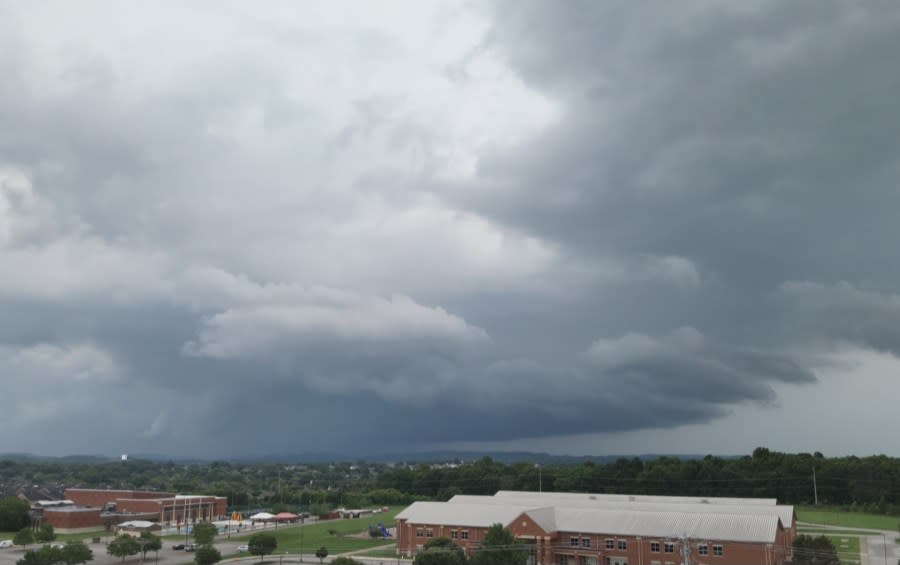
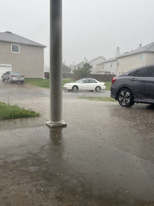
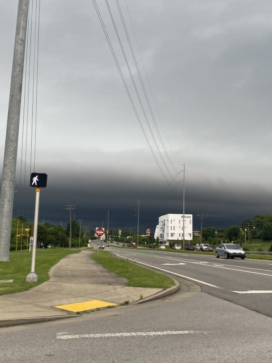
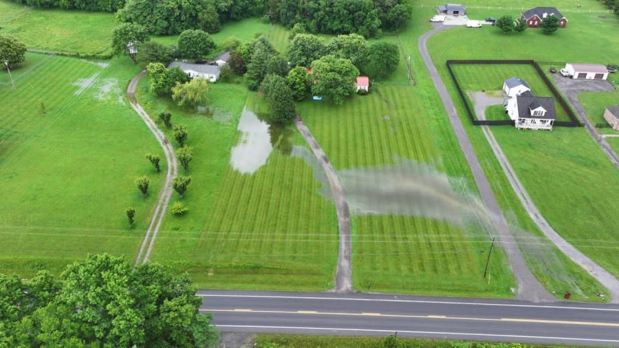
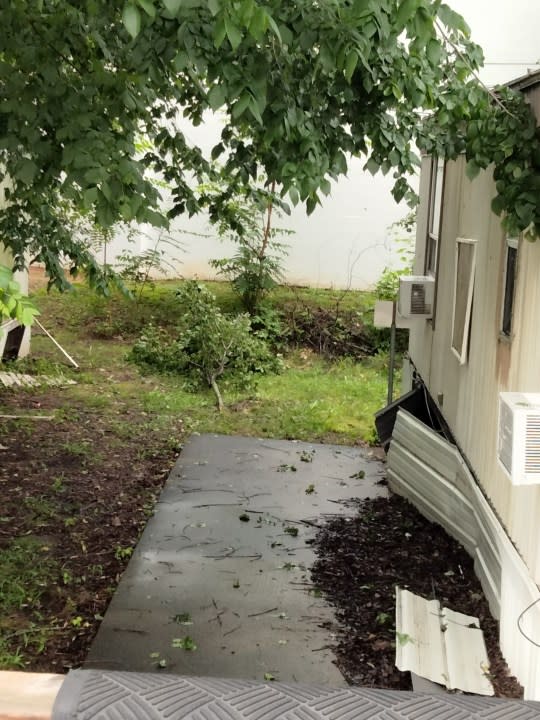
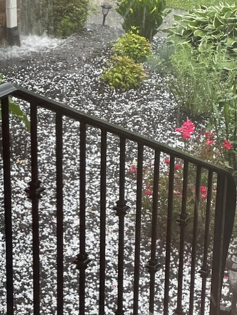
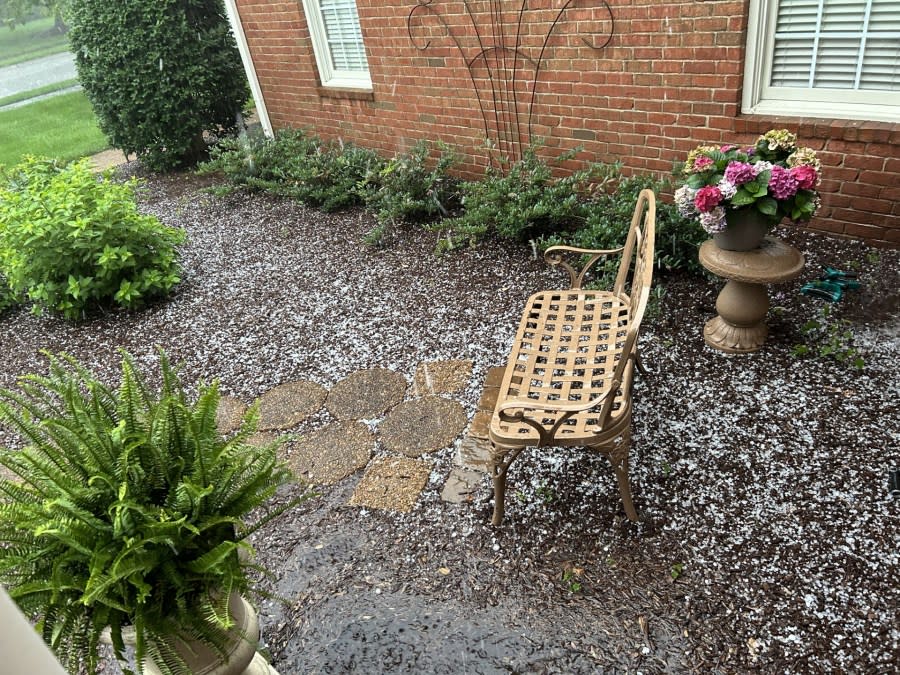
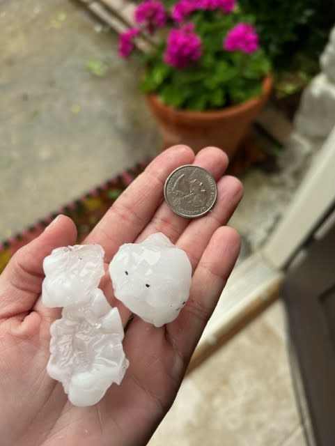
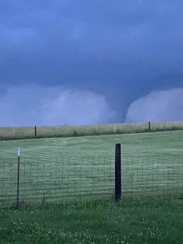
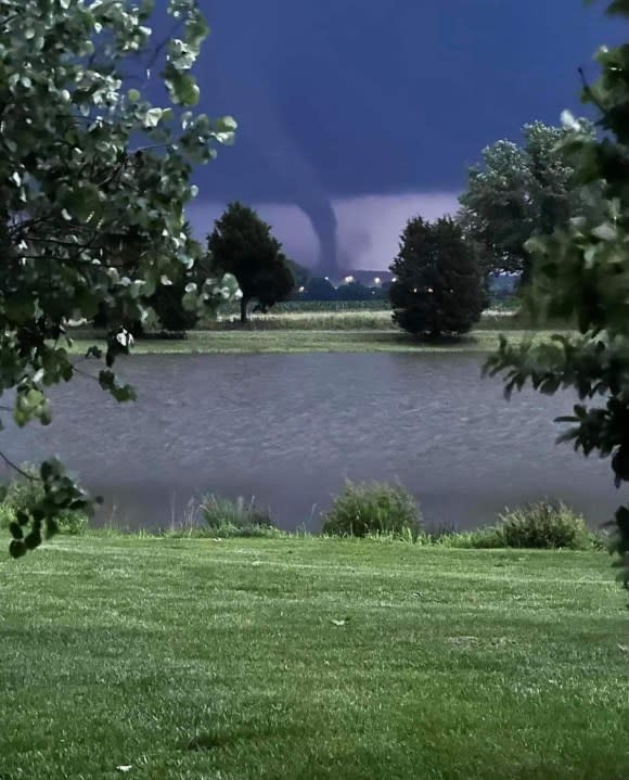
News 2 employees and viewers, along with local officials, shared the following photos of the storms from earlier in the day on Sunday, as well as the hail that fell during the storms and the resulting damage:
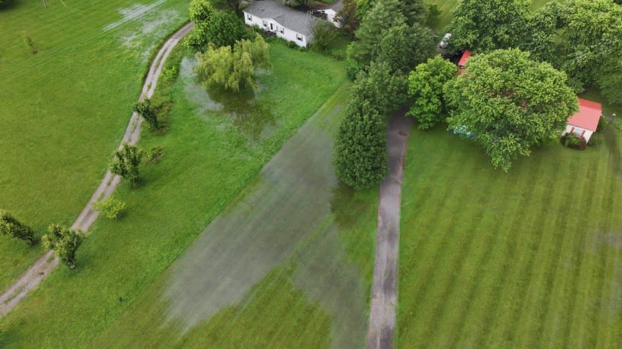
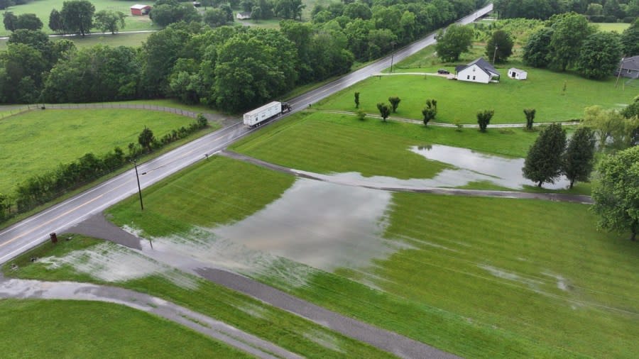
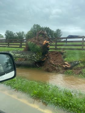
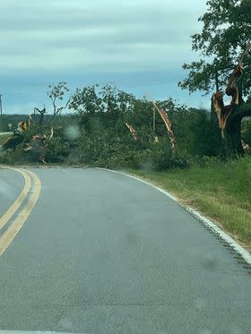
Drone photo from Spring Hill of Franklin storm (Courtesy: Barry Runk) Drone photo from Spring Hill of Franklin storm (Courtesy: Barry Runk) Storm in Murfreesboro (Courtesy: Alison Norton) Storm in Hermitage (Courtesy: Nancy Greene) Storm in Lascassas (Courtesy: Christopher Hunt) Storm in Lebanon (Courtesy: Katie Kirby) Storm in Gallatin (Courtesy: Elizabeth Summers) Flooding in Castalian Springs (Courtesy: Jared Ambrose) Flooding in Castalian Springs (Courtesy: Jared Ambrose) Flooding in Castalian Springs (Courtesy: Jared Ambrose) Flooding in Castalian Springs (Courtesy: Jared Ambrose) Flooding in Castalian Springs (Courtesy: Jared Ambrose) Crews restoring power in Mitchellville (Photo: WKRN) Storm damage in Mitchellville (Photo: WKRN) Storm damage in Mitchellville (Courtesy: Sandy Lynn Day) Storm damage in Mitchellville (Courtesy: Sandy Lynn Day) Storm damage in Mitchellville (Courtesy: Sandy Lynn Day) Storm damage in Mitchellville (Courtesy: Sandy Lynn Day) Storm damage in Clarksville (Courtesy: City of Clarksville) Storm damage in Clarksville (Courtesy: City of Clarksville) Storm damage in Clarksville (Courtesy: Billy Mills) Storm damage in Clarksville (Courtesy: Billy Mills) Hail in Murfreesboro (Courtesy: Kara Molitor) Hail in Franklin (Photo: WKRN) Hail in Franklin (Courtesy: Maury Curry) (Courtesy: Tammy Taylor) (Courtesy: Tammy Taylor) Hail in Leipers Fork (Courtesy: Priscilla Deal) Hail in Leipers Fork (Courtesy: Priscilla Deal) Hail in Fairview (Courtesy: Rebecca Dominguez) Hail in Bon Aqua (Courtesy: Maddie Lebens) Hail in Bon Aqua (Courtesy: Maddie Lebens) Hail in Bon Aqua (Courtesy: Maddie Lebens) Hail in Bon Aqua (Courtesy: Cassandra Miller) Hail in Bon Aqua (Courtesy: Terry Haley) Hail in Franklin (Courtesy: Sarah Ashby) Hail in Franklin (Courtesy: Tom Evans) Source: Sheriff Brent White Source: Sheriff Brent White Source: Sheriff Brent White


If you took any pictures or videos of the severe weather, please email them to pix@wkrn.com.
Don’t forget to take the power and reliability of the WKRN Weather Authority with you at all times by downloading the News 2 Storm Tracker app.
Copyright 2024 Nexstar Media, Inc. All rights reserved. This material may not be published, broadcast, rewritten, or redistributed.
For the latest news, weather, sports, and streaming video, head to WKRN News 2.

