Friday Outlook: AM mix of sun and clouds, spotty PM storms possible around Charlotte
CHARLOTTE (QUEEN CITY NEWS) – Friday is finishing off the week with some spotty showers and storms that will continue to taper off ahead of daybreak. Look to see temperatures hover in the mid to upper 60s making for a warm morning.
Click here to see our latest Pinpoint Weather forecast! 🌤️🌦️
Patchy fog will develop ahead of sunrise with light winds out of the west-northwest locked in. Highs will make a run for the mid to upper 80s under partly cloudy skies and pockets of sunshine. We’ll be on the lookout for a spotty storm or two for this afternoon and evening as heat helps to build instability in the atmosphere.
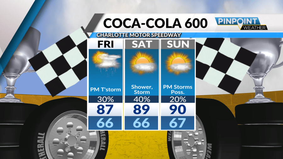
Overnight lows will dip into the mid-60s before rebounding into the upper 80s and near 90 degrees on Saturday. We’ll start the weekend with highs touching 89 degrees and spotty storms impacting the peak heating hours of the day. These storms will be hit-and-miss and spotty in nature.

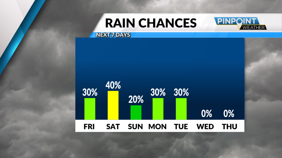
Sunday will be less stormy but still hot as highs aim for 90 degrees. We’ll host partly cloudy skies for the end of the week as The Coca-Cola 600 kicks off in the evening.
Memorial Day is looking hot and stormy as highs will settle into the low 80s. We’ll see spotty showers and storms through the afternoon with a cold front ushering in cooler temperatures for the work week.
Upper 80s will become upper 70s as cooling temperatures and mostly sunny skies take hold through Wednesday and Thursday of next week.
Today: Partly Cloudy & Hot. High: 87.
Tonight: Partly Cloudy & Warm. Low: 66.
Copyright 2024 Nexstar Media, Inc. All rights reserved. This material may not be published, broadcast, rewritten, or redistributed.
For the latest news, weather, sports, and streaming video, head to Queen City News.

