Flood, avalanche worries elevated in B.C. with bout of rain and snow
The West Coast is in for an active weekend as one system after another continues sweeping across British Columbia.
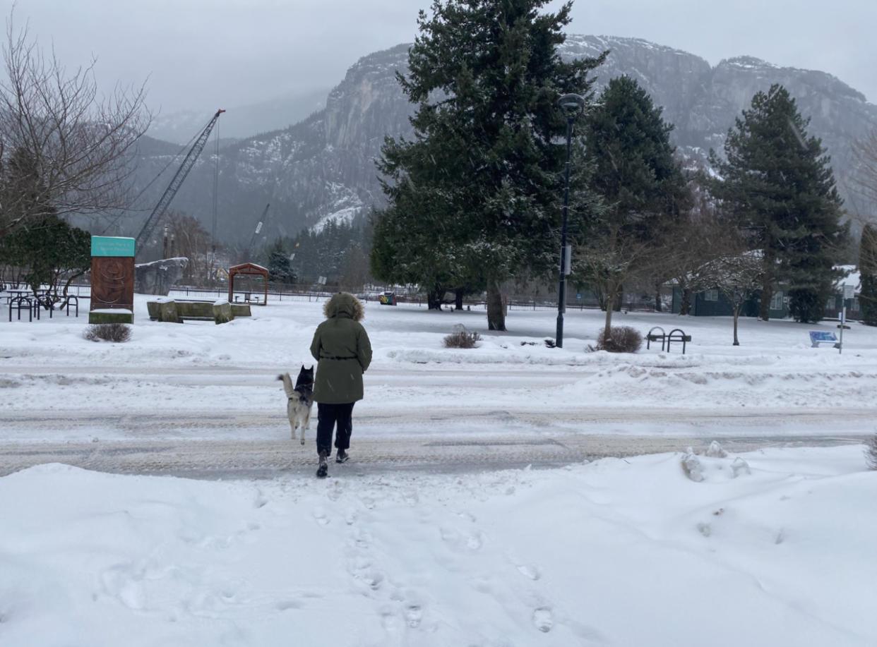
Continuous rounds of heavy low-elevation rain and heavy alpine snow will accumulate throughout the weekend and into early this week.
The impacts will be considerable for travellers and backcountry skiers. The latter are urged not to venture out this weekend as fresh snow and an unstable snowpack have elevated the avalanche risk.
Rainfall warnings and special weather statements are in place for parts of the South Coast. In areas that see heavy rain, localized flooding in low-lying areas is possible.
DON'T MISS: Everything you need to know for April's spectacular and rare solar eclipse
Rain and gusty winds persist this weekend
Rain over Vancouver Island and the South Coast will continue straight through Sunday.
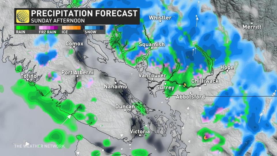
Widespread rainfall totals of 30-50 mm are expected throughout the region, with totals of 40-70 mm possible north of Metro Vancouver. Western Vancouver Island will take the brunt of the heavy rain with totals exceeding 100 mm through Sunday.
MUST SEE: How 10 days turned the entire B.C. ski season around
Environment and Climate Change Canada has issued several rainfall warnings and special weather statements for Vancouver Island and the Metro Vancouver area ahead of these systems.
Gusty winds will accompany the heavy rain at times. Another round of blustery southerly winds will sweep over the Strait of Georgia on Sunday, bringing gusts of 70+ km/h at times.
Heavy snow hammers the Coast Mountains
While folks at lower elevations contend with persistent rains, snow will continue this weekend for elevations above 1000 m. We might see freezing levels drop a bit over the next day or so.
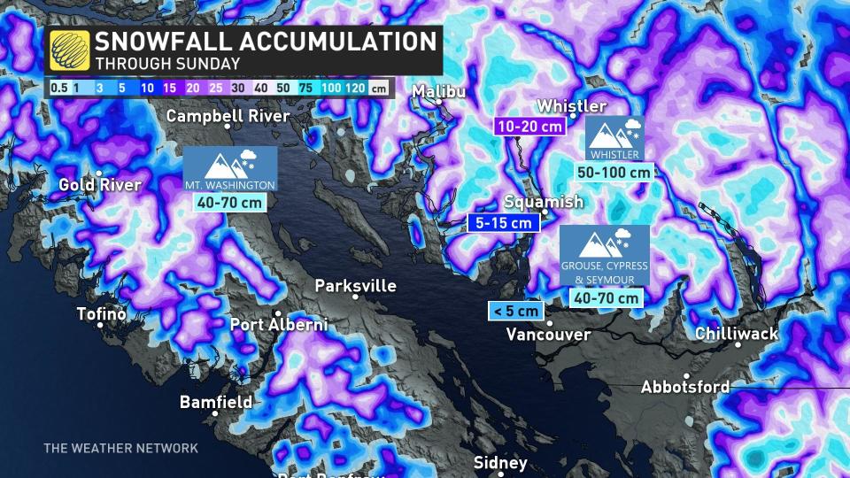
Farther inland, we’ll see snow build across the Interior through the weekend. Heavy snow is possible by Sunday evening.
Snow accumulation could vary greatly depending on the intensity of precipitation as well as the temperatures. Regardless, the threat of 40-70+ cm across the hardest-hit areas will make for difficult travel conditions throughout the weekend.
Folks travelling along Highway 99 between Howe Sound and Whistler may experience slippery roads. Drivers are urged to consider postponing any non-essential travel until conditions improve.
RELATED: What recent snowstorms mean for the drought and wildfire risk in Western Canada
This round of unsettled weather will make for dangerous avalanche conditions across B.C. this weekend.
A high avalanche danger exists for much of the South Coast, Vancouver Island, and portions of the Interior into Sunday. Avalanche Canada issued a special public avalanche warning for Banff, Kootenay, Yoho National Parks, and Kananaskis Country through the end of the day on Sunday.
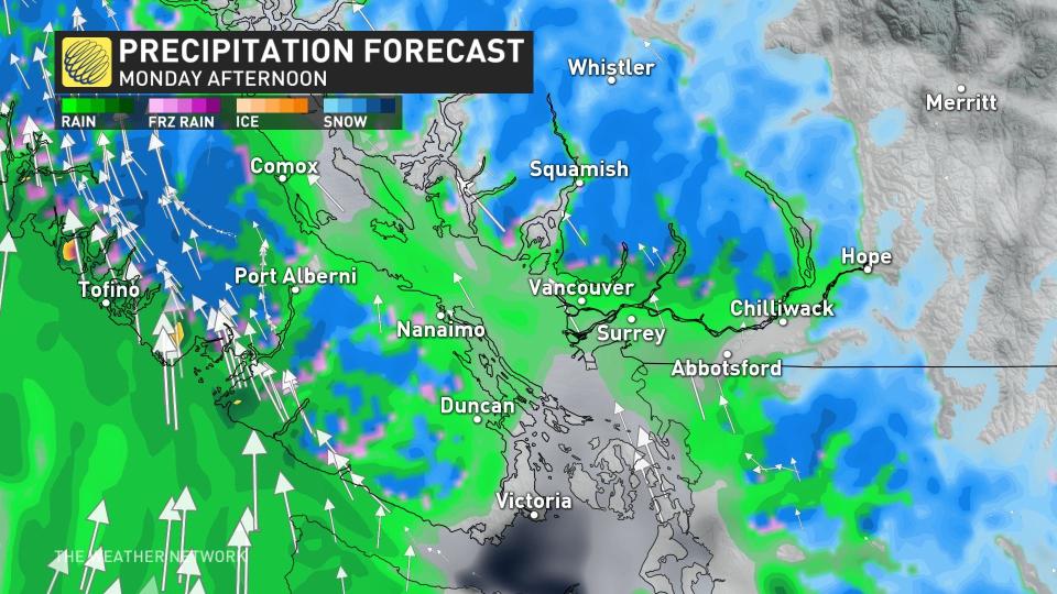
Looking ahead, rounds of rain and snow will continue for southern B.C. through the start of the week. A much milder and drier pattern is set to take shape by the middle of the month and continue well into the second half of March.

