‘Fighting this clear into June.’ Epic snowpack means flooding problems are only beginning
The winter of 2022-23 has piled a record snowpack onto the southern Sierra Nevada range on the east side of the San Joaquin Valley. And water officials — already dealing with floods wrought by a series of storms that have drenched central California over the past few weeks — are also facing the likelihood that even more flooding could happen when all that snow inevitably melts.
Fresno County Supervisor Buddy Mendes, a farmer in the Riverdale area of southwestern Fresno County, says he’s keeping a wary eye on channels that in normal years are dry, but this year are being pushed to their limits as operators of foothill dams release water to make room for more rain and snow.
“I’ve told our emergency services group that we’ve got a short-term deal” with storms expected this week, Mendes said on Monday. “But we’ve kind of got to go to the long game. We’re going to be fighting this clear into June.”
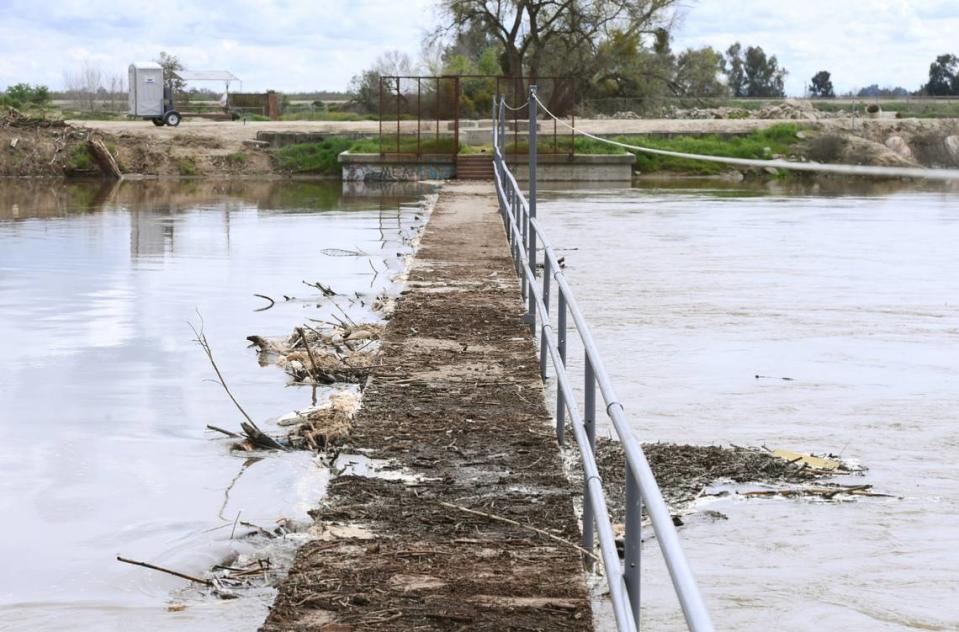
Over the past week and into last weekend, Mendes tweeted photos of the Kings River at Crescent Weir, a structure that controls the flow of the river’s north fork. In the photos, water is at the top of the weir and choked with debris carried from upstream. The river, he said, “will be running high from now on.”
A few miles upstream, Army Weir sits where the north and south forks of the lower Kings River diverge. Together, the Crescent and Army weirs serve to steer excess water in very wet years either south to the historic Tulare Lake basin or north to the San Joaquin River through a bypass channel in western Fresno County.
The U.S. Army Corps of Engineers, which operates Pine Flat Dam, began making flood releases from the dam on Monday. By Tuesday, water will be diverted at Army Weir into channels toward the former Tulare Lake bed, reaching as much as 1,500 cubic feet per second (cfs). Those releases may potentially last into the summer, according to the Kings River Water Association.
And that’s even before the snowmelt begins in earnest.
In the meantime, the San Joaquin River downstream from Friant Dam is also running high as the U.S. Bureau of Reclamation tries to make room for the onslaught of a spring thaw in the mountains.
With communities along both rivers already facing the prospect of flooding from the recent storms, there is concern about the seldom-used Fresno Slough / James Bypass — that channel that can carry excess Kings River water northward to the San Joaquin River near Mendota. Would the San Joaquin River be able to handle extra Kings River water without topping its own banks and levees in the Mendota and Firebaugh areas?
Mendes said there are formulas in place for determining how much water goes north or south, depending on the volume of flood releases from the Kings River. “The first 4,750 cubic feet per second of pure flood release goes through the Crescent Weir and goes north,” Mendes said. “The next 3,200 cfs is supposed to south into Tulare Lake.” If flows exceed that combined 7,950 cfs, that extra water gets split 50-50, Mendes added — half toward the San Joaquin River, half toward Tulare Lake.
A cubic foot of water amounts to almost 7.5 gallons.
Under current conditions, Mendes said he believes that for now, areas of the James Bypass and Fresno Slough channel between Crescent Weir and the community of Tranquillity, southeast of Mendota, will probably be OK. “But once the water gets beyond about Tranquillity, there could be problems,” he added.
Sierra Nevada snowpack at or above record levels
“There is growing concern over the medium term — talking about weeks rather than days — about what this extremely large snowpack portends,” Daniel Swain, a climate scientist at UCLA, told The Bee in a recent interview. “Eventually that (snowmelt) is going to happen, and the question is whether it happens quickly versus slowly.”
“The longer we wait to start the melting, the more rapid it could be,” Swain added. “There is so much water stored in the southern Sierra snowpack, at or above record levels, “And we haven’t had a climate as warm as we currently do with a snowpack this large.”
An early season heat wave, which has become a more common occurrence in recent years, “could happen in the spring and could cause a lot of this snow to melt quickly,” he said. “The question isn’t, ‘Will there be snowmelt flooding?’ but more, ‘When will it peak?’”
An early or sudden snowmelt could spell trouble for water levels behind Valley reservoirs and for communities and property owners in low-lying areas downstream.
Randy McFarland, a local historian and a longtime consultant with the Kings River Water Association, said recent snow surveys and monitors indicate that the current snowpack — estimated at 268% of the historic benchmark April 1 average — represents far more water than dams along the San Joaquin, Kings, Kaweah, Tule and Kern rivers can contain.
“Right now the estimate is that there is 2.6 million acre-feet of water locked up in the snow that’s going to melt and come our way” in the Kings River watershed upstream from Pine Flat Dam, McFarland said Monday. “We have a reservoir that is big, 1 million acre-feet. But as of (Monday) it’s already holding 780,000 acre-feet.”
That leaves room for only another 220,000 acre feet in Pine Flat Reservoir to hold more water when the snow starts to melt.
An acre-foot equals almost 326,000 gallons, and is the volume of water needed to cover one acre of land to a depth of one foot. To put that into perspective, an American football field occupies about 1. 3 acres. Now imagine almost 2 million football fields, each submerged under a foot of water, and that offers an idea of the water now contained in the snowpack just in the Kings River watershed.
The Kings River Water Association also is anticipating “the inevitability of much-above-normal snowmelt runoff during the spring and summer months,” the agency said in a statement. The increased flood releases from Pine Flat Dam by the Army Corps of Engineers, “is aimed at creating room in the reservoir for any very high inflows resulting from additional rain or melting snow in order to minimize high-water danger to properties along the river.”
During a recent storm, as much as 40,000 cubic feet of water — or about 299,200 gallons — flowed into Pine Flat Reservoir every second, most of that likely from rain and some lower-elevation snow that melted, but very little from the higher-elevation snowpack.

