Should Arizona give up more Colorado River water? Mountain states plan says 'yes'
States that use the Colorado River’s climate-stressed water offered competing views Wednesday on how the federal government should manage the dams and any needed water restrictions when it adopts new shortage-sharing guidelines in 2026.
The more populous Lower Basin group of states — Arizona, California and Nevada — asked the U.S. Bureau of Reclamation to review a plan that would force them to deepen their conservation in most dry years, but also would force reductions on the four Upper Basin states in the Rocky Mountains during extremely dry periods.
The Upper Basin states of Wyoming, Colorado, Utah and New Mexico asked instead for a plan that protects their far-lower take from the river in all years.
Colorado and others in the Upper Basin have argued that they already suffer the sting of climate change most years because, under the Colorado River Compact and related laws, they must send 7.5 million acre-feet of water through Glen Canyon Dam every year, plus more for Mexico’s share.
In recent decades that has amounted to far more than half of the river’s flow, and it forces farmers and others in the Rocky Mountains to dry their canals and croplands in many years. The Lower Basin states argue they’ve borne the brunt of reduced water downstream in Lake Mead and are willing to take more — but not all — of the coming reductions to prevent an unpredictable lawsuit over allocation.
“Any alternative that doesn’t share the pain across seven states is going to be ultimately an alternative that’s a blueprint for litigation,” Southern Nevada Water Authority General Manager John Entsminger said.
To date, the river's decline has punished Arizona most severely among the states, lopping more than 18% from its share of the river this year and in each of the last two. California, the river's biggest user, faced no such mandatory cuts.
The system treats water flowing through the Central Arizona Project as a lower priority than water for farms and cities in California, a condition that Arizona had to accept when seeking congressional approval for building the canal. Arizona and California have since collaborated on taking even deeper cuts, many of them from willing water users who receive federal compensation, but the mandatory cuts have reshaped life in central Arizona, particularly on Pinal County farmers who have fallowed fields or turned to groundwater pumping.
A new river agreement would also be affected by senior water rights held by the 30 tribes in the basin, who control about 20% of the river’s water overall and about 40% in Arizona. At least one of those tribes is unhappy with what the states proposed and plans to submit its own plan.
Competing plan would change the way reservoirs are managed
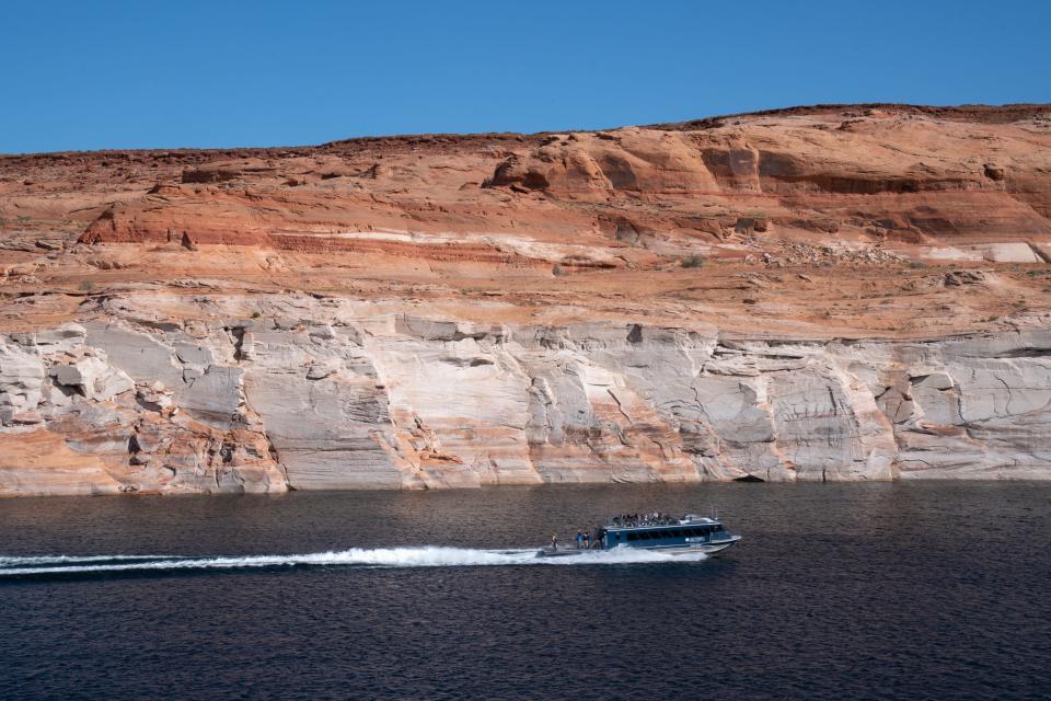
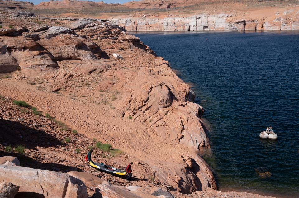
The states divided the water in the last century in a deal that counted on a river theoretically providing the two basins with 7.5 million acre-feet apiece, with water left over for Mexico. In recent decades, the river has at times provided 12 million acre-feet or less, forcing big withdrawals from stored water in Lake Mead to satisfy the Lower Basin’s fully developed allocation, and from Lake Powell to restock Lake Mead.
An acre-foot is roughly 326,000 gallons, generally enough to support a few households for a year, though most of the river’s water is used on farms.
The Upper Basin states submitted a competing plan that focuses on how much to release from Lake Powell toward Lake Mead in various states of drought, pegging releases to Powell’s current storage levels.
When the reservoir contains less than 81% of capacity but more than 20%, as it does now, releases would range between 8.1 million acre-feet at the high end or as low as 6 million acre-feet at the low end. Annual releases when Powell is less than 20% full would remain at 6 million. That’s down from the 8.23 million that must flow past Glen Canyon Dam now on average to fulfill the Upper Basin’s commitment to both the Lower Basin and Mexico.
Both plans envision years in which the Upper Basin will not send downstream the amount of water required under the compact, a reality that Entsminger acknowledged tests the compact's legal limits but is a realistic nod to a changed climate.
Arizona Water Resources Director Tom Buschatzke characterized the Upper Basin’s proposal as one that forces all the cuts on Arizona, California, Nevada and Mexico.
“They take no reductions under any circumstance” in their proposed plan, he said.
Ongoing drought: Colorado River conservation measures will protect reservoir levels through 2026, feds say
Plan for 'the river we have, not the river we dream for'
Colorado’s river commissioner, Becky Mitchell, has argued that the Upper Basin already takes its share of cuts when nature provides too little snowmelt for users in her state to exercise their full water rights, and that the larger problem to be solved rests with how much the Lower Basin takes from the big reservoirs. The mountain states use less than half as much as what they must send downstream, she said at an interstate river conference in December, so the bulk of conservation must come from Arizona, California and Nevada.
Mitchell was not immediately available for comment on Wednesday. Upper Colorado River Commission Executive Director Chuck Cullom was traveling and asked The Arizona Republic to submit written questions, but did not immediately respond to them. The Upper Colorado River Commission, which represents the four mountain states, released statements from each of them.
“We can no longer accept the status quo of Colorado River operations,” Mitchell said in her written statement. “If we want to protect the system and ensure certainty for the 40 million people who rely on this water source, then we need to address the existing imbalance between supply and demand. That means using the best available science to work within reality and the actual conditions of Lake Powell and Lake Mead. We must plan for the river we have — not the river we dream for.”
“Although our proposal can stand on its own, it was also designed to promote the development of a seven-state consensus alternative, which is a goal we all still seek to achieve," Wyoming Commissioner Brandon Gebhart said.
Bureau of Reclamation shortage guidelines, adopted in 2007, expire at the end of 2026, and the agency has said it intends to publish a proposed update this year and approve a final version next year. Until drought in recent years forced the Lower Basin to cut back and prop up water levels in Lake Mead, the three-state region fully used its 7.5 million acre-foot allocation.
On Tuesday, while announcing agreement on shorter-term reductions in the Lower Basin that will protect flows at least through 2026, federal officials acknowledged the need for more negotiations between the states in coming months.
“We are not expecting every single issue to be worked out between the Upper and Lower basins tomorrow,” Acting Deputy Interior Secretary Laura Daniel-Davis said. Her department, which oversees Reclamation, will work collaboratively with the states to seek “as much consensus as possible” before deciding how to manage the river’s dams after 2026, she said.
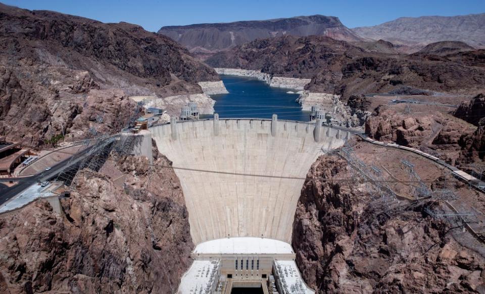
Lake Mead and Lake Powell, by far the biggest of the reservoirs, are now around one-third full. It’s in everyone’s interest to work out differences and keep the river’s reservoirs from crashing, Daniel-Davis said. “There is no them. It will take all of us to get this right.”
Entsminger likewise said history suggests the states can still come together. He noted that the states initially couldn’t reach consensus on sharing short-term cuts last year, but later reached a deal that resulted in the Lower Basin using less Colorado River water than it has since the early 1980s.
Tribes in Arizona and other basin states have watched the negotiations closely, in no small part because they have given up significant amounts of water to help shore up storage in Lake Mead.
Indigenous leaders have long been concerned that their senior rights aren’t given due consideration or that gaps in infrastructure have prevented them from making full use of their water, in effect giving parts of their water away to states and other entities for free.
Buschatzke acknowledged the tribes' role in preventing deeper cuts, calling them “important partners.” He said the lower basin states held talks with some of the tribes who might be affected by the reductions outlined in the Lower Basin plan. The group also was examining “creative mitigation” and resource sharing.
Quechan Tribal President Jordan Joaquin said that due to climate change and the hydrologic challenges it creates, “it is essential that the post-2026 management framework for the river provides for human and ecosystem needs, protects tribal water rights, and reflects a viable strategy for preserving the river for us all.”
But Gila River Indian Community Governor Stephen Roe Lewis said the tribe cannot support the proposal in its current form.
"While the proposal has some important elements, it fails to share the reductions we are all facing in a fair and equitable manner among the states or water users, and it fails to account for the disproportionate impacts on tribes," he said.
The tribe, located southwest of Phoenix endured having its water taken in the early 20th century and fought a long and hard battle to get the taps flowing and their fields productive again.
Gila River will submit its own proposal that Lewis said would more equitably share any needed water cuts through a pro-rated cut on water users throughout the basin and provide mitigation and replacement for water taken from tribes.
"We have fought for our water rights before and we are prepared to do so again," he said. "We will do whatever it takes to prevent a second taking of our water."
The Basin Tribe Coalition in 2023 outlined tribal principles for the post-2026 management plan. Some of those included fully recognizing and protecting each tribe’s ability to benefit from their full water rights allotment, and promises from the federal government to help develop alternative sources of water when tribal water rights are disrupted.
Gap between plans is 'large' and will require negotiations
Until now, Reclamation has used elevations in Lake Mead, behind Hoover Dam, to chart cutbacks on the downstream states. When the reservoir surface is below 1,025 feet above sea level, those states and Mexico must give up more than 1.3 million acre-feet a year. That does not include recent emergency cutbacks to get the region through the next three years, with irrigators accepting federal funds to leave more water in Mead.
On Wednesday, representatives from the three Lower Basin states acknowledged that those cuts are too small in the face of a warming and drying climate, and offered a plan that would bump that to 1.5 million acre-feet when the total of all Colorado River reservoirs’ storage dips between 58% and 38% of capacity.
Under current or similar conditions in the reservoirs, they said, this would cover the full water deficit. When storage dips even lower, though, their plan would shut off up to another 2.4 million acre-feet and take at least half of those additional cuts out of the Upper Basin.
California’s river commissioner, J.B. Hamby, said the Lower Basin is home to three-quarters of the 40 million people drawing on the river, as well as the most productive farmland in the United States. It will do its part, he said, but cannot bear all of the extra losses in a future when the snowpack at the river’s source will likely diminish further.
“Adaptation to climate change is not just the responsibility of one sate or one basin,” Hamby said, “or just cities or farms. It is all of our responsibility.”
All seven states have continued to meet and negotiate, most recently in late January, Buschatzke said. They’ll continue to do so regularly, he added.
“The gap between the two proposals is pretty large and there’s a lot of work to be done to close that gap,” he said.
Republic Indigenous Affairs reporter Debra Utacia Krol contributed to this story.
Brandon Loomis covers environmental and climate issues for The Arizona Republic and azcentral.com. Reach him at brandon.loomis@arizonarepublic.com.
Environmental coverage on azcentral.com and in The Arizona Republic is supported by a grant from the Nina Mason Pulliam Charitable Trust.
Sign up for AZ Climate, our weekly environment newsletter, and follow The Republic environmental reporting team at environment.azcentral.com and @azcenvironment on Facebook and Instagram.
You can support environmental journalism in Arizona by subscribing to azcentral.com today.
This article originally appeared on Arizona Republic: Southwest and Mountain states offer competing Colorado River plans

