'Extremely rare event:' Satellite images show lake formed in famously dry Death Valley
Kayakers and nature lovers are flocking to Death Valley National Park in California to enjoy something exceedingly rare at one of the driest places in the United States: Water.
A temporary lake has bubbled up in the park's Badwater Basin, which lies 282 feet below sea level. What is typically a dry salt flat at the bottom of Death Valley has for months been teeming with water after record rains and flooding have battered eastern California since August.
In the past six months, a deluge of storms bringing record amounts of rain led to the lake's formation at the park − one of the hottest, driest and lowest-elevation places in North America, according to the U.S. Geological Survey.
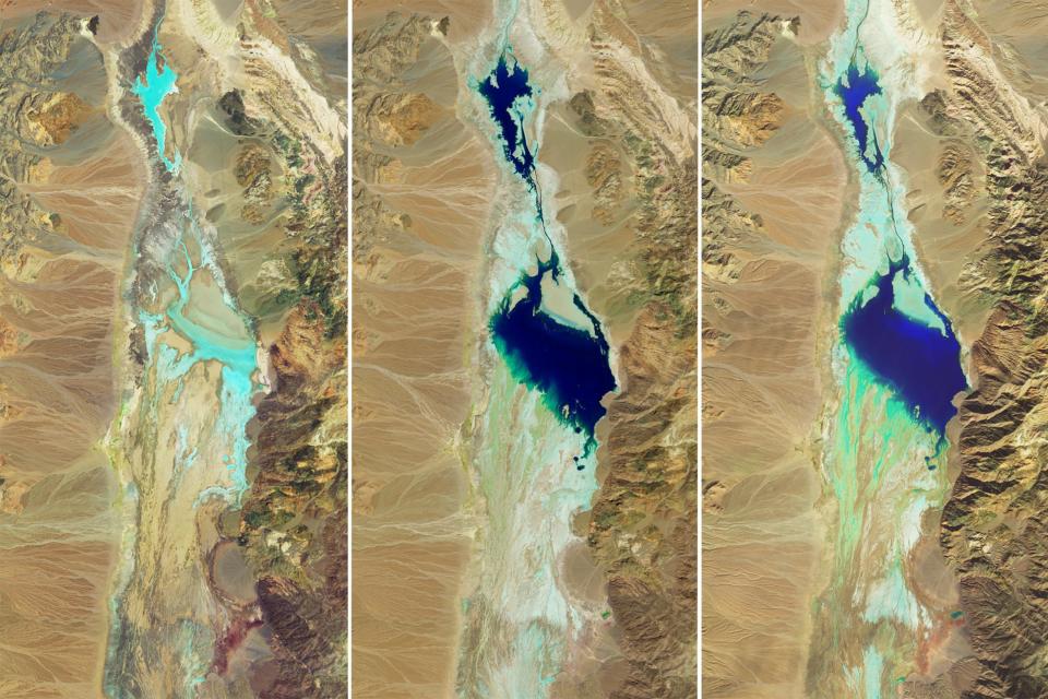
Satellite images from NASA show how the lake formed in August in the aftermath of Hurricane Hilary. Though it gradually shrank, it persisted throughout the fall and winter before it was filled back up by another strong Californian storm earlier this month, known as an atmospheric river.
Lake Mead: Water levels measure highest since 2021 after 'Pineapple Express' slams California
Sea spiders mystery solved: After 140 years, researchers finally learn how giant sea spiders in Antarctica reproduce
NASA satellite photos show lake formation
Between the two torrential downpours, Death Valley National Park's valley floor has received a record 4.9 inches in the past six months, far surpassing the average annual rainfall of about 2 inches per year, according to park officials.
NASA's series of three images compares the desert basin in July before the flooding with its more-waterlogged state following both major storms in August and then in February.
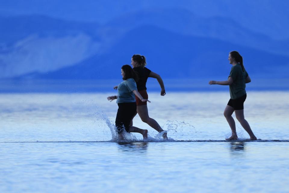
Visitors wade through Death Valley waters
Road closures and and flash flooding damage had prevented visitors from reaching the basin in the aftermath of Hurricane Hilary.
Until now.
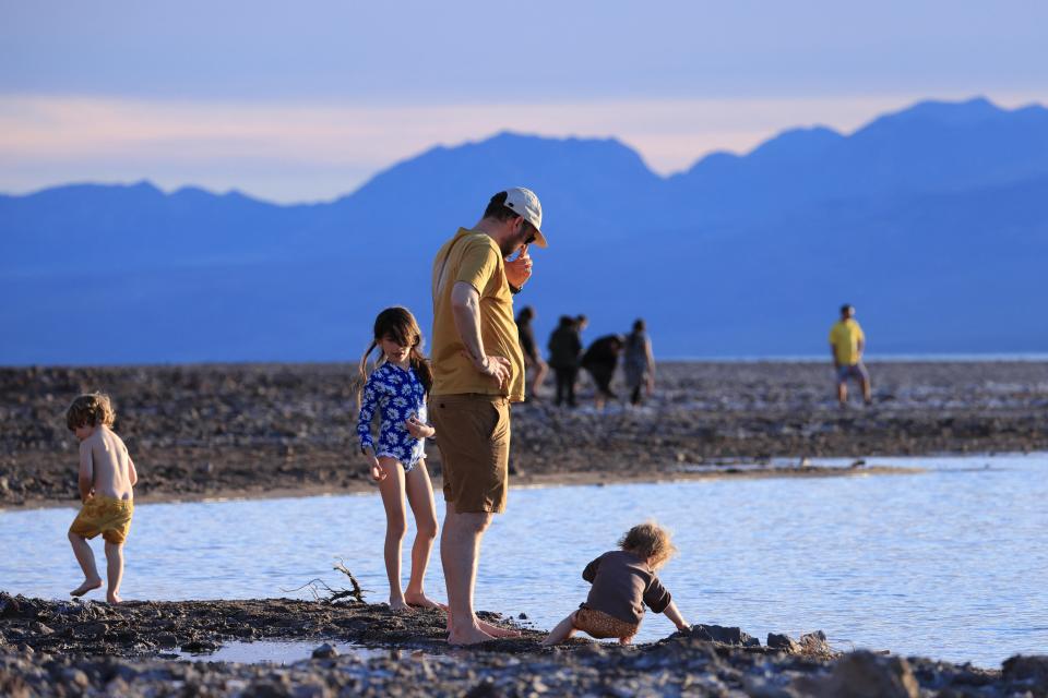
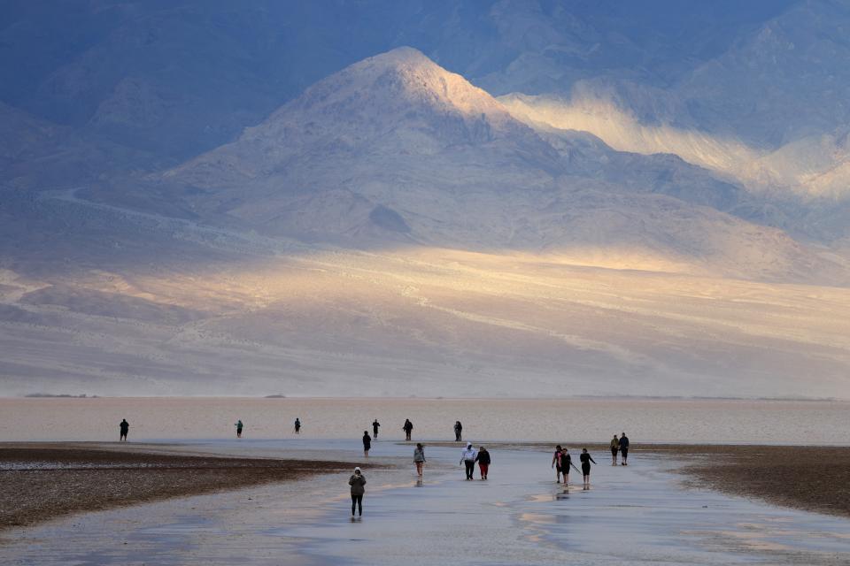
In the last few days, the salt flats have attracted plenty of visitors eager to witness and enjoy "an extremely rare event," according to the National Park Service.
“The lake was deep enough to kayak for a few weeks after Hurricane Hilary, but unfortunately people couldn’t come enjoy it then,” park ranger Abby Wines said in a statement. "Most of the main roads are open, so it’s a great time to come visit."
Before the February downpours, the lake was too shallow for kayaking. Since then, it's only continued to expand as more water drains into the area.
How long will the lake remain at Death Valley National Park?
Park officials didn't expect the lake to stick around too long, but as the NASA images show, it has endured.
"Most of us thought the lake would be gone by October,” Wines said in a news release before the rains returned in February. “We were shocked to see it still here after almost six months.”
The Badwater Basin is endorheic, meaning it does not drain into the sea. Usually, though, the water evaporates faster than it can flow into the basin, park officials said.
That's changed in the past few weeks as the water continues to fill the basin faster than it can evaporate. But it won't last forever.
Park officials speculated that the lake, which is shrinking every day, could last until late March, though even that prediction is uncertain. Past appearances of the lake are rare and offer little insight into what could happen, officials said.
Last week, the lake was a foot deep and three miles wide in places, stretching for six miles. Kayakers should have only a couple more weeks to paddle out into the waters, but park officials believe visitors will be able to see stunning reflections of the surrounding peaks in its calm waters potentially through April.
Eric Lagatta covers breaking and trending news for USA TODAY. Reach him at elagatta@gannett.com
This article originally appeared on USA TODAY: Lake forms at Death Valley National Park in California: See photos

