Temperature drop to bring multi-day snowfall event to Alberta
Soak up these final hours of spring-like warmth on the western Prairies before the cold front arrives.
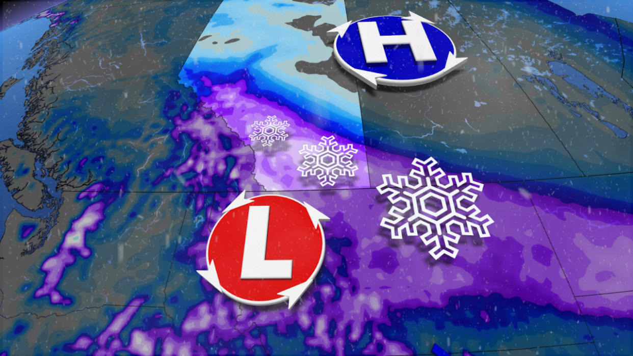
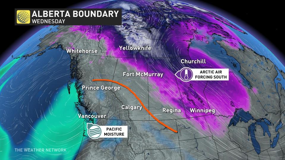
A double-digit temperature swing will blow across most of Alberta through the middle of the week as our comfortable weekend pattern breaks down in the face of winter’s revenge.
The same winds that’ll crash frigid temperatures into the province will also generate a multi-day snowfall event through the end of the week.
Substantial snows and major travel impacts are possible across parts of the province. Plan ahead for disruptions.
DON’T MISS: Warmest winter ever: Canada's record season reaches new heights
Tuesday: A brutal mid-March reality check
A disturbance rolling out of the northern Prairies will gradually replace the ridge responsible for our weekend warmth.
MUST SEE: Historic El Niño has weakened, but its impacts hang on
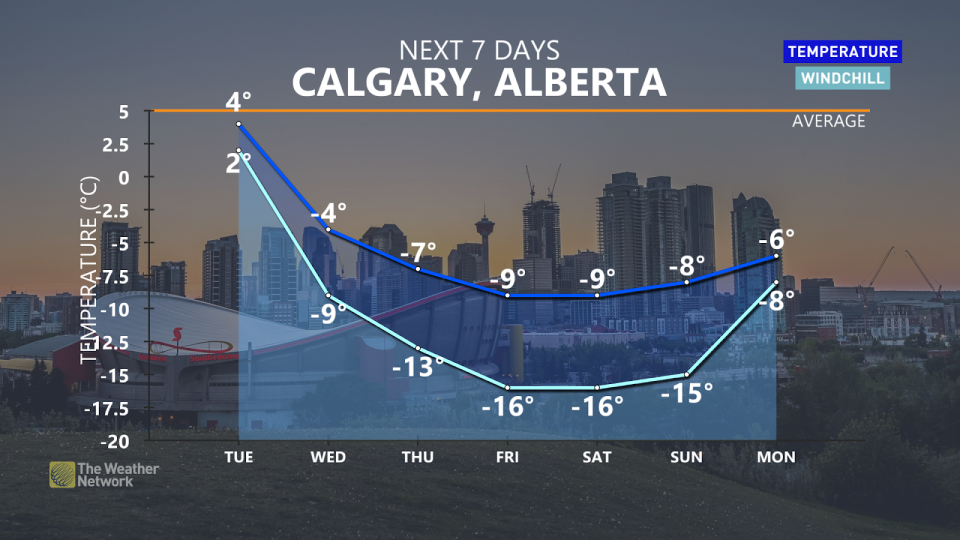
Calgary’s high of 7°C on Tuesday will seem like a distant memory by Wednesday, when snow will accompany a brisk daytime reading of just -5°C. Yes, that’s a minus sign next to the day’s high.
A persistent slog of chilly northeasterly winds blowing against the mountains will generate a long-duration, upsloping snow event for much of central and southern Alberta.
Periods of snow will begin developing Tuesday evening in the Elbow region, spreading over the Queen Elizabeth II Highway during the overnight hours.
Wednesday and beyond: Multi-day snowfall event
Cold air and and an inflow of Pacific moisture will continue to fuel snowfall across southern Alberta, making this a multi-day event.
Bursts of locally heavy flurries, blowing snow and upsloping snow will make for hazardous driving conditions and reduced visibilities, so take caution when commuting this week.
Snowfall totals by next weekend could exceed 30 cm across four days for parts of southwestern Alberta, marking some of the greatest accumulations we’ve seen in six months.
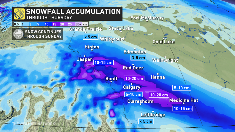
There is some benefit to this blast of snow - the highest snowfall totals are expected in areas in the province most impacted by extreme drought conditions.
There is still some uncertainty with just how much snow will fall across the province, so be sure to check back over the next couple of days as forecasters monitor this pattern flip and the potential for snowfall.
Stay with The Weather Network for all the latest on your forecast across Alberta.

