Tropical Storm Danny is gone, but now there are two systems in the Atlantic to watch
Forecasters are monitoring a disturbance in the central Atlantic that could possibly see some “slow development” later this week as it moves into the Caribbean Sea, as well as another brand new disturbance just behind it.
As of the National Hurricane Center’s 2 p.m. advisory, the easternmost system had a stronger likelihood of forming into a tropical depression within the week, although it’s too soon it tell if either disturbance poses a threat to Florida.
The first tropical wave was about 850 miles east of the Lesser Antilles early Tuesday and associated with disorganized showers and thunderstorms in the area, according to the afternoon update.
The system is forecast to move west to west-northwest quickly, between 15 to 20 mph, and could reach the Lesser Antilles by Wednesday night, according to the hurricane center.
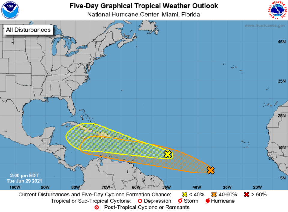
Forecasters slightly downgraded the system’s shot at forming to a 20% chance of formation in the next 48 hours and a 30% chance in the next five days.
The newer system, a tropical wave about 900 miles southwest of the Cabe Verde islands, could see slow development in the next few days. Forecasters upgraded its chances to a 2% chance of strengthening into a tropical depression in the next two days and 40% in the next five.
As for Tropical Storm Danny, the fourth named storm of the season formed Monday before making landfall in South Carolina. It was a short-lived storm and dissipated over Georgia early Tuesday.
The next name on the 2021 Atlantic Hurricane Season list is Elsa.

