Days of heat set to give way to autumn-like temperatures in San Diego County

SAN DIEGO — After a few days of near three-digit heat, it will start to feel a little more like autumn in San Diego County this week.
The National Weather Service forecasts that a slow cooldown will start to set in across the region starting Monday, bringing temperatures down to about two to seven degrees below seasonal averages by Wednesday.
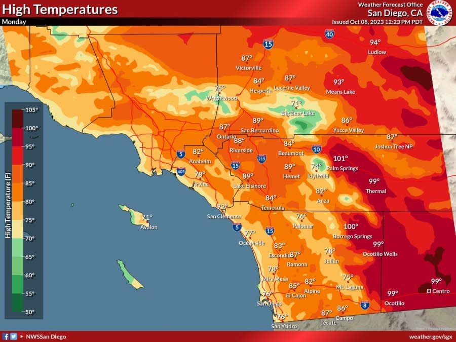
Temperatures on Monday are expected to dip slightly from the weekend’s highs as a ridge continues to weaken and shift eastward, NWS says, giving way to a large, dynamic low pressure system moving in from the northwest.
According to the agency, coastal regions will see high temperatures around 70 to 75 degrees, while the inland valley and mountain communities will see temperatures anywhere from 75 to 85 degrees. Desert areas are still anticipated to see highs around 99 to 101 degrees on Monday.
How much rainfall has San Diego County had this water year?
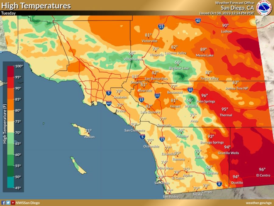
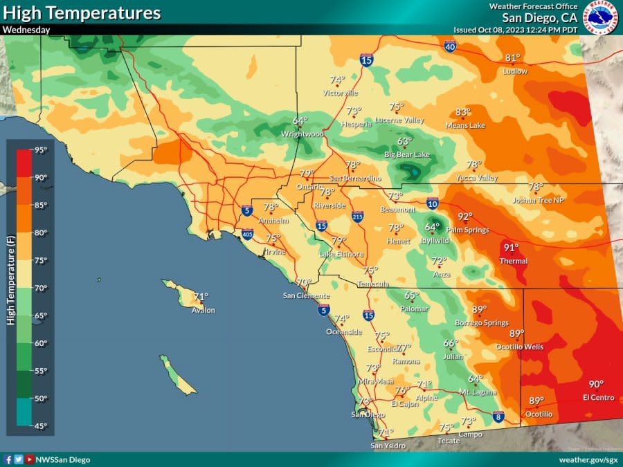
The cooling trend will continue into the week as the low pressure system moves, bringing the lowest daytime temperatures for the week on Wednesday.
Coastal and mountain communities will see highs around 60 to 65 degrees, NWS says. Inland valley highs will range from the low 70s to just shy of 80 degrees. Desert areas will still be feeling the heat, with highs expected to hit anywhere from 89 degrees to 95 degrees in some places.
High temperatures on Monday. (Courtesy of National Weather Service) High temperatures on Tuesday. (Courtesy of National Weather Service) High temperatures on Wednesday. (Courtesy of National Weather Service)
The early-week cooldown will also bring with it a deepened marine layer, enabling low clouds and fog to spread inland to the coastal slopes overnight into the morning.
Gusty westerly winds are anticipated each afternoon and evening through the beginning of the week for the mountains and adjacent desert areas due to the stronger onshore flow. According to NWS, individual gusts of 35 to 50 miles per hour are expected.
Later in the week, NWS says a weak dynamic ridge will start to move over the region, warming temperatures slightly to reach seasonal averages for most areas. The marine layer will also become a little shallower, with low clouds and fog not reaching as far inland.
For the latest news, weather, sports, and streaming video, head to FOX 5 San Diego.

