These Apocalyptic Photos Show Just How "Critically Low" Water Levels Are In The American West
It's one thing to read about the water shortage facing the American West. It's another thing altogether to see it for yourself.
1.Take, for example, Shasta Lake, the largest water reservoir in California, which is at just 48% of its historical average storage level for this time of the year.

Shasta Lake supplies about one-fifth of the Golden State's developed water supply.
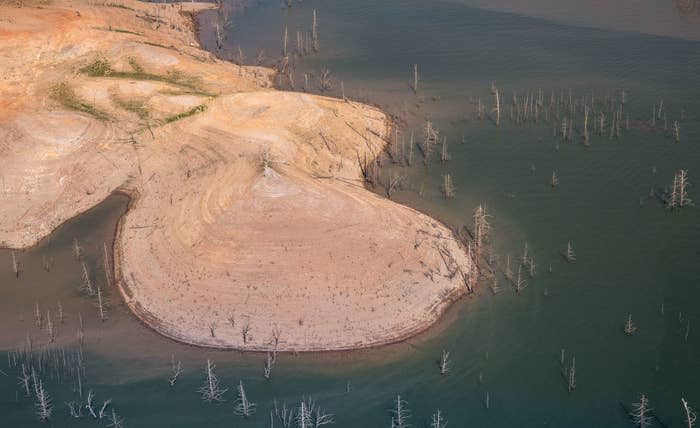
2.In fact, its water level is the lowest it's been since at least 1976, exposing Martian-like terrain that's been underwater for decades.
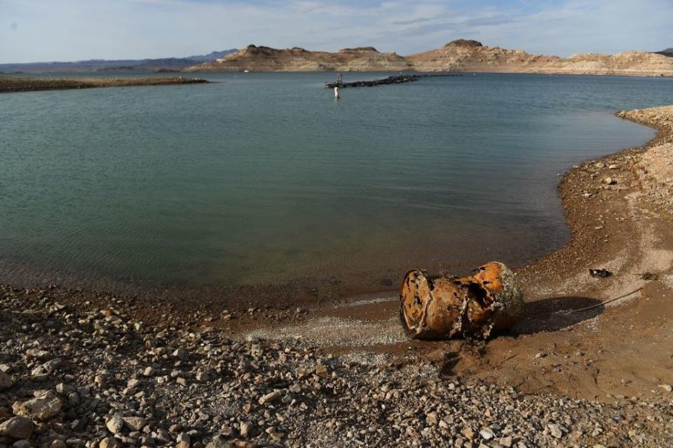
3.The problem extends beyond California, though. Water levels at Lake Mead, the country's largest manmade reservoir, have dropped low enough to expose one of its three intake valves, meaning that — for the first time since 1971 — it can no longer draw in water.

4.Just a week ago, boaters at Lake Mead found a barrel, exposed by dropping water levels, that contained the remains of a suspected murder victim from the late '70s or '80s. New human remains were then discovered at the lake on Saturday — and authorities expect to find more as the drought deepens.
5.The Enterprise Bridge below once spanned the waters of Lake Oroville, the second largest reservoir in California. Now, it crosses little more than a trickle, with the lake at just 55% of its total capacity.

6.Perhaps nothing illustrates the crisis better than these photos comparing Lake Powell in summer 2021, which itself saw historic lows...

7....and spring 2022, which saw water levels drop — again — to their lowest level since the lake was created by damming the Colorado River in 1963.
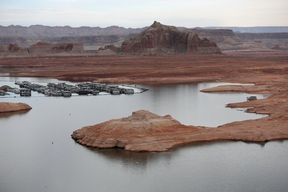
Lake Powell, along with Lake Mead, supplies water to 40 million people in seven western states.
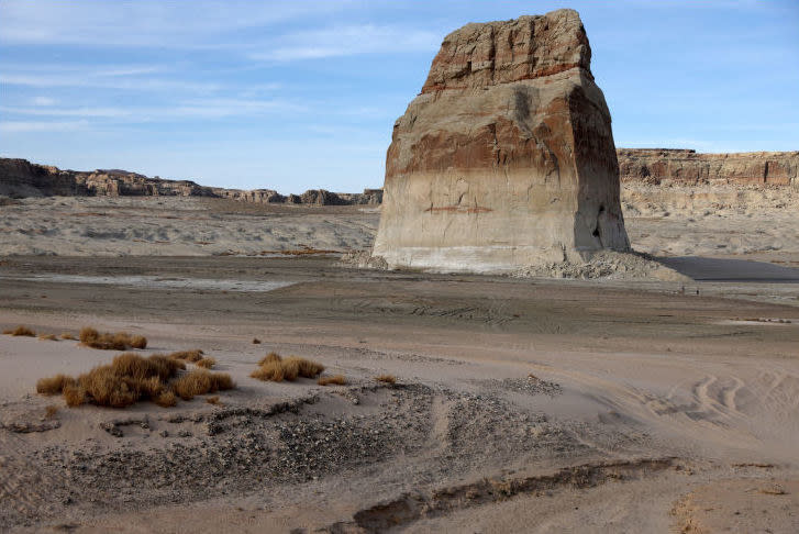
8.Here's Lone Rock Beach on Lake Powell in 2021:
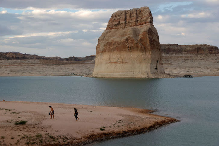
9.And here it is in late March of this year:
10.Low water levels at Lake Mead have left a bathtub ring along its banks — one that continues to grow by the year.

11.Ditto at Lake Powell, which has dropped 44 feet in the past year alone.

12.Literal tumbleweeds now blow across the dry, cracked earth once submerged beneath Lake Powell.

13.This boat ramp at Lake Powell doesn't even come close to touching the water anymore.

14.The water shortage also threatens the region's energy supply: Lake Powell is currently just 33 feet above the minimum power pool, or the threshold needed for the Glen Canyon Dam to be able to generate electricity.

15.Similarly, Lake Oroville's Edward Hyatt Power Plant might be forced to shut down if water levels continue to drop.

16.The images are apocalyptic.

17.Were it not for the trees and sky in the distance, the landscape around Shasta Lake might be confused for that of another planet.

18.Houseboats look more like interplanetary spacecraft than aquatic recreational vehicles.

19.And they compete for increasingly limited space as the lake shrinks.

20.No, this is not a major international canal. It's a line of houseboats in a depleted Lake Oroville.

21.Signs of the crisis are everywhere, like on the piers supporting this bridge near Redding, California.

22.A marooned boat here, an unnecessary buoy there.

23.No swimming. No fishing. And most dire, no water.


