Crews carve through solidified lava to make evacuation route near Kīlauea
Solidified lava that made a road impassable in Hawai'i Volcanoes National Park has been removed so the road could serve as an emergency evacuation route if needed.
Chain of Crater Road is a 19-mile stretch of road that extends through Hawaii Volcanoes National Park, starting near the summit of the Kīlauea and winding its way down to the coast.
"Opened in 1965, the road has been blocked by lava for 41 of its 53-year existence," the National Park Service (NPS) said in a news release.
"Work began May 30 to remove a 0.7-mile-wide section of solidified lava from the now-defunct 61g lava flow that covered the emergency road in 2016 and 2017," the statement said.
Clearing hardened lava flows can be time-consuming as it requires heavy equipment and hydroponic hammers to drill through the rock. The time it takes to clear the rock also depends on the height of the lava flow.
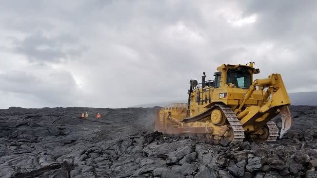
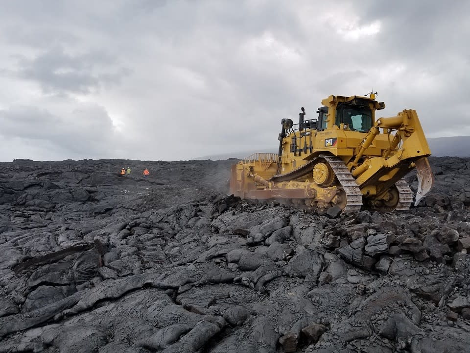
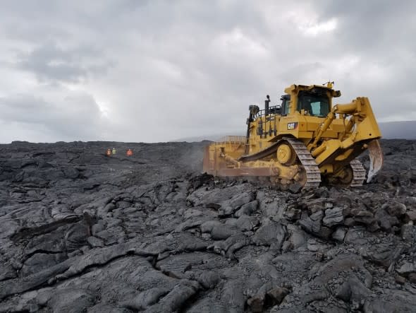
A bulldozer prepares Chain of Craters-Kalapana Road as an emergency evacuation route for the community. (NPS Photo/Mike Theune)
On Tuesday, officials said that the section of the Chain of Crater Road is ready for use if Highway 130 becomes impassable, Big Island Now reported.
While the section of road is now passable, crews will continue to work in the area to improve the surface of the freshly-cleared road.
"The route is for evacuation purposes only and will not be an alternate route for travel to and from the Kalapana area," the NPS said.
Chain of Crater Road runs through the Kīlauea section of Hawai'i Volcanoes National Park, which is where the Kīlauea caldera is located.
This area of the park has been closed to the public since May 11 due to damaging earthquakes, corrosive volcanic ash and continuing explosions from the summit crater of Kīlauea.
"Unlike lava, which you can see coming and avoid, we cannot see or predict earthquakes, nor can we foresee a summit explosion, but both threats continue," Park Superintendent Cindy Orlando said.
Related Video: New Lava Flow Destroys Homes in Hawaii
Watch news, TV and more on Yahoo View.
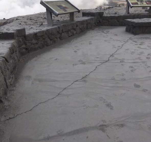
The recent magnitude 5.5 earthquake that rattled the island caused a large crack to develop at the Jaggar Museum overlook at the Kīlauea Visitor Center. Additionally, the park is without running water.
"We'll only reopen when it is safe to do so, and we will need time to assess, make repairs and clean up," Orlando said.
Damage to Jaggar Museum overlook following 5.5 earthquake on June 3, 2018. (Photo/NPS)
Another emergency route is being constructed in the area should the volcanic activity damage the infrastructure that is currently in place.
On Monday, June 4, the Hawaii Department of Public Works announced that they have begun to work on an alternate emergency route for Highway 130 to the southwest of Leilani Estates.
"Motorists are advised to expect delays and to drive with caution as heavy machinery will be in the work area," the Department of Public Works said.
State Department of Transportation and the County of Hawai‘i, in partnership with Sanford's Service Center Inc., has begun work on an alternate emergency route for Highway 130. https://t.co/69xtuM6n9Y
— Mayor Harry Kim (@MayorHarryKim)
June 5, 2018
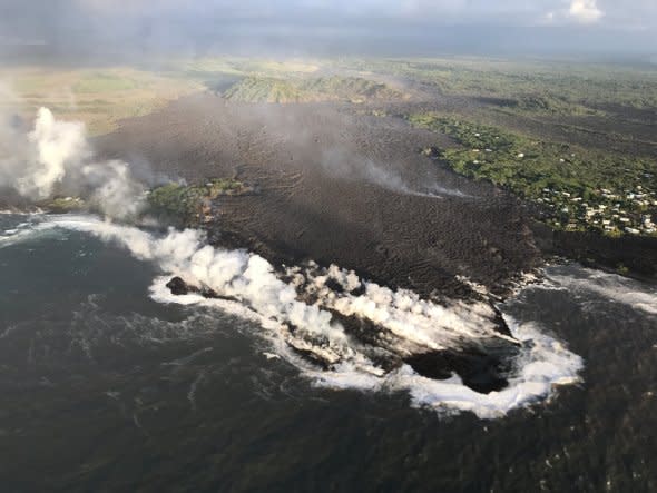
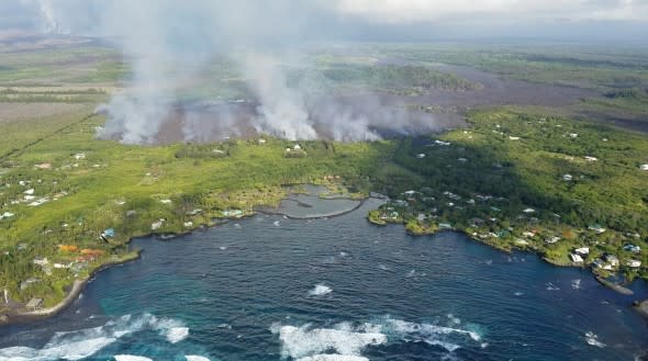
On Tuesday morning, it was confirmed that lava flowing from Fissure 8 completely filled in Kapoho Bay and caused extensive property damage near Vacationland Hawaii.
Hundreds of homes have been destroyed, but the exact number is still unclear. One of the homes that was destroyed belonged to Mayor Harry Kim.
"[Hawaiian Volcano Observatory]'s 6:30 a.m. HST overflight confirmed that lava completely fills Kapoho Bay, extending 0.7 miles from the former coastline," the USGS said.
"Lava is entering the water at the Vacationland tidepools, having inundated most of that subdivision," the USGS added.
Fissure 8 continues to feed a channel transporting lava to the northeast along Highway 132 and east to the ocean entry in Kapoho Bay, according to a USGS.
Kīlauea Status Report 8:10 a.m. HST on June 5, 2018: Fissure 8 130-160 ft fountains; Kapoho Bay filled by lava; much of Vacationland and Kapoho Beach Lots inundated; Fissure 8 north flow slight advance overnight. (Twitter/ USGS)
A photo from a helicopter overflight at 7 a.m. HST Sunday, hovering offshore and looking up the flowfront near Kapoho Bay. (Photo/USGS)
Imagery taken by our WorldView-3 satellite from June 3, 2018 shows the active lava flows approaching Kapoho Bay. See our color, near-infrared and SWIR images. #Kilauea#Hawaii#volcanopic.twitter.com/EuksdBUXVP
— DigitalGlobe (@DigitalGlobe)
June 4, 2018
