Conditions worsen as major snowstorm spreads over Prairies
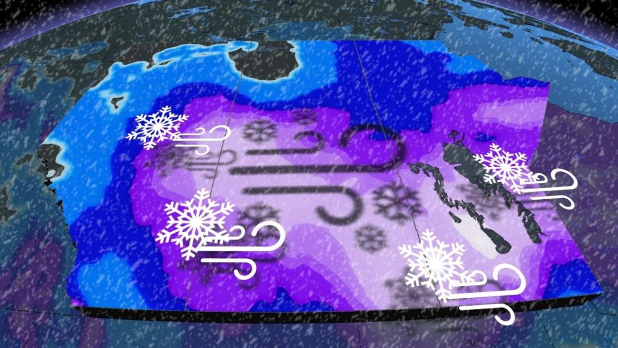
Warnings span the Prairies from Calgary to Winnipeg as a major storm develops over the region through the weekend. Heavy snow and gusty winds led to near-blizzard conditions on Saturday, and conditions will worsen heading into Sunday.
Expect high snowfall rates and gusty winds to spread throughout the region heading into Sunday. Whiteout conditions are possible for many areas. Travel will be difficult if not impossible on highways and side roads alike during the storm’s peak. Road closures are likely.
MUST SEE: Expect a turbulent March across Canada as the seasons duke it out
Snow and winds intensify and spread into Sunday
A low-pressure system developing south of the border spilled snow across southern portions of Alberta and Saskatchewan through the day Saturday. Heavy snow and gusty winds led to near-blizzard conditions in Saskatoon at times on Saturday afternoon.
Road conditions quickly deteriorated through Saturday evening for areas experiencing poor visibility from snow and gusty winds.
Folks across Alberta will see snowfall ease on Sunday as the system continues to strengthen and push east across Saskatchewan and into southern Manitoba.
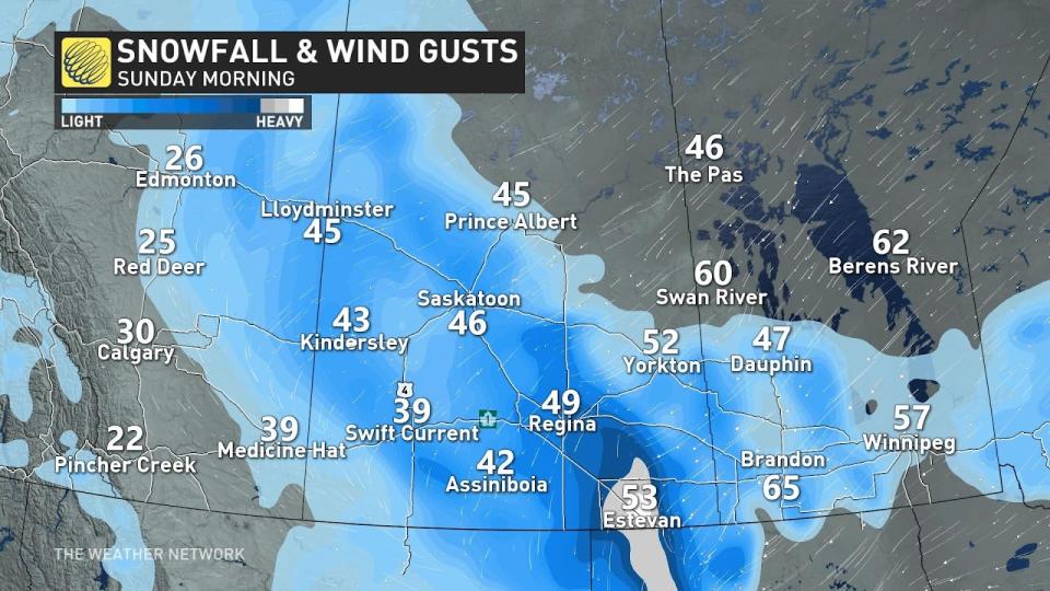
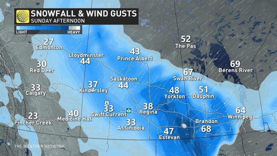
Heavy snow is likely across much of southern portions of Saskatchewan and Manitoba by Sunday morning, continuing through the day. Very heavy snowfall rates of 2-4+ cm per hour are possible around the Yellowhead Highway during the storm’s peak on Sunday.
Blowing snow a significant concern for weekend travel
Cold temperatures across the western half of the Prairies will make this a light and fluffy snow, which accumulates in a hurry and easily blows around in gusty winds.
Gusty winds of 50-70 km/h will accompany the heavy snowfall across the region, leading to extended periods of severely reduced visibility. Blizzard conditions will continue through Sunday and end Monday morning.
Complete whiteouts are likely at times. Travel will be difficult if not impossible on all roads across the region during heavy snow and high winds.
Expect tough if not impossible travel during the height of the storm into Sunday, especially along most of the Yellowhead Highway east of Edmonton. Road closures are likely in the hardest-hit areas due to rapidly accumulating snow and poor visibility.
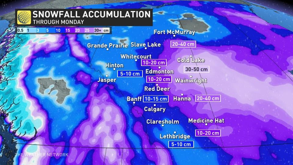
Snowfall totals of 40+ cm are possible
The greatest accumulations in Alberta will largely miss the QE2, with 10-15 cm in the forecast across Calgary, and potentially as much as 20 cm for Red Deer and Edmonton. Farther east, we could see well over 20 cm of snowfall by the end of the weekend around Oyen and Cold Lake, with totals of 40+ cm possible around Lloydminster.
RELATED: Avalanche warning issued as snow piles up in the Rockies
Since the snowfall is anticipated to be light and fluffy, accumulations will likely exceed forecast amounts in some areas.
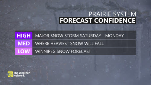
Forecasters expect the heaviest snowfall totals to target central and southern Saskatchewan, and southwestern Manitoba, where 20-40+ cm of snow is possible by the time precipitation wraps up on Monday.
Folks around Regina in the south could see 15-30 cm of snow by Monday. It would only take a slight shift in the storm's track to bump these higher totals toward the north or south.
The greatest uncertainty surrounding this storm is the potential for a sharp cutoff in snowfall totals around Winnipeg. That is due to the centre of low tracking across the Red River Valley, and as it does so, pulls in warmer air with it and will elevate the risk of a wintry mix.
This intrusion of warm air into southern Manitoba could force a changeover to ice pellets in and around Winnipeg, which would significantly cut down snow accumulations here. Warmer temperatures will also make for wetter snow in Manitoba as opposed to the light and fluffy powder expected to the west.
Snow will continue overnight Sunday and start to taper off by Monday morning. The precipitation will end by Monday afternoon as the storm moves northeast.
Stay with The Weather Network for all the latest on this snowstorm across the Prairies.

