Storms move out of the region; Not as hot later this week
QUICK-LOOK FORECAST:
Isolated evening storms possible
Daily storm chances continue
Not as hot later this week
>>TRACK THE LATEST CONDITIONS: Live Doppler 7 Radar
DETAILED FORECAST:
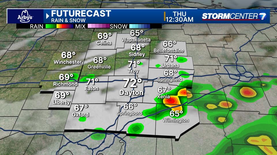
TONIGHT: Partly cloudy with isolated thunderstorms possible this evening, mainly along and southeast of the I-71 corridor. says Storm Center 7 Chief Meteorologist Austin Chaney.
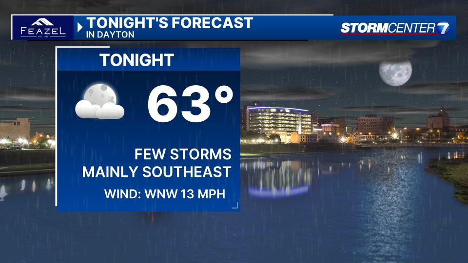
Much of the Miami Valley may finish the evening dry. If a strong storm develops, damaging winds would be the main threat. Temps in the 80s this evening give way to lows in the low 60s overnight.
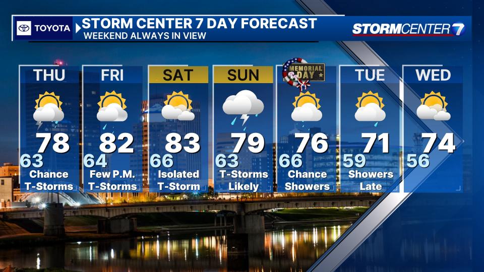
THURSDAY: Partly cloudy with a few more storms possible, especially south of I-70 with highs in the upper 70s.
FRIDAY: Partly cloudy to mostly cloudy. A few storms are possible, mainly late in the day and at night. Highs around 80..
SATURDAY: Partly cloudy with a chance of an isolated shower or storm. Highs in the lower 80s
SUNDAY: Showers and storms looking more likely. There will be the possibility of some stronger storms. Highs in the upper 70s to near 80.
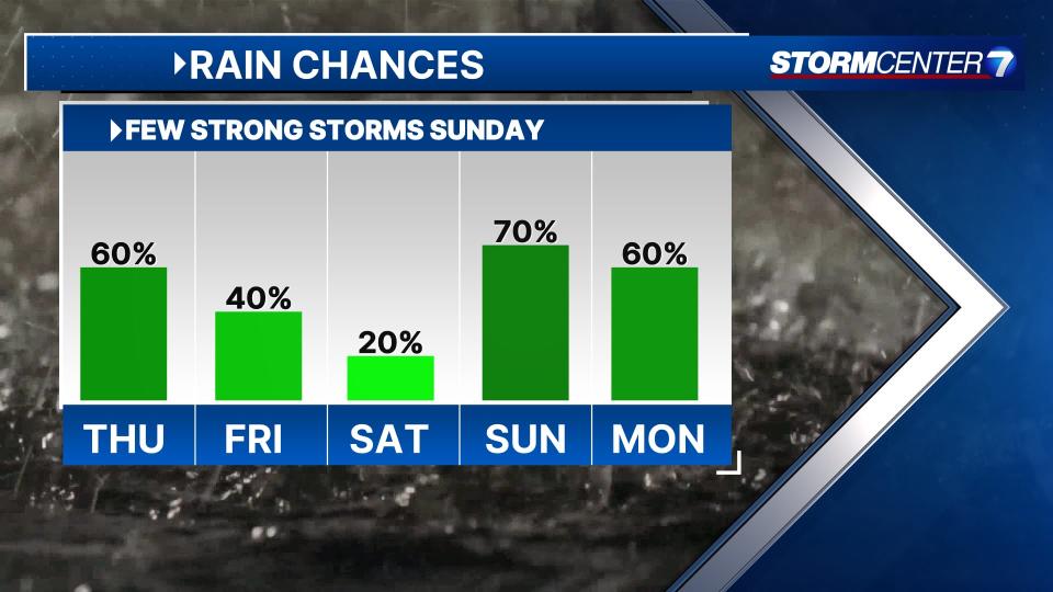
MONDAY: Partly cloudy with a chance for showers and storms. Highs in the upper 70s.
TUESDAY: Partly cloudy with another chance for showers and storms. Highs in the mid-70s.
WEDNESDAY: Partly cloudy. Looking like a dry day for now. Highs in the low to mid-70s.