Chance of severe weather through tonight; Heavy rain, damaging winds, tornadoes possible
Now through Tuesday night will be very busy for the Miami Valley.
We have a substantial risk of severe weather through tonight.
Storm Center 7 Weather Specialist Nick Dunn is tracking this system and will have the latest starting at 4:25 a.m. on News Center 7′s Daybreak.
>>Severe weather possible today; Flood watch for entire region through tonight
FLOODING:
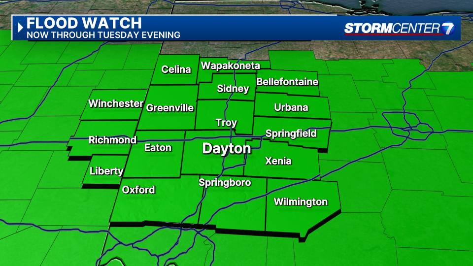
First, there is a risk of flooding. Grounds are saturated across the region following recent heavy rainfall.
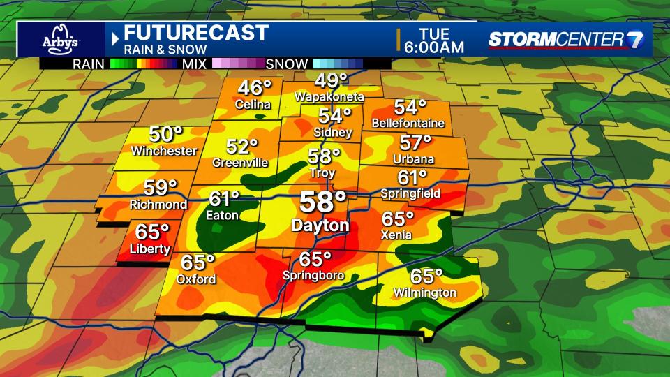
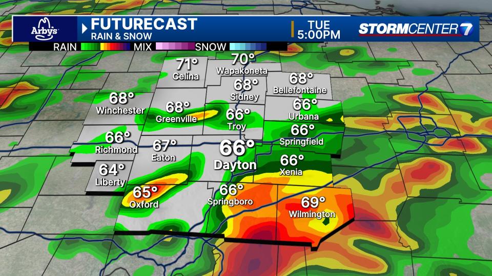
Heavy rain is likely this morning, and an isolated severe storm remains possible, according to Dunn.
Tuesday afternoon into Tuesday night, storms will bring additional heavy rain.
An additional two to four inches of rain is possible by the time it is all said and done, and a flood watch is in effect for the entire region, Dunn said.
The main things to remember with localized flooding are to turn around, don’t drown when you come across a flooded roadway, and if you live near a river, creek, stream, or other body of water that tends to flood, know those water levels may be rising over the next day or so.
>>TRACK THE LATEST CONDITIONS: Live Doppler 7 Radar
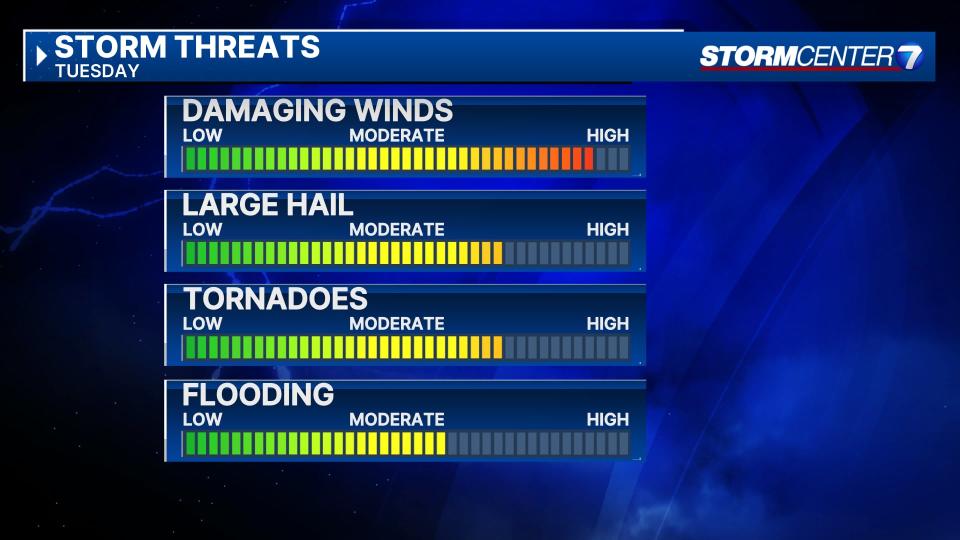
SEVERE WEATHER RISK:
We have the chance for a few severe storms through daybreak today. Damaging winds, hail, and the possibility of a brief tornado will be a threat overnight. We need to not let our guard down on this risk, but the more significant risk arrives on Tuesday.
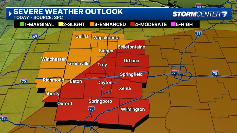
The Storm Prediction Center has placed a level three (Enhanced) to a level four (Moderate) risk of severe weather for the Miami Valley, according to Dunn.
This has changed a bit from Monday night, however, still significant for the area. This means a severe weather outbreak of damaging winds, hail, and tornadoes is possible. A few strong and/or long-track tornadoes are possible.
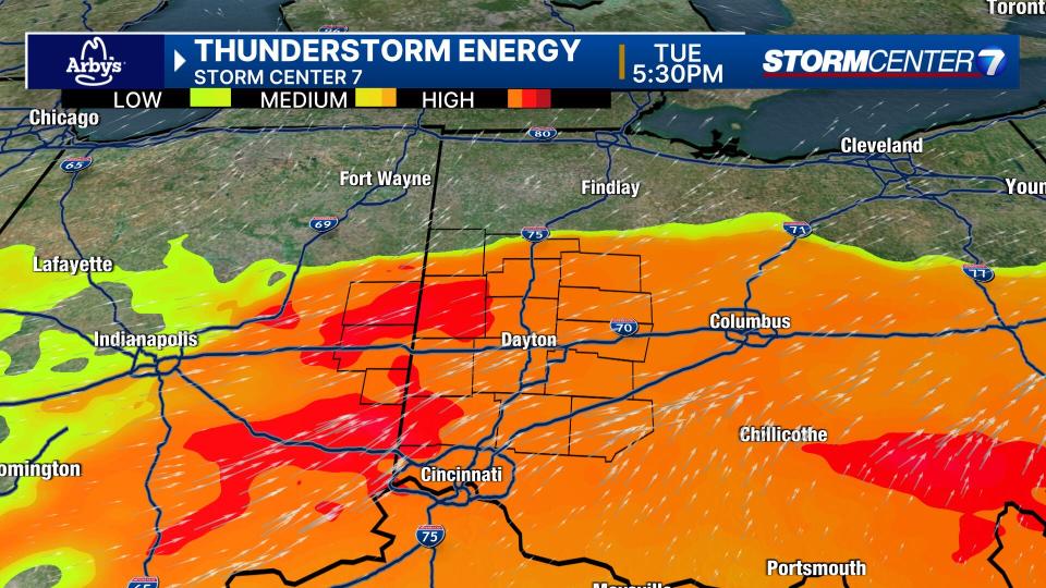
The greatest risk for severe weather should occur between 3-10 p.m. on Tuesday. All severe weather hazards will be possible.
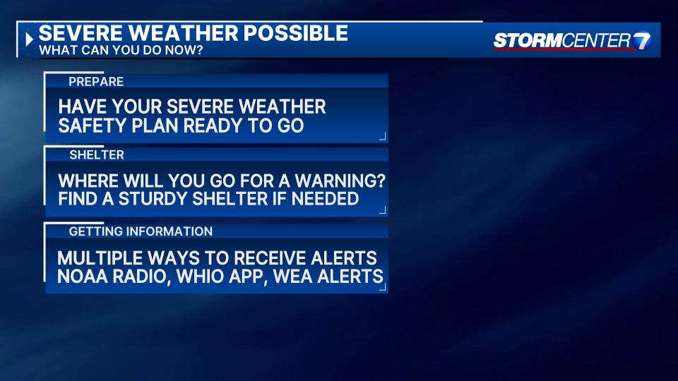
Now is the time to know where you would go if a tornado warning comes out. If you live in a manufactured or mobile home, make plans to be at a sturdier structure, like a friend or family member’s house, tomorrow evening.
We will continue to follow this story.

