Chadwick Flyer Trail development will soon move into Springfield. Here's what is planned
The new Chadwick Flyer Trail is slowly making its way toward downtown Springfield, bringing new features and safety elements along the way. But for the trail to come to life, there are hurdles the city and the Ozark Greenways need to overcome.
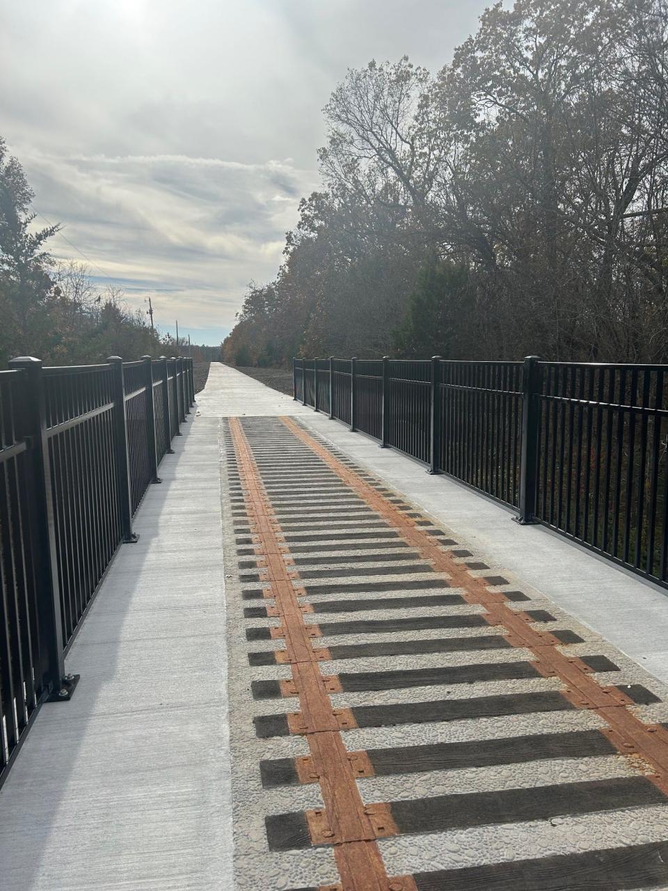
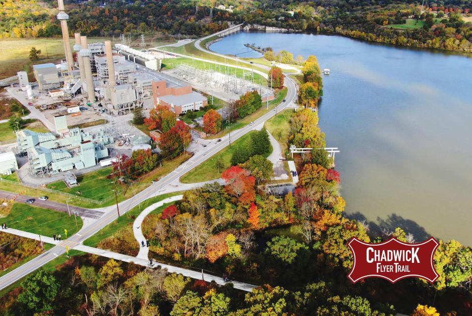
The regional trail will span 12 miles and connect downtown Springfield to Ozark Community Center in Christian County. The project will cost an approximate total of $20 million, with much of the funding yet to be identified. Currently, 3.2 miles of the trail have been completed — 1.4 miles in three segments in Ozark and 1.8 miles in Greene County by the James River Power Station up to Kissick Avenue. Almost half — 5.6 miles — of the trail remains unfunded.
The segment of the trail at the forefront of current trail development will connect Kissick Avenue to Sunshine Street by Oak Grove Avenue and feature connections to other regional trails. Ozark Greenways was awarded $3 million to go toward trail planning and development in this area. The portion of the trail that has secured construction funding will connect the completed segment at Kissick Avenue along Lake Springfield to Trail of Honor by the Missouri Veteran's Cemetary.
Railway negotiations stall trail's progress
Ozark's portion of the trail up to the county line may seem further ahead but Ryan Stehn, civil engineer at Crawford, Murphy & Tilly, said that is only because BNSF Railway had already abandoned the rails there. The city of Springfield has been in negotiations with BNSF to acquire the corridor that follows north to Sunshine Street in order to move forward with the trail.
These negotiations can be lengthy and slow. The project is tied to $3 million in American Rescue Plan Act (ARPA) funds from the city that have to be spent by the end of 2026. Because of this deadline, Stehn said that the portion from Kissick along Lake Springfield will be completed by that time to ensure that money isn't lost. At a recent ARPA Review Committee meeting, committee members worried about rail negotiations slowing down expenditure of the funds. As of Feb. 14, 11% of the allocated ARPA funds had been spent. They were reassured that the money can always be used for the design or study of other parts of the trail in order to meet the deadline.
Completing this portion will still provide a northward connection via the Galloway Creek Greenway Trail through the Trail of Honor and James River Greenway. But construction of the remaining Chadwick Flyer, running parallel to the Galloway Creek Greenway, still does not have a timeline or funds. Despite this, the trail plans include components to make the trail more welcoming and safer for all who use it.
Under- and overpass, new crossings planned
The entirely paved trail will cross over, and at times under, some large roadways in Springfield.
New crossings will come where the trail intersects Republic Road as well as Southern Hills Boulevard. A new enhanced crossing is planned for Covington Street. A trailhead with a paved parking lot is planned at the intersection of Republic Road and Lone Pine Avenue.
For those who may frequent the Galloway Creek Greenway the Battlefield Road underpass may be a familiar spot to avoid during high water times. Stehn said currently, the underpass has significant drainage issues that makes it impassable during wet conditions. To solve this, the Chadwick Flyer Trail will include another underpass and connections between the trails will be created to give those on the Greenway an alternative route.
The end portion of this segment of Chadwick Flyer includes a proposal of a pedestrian overpass across Sunshine Street.
Historic significance of Chadwick Flyer Trail
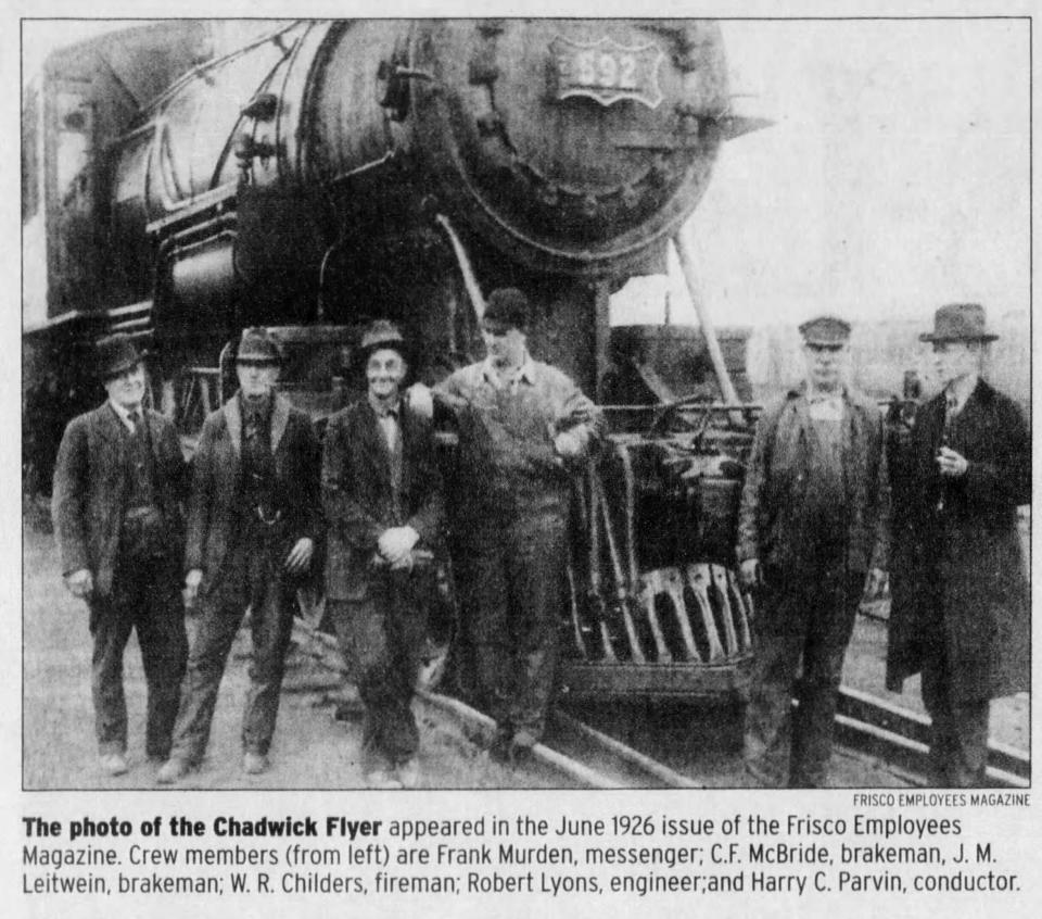
The Chadwick Flyer was part of the old St. Louis San Francisco Frisco Railroad and was originally established to transport timber and railroad ties produced in Christian County for railroad expansion to the west. The Chadwick Flyer made daily trips on the corridor, carrying both cargo and passengers, between Springfield and Chadwick, according to the Ozark Greenways.
More: New multistate cycling trail to extend through the Ozarks, connect Louisiana to Minnesota
Though named the Flyer, the train only traveled at an average 10 mph. The Chadwick Flyer in its heyday ran 34 miles from the Frisco station on Commercial Street and Benton Avenue to Chadwick, where a hand-operated wooden turntable allowed the train to turn around, according to News-Leader archives.
For more information and updates on the trail visit the Ozark Greenways website.
Marta Mieze covers local government at the News-Leader. Contact her with tips at mmieze@news-leader.com.
This article originally appeared on Springfield News-Leader: Chadwick Flyer Trail plans include new crossings, safety measures

