California plans to divert 600,000 acre feet of San Joaquin River water. Here’s where | Opinion
Fresno County’s newest large-scale water storage project is happening below ground.
With California inundated by rain and snow, state and federal water regulators hatched a plan to help replenish underground aquifers further depleted by heavy agriculture pumping during the recent drought.
In an agreement announced last week, more than 600,000 acre-feet of floodwater from the San Joaquin River system will be diverted and allowed to soak back into the earth in areas with permeable soils and wildlife refuges.
How much water is 600,000 acre-feet? Enough to overflow Millerton Lake, which stores 520,000 acre-feet at capacity. Or enough to meet the annual needs of more than 1 million average households.
So not a trivial amount of life’s most precious liquid. Returned to the aquifer so it can be reused during one of the not-so-rainy years that are sure to follow.
Opinion
“Coming off the heels of the three driest years in state history, California is taking decisive action to capture and store water for when dry conditions return,” said Gov. Gavin Newsom, whose strategy to increase the state’s water storage capacity highlights capturing storm water and groundwater recharge.
A temporary order by the state Water Resources Control Board allows the U.S. Bureau of Reclamation, the federal agency that operates Friant Dam and other Central Valley Project infrastructure, to divert up to 2,200 cubic feet per second of San Joaquin River water at Mendota Pool from March 15 to July 30, provided a number of stipulations are met. Among them are adherence to minimum-flow requirements for chinook salmon as mandated by the San Joaquin River Restoration Program.
The order essentially allows water districts and other agencies to enter into temporary contracts with the federal government to divert flood waters to areas with soil permeable enough for groundwater recharge. Some will be sent to the San Luis National Wildlife Refuge, Mendota Wildlife Area, Los Banos Wildlife Area and others.
This action wouldn’t be possible without the largest snowpack in the southern Sierra Nevadas recorded in at least 40 years. Even recent warmer storms that brought rain to lower mountain elevations increased the snowpack’s overall size when measured by snow water equivalent, according to UCLA climate scientist Daniel Swain.
Relevant information for those of us living below the “largest snowpack in recorded history” in the southern Sierra. https://t.co/Ey4vyScy3h
— Marek Warszawski (@MarekTheBee) March 12, 2023
Local groundwater recharge efforts
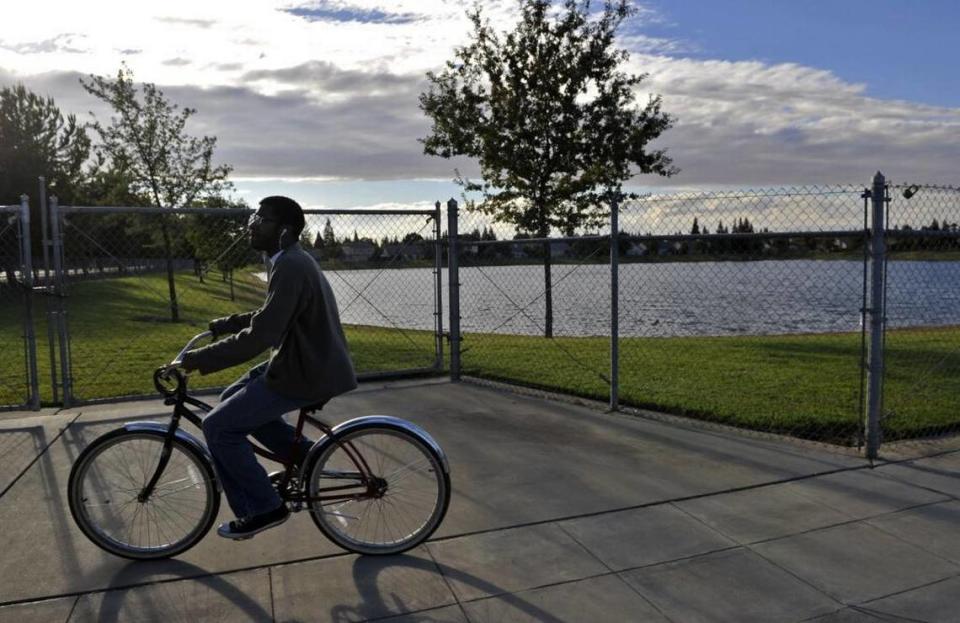
Groundwater recharge certainly isn’t a new concept to Fresno County. Local water managers have been taking advantage of rainy and snowy years to store groundwater and replenish aquifers for decades.
“It’s in these wet years when you can really take a big gulp,” said Bill Stretch, Fresno Irrigation District general manager.
What state and federal agencies are proposing to do — take a “really big gulp” of 600,000 acre-feet over 4½ months — is on a different scale.
During 2017, the last really wet year, the combined agencies of the Fresno Irrigation District, the Fresno Metropolitan Flood Control District and the cities of Fresno and Clovis recharged a total of 176,000 acre-feet. Stretch, who provided that figure, added the anticipation is for similar volumes this year, if not slightly higher.
Over the last 15 years, FID by itself has recharged 550,000 acre-feet of groundwater at 35 basins, Stretch said. Much of that occurred in 2012, 2017 and 2019.
Further south, the Consolidated Irrigation District spanning Sanger, Reedley, Fowler, Selma and Kingsburg, has recharged 406,000 acre-feet since 2018 according to its website.
“People might poo-poo how much you can do in recharge basins, but there’s a lot you can put away in wet years,” Stretch said.
One year’s worth of recharge won’t significantly raise the water table. A 2022 study found that the rate of groundwater depletion in the Central Valley more than tripled during 2019-21 compared to 2003-18, and that 36 million acre-feet of water has been pumped since 2003.
However, 600,000 acre-feet of San Joaquin River water that would normally flow to the Delta (and probably cause flooding along the way) definitely doesn’t hurt.
Objections over salmon flows raised, refuted
The loudest objections came from the Natural Resources Defense Council and the Bay Institute, environmental organizations involved in the 2006 legal settlement with the Bureau of Reclamation and Friant Water Authority to restore salmon. Their primary concern is that if so much water gets diverted at Mendota Pool, there won’t be enough to provide spring-run salmon with mandated flushing flows.
State officials refuted that contention, both in the order and in interviews.
“There’s still going to be a lot of water moving down the San Joaquin,” State Water Board deputy director Erik Ekdahl told the Los Angeles Times. “The amount of water that will be re-diverted here is still relatively low compared to how much water will be flowing in the system.”
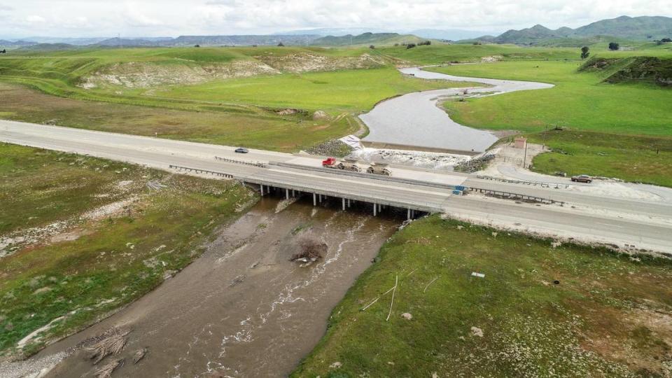
Fresno will have a front-row seat. Releases into the San Joaquin River from Friant Dam were 6,085 cfs on Monday, according to Millerton Lake’s daily operations report. Twelve months ago, flows were about 600 cfs. That’s 10 times as much water, and doesn’t include the inflow of feeder streams such as Little Dry Creek and overflow from the Big Creek Reservoir.
All that water will undoubtedly produce safety hazards. When temperatures turn hot, the abundance of cold snowmelt will prove tempting for many. Just as this column published Tuesday, the Fresno County Sheriff closed the San Joaquin and Kings rivers to recreational activities indefinitely. Months of high flows will also put aging infrastructure at certain San Joaquin River Parkway properties to the test. (Thinking about the bridge connecting Ball Ranch and Ledger Island in particular.)
Besides the benefits to the water table and the environment, the 600,000 acre-foot water banking deposit should put to rest the false and oft-repeated trope that California “wastes” water by “flushing it to the ocean.”
For a few months, anyway.

