What’s Boise’s risk of a tornado? Earthquake? Higher than you’d think, according to FEMA
Have you ever felt at risk of falling victim to a natural hazard while in Ada County?
Probably not.
Perhaps an especially heavy rainfall may cause localized flooding, or snow has resulted in dangerous round conditions. However, in general, we don’t have to look out for major tornadoes or brace ourselves for strong earthquakes like elsewhere in the United States.
But as it turns out, according to the Federal Emergency Management Agency, Ada County is the only county in Idaho that has a “relatively moderate” risk assessment on the National Risk Index.
The National Risk Index is a dataset that compiles data for 18 natural hazards and calculates the risk of each hazard occurring in a county.
Many coastal counties, such as those along the Gulf Coast, have a “relatively high” or “very high” risk assessment, mainly because of the threat of hurricanes and coastal flooding. The same can be said for the California coast, with the addition of an earthquake threat.
But why does Ada County have a “relatively moderate” risk assessment, the third-highest risk category?
Breaking down Boise’s risk assessment
The risk index uses a calculation to score each potential risk on a scale from 0 to 100.
The calculation considers the expected annual loss in terms of dollars from each natural hazard and multiplies it by the county’s social vulnerability score, which is determined by the potential adverse effects on a community caused by an external stressor, such as a natural hazard.
That total is then divided by the county’s community resilience score, which calculates a community’s ability to bounce back and adapt from a natural disaster. The resulting number is the county’s risk index rating.
Here’s how Ada County ranked for each risk:
Avalanche: Not applicable
Coastal flooding: Not applicable
Cold wave: Relatively high
With an expected annual loss of $1.2 million from bitter cold spells of weather, Ada County was rated “relatively high” with a score of 94.9. Boise endured one cold snap this past winter when temperatures bottomed out at 3 degrees on Jan. 15 and Jan. 16 and didn’t jump above freezing between Jan. 13-17.
Drought: Very low
Despite Ada County experiencing 16.4 drought events per year, according to FEMA, the expected annual loss is only $9,100, resulting in a score of 40.6. Most of southern Idaho, including most of Ada County, are heading into the spring with zero or little drought conditions.

Earthquake: Relatively moderate
You may not think of Ada County as a major earthquake zone, but large earthquakes occasionally happen in Idaho. A 4.9-magnitude earthquake was felt in Boise in February despite the epicenter being 75 miles north of Boise, and in 2020, a 6.5-magnitude quake shook Challis in central Idaho.
FEMA gives Ada County an earthquake score of 93.5, with a chance of an earthquake occurring at just 0.118% in any given year.
Hail: Relatively low
It’s not often that Ada County is pelted by large hail—FEMA estimates it happens about once every five years. The last significant hail to fall in the area was in June 2022, when coin-sized hail, about 1.25 inches in diameter, was recorded in Melba. FEMA forecasts an annual expected loss of $218,000 from hail damage, giving Ada County a risk assessment score of 68.7.
Heatwave: Relatively high
It’s no secret that summers are getting hotter in Boise. The City of Trees recorded one of its hottest-ever summers in 2022, reaching at least 100 degrees on 27 occasions, shattering the previous record of 20 in 2003. FEMA predicts annual losses of $4.2 million in Ada County from heatwaves, with the county almost averaging two yearly.
Hurricane: Not applicable
Ice storm: Relatively high
Ice storms only occur in Boise about once every 10 years, according to FEMA, but a predicted annual loss of $600,000 from ice-related weather resulted in Ada County receiving a 90.7 index score.
Landslide: Relatively moderate
Ada County and landslides don’t typically go together, with many of the state’s more dangerous landslides occurring in the Idaho Mountains north of Boise. However, the Boise Foothills provide a slight landslide threat under adverse conditions, resulting in an index score of 94.5.
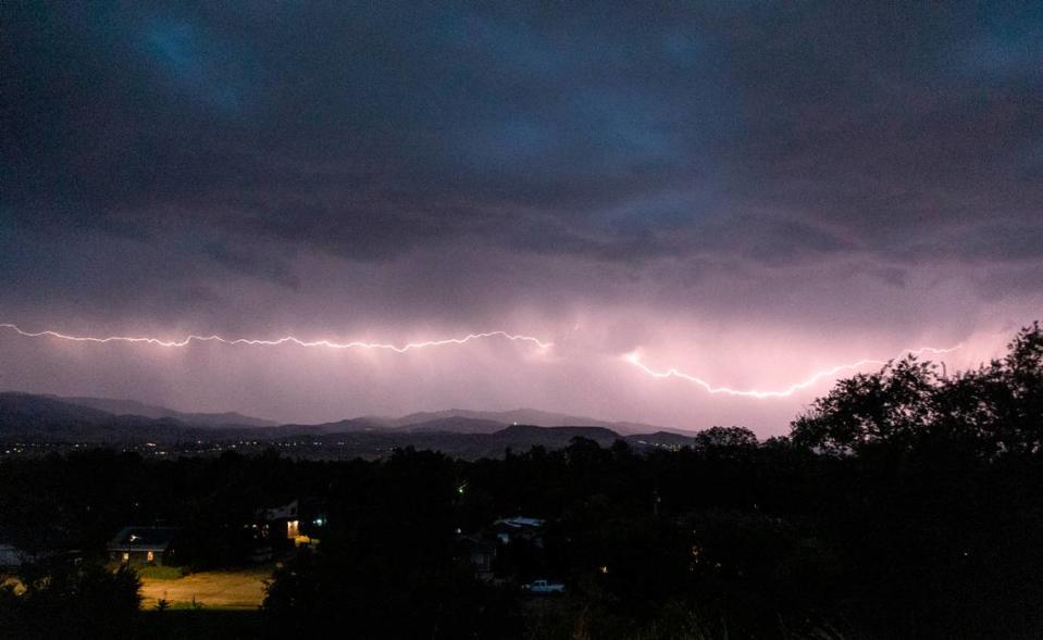
Lightning: Relatively high
The foothills are once again to blame for a “relatively high” index score. Lightning is often the cause of wildfires throughout Idaho; in 2021, the Idaho Department of Lands spent $68 million on fighting fires throughout the state, many of which were caused by lightning.
Riverine flooding: Relatively low
The Boise River runs right through the middle of Boise, while the Snake River makes up the southern part of Ada County. The Boise River occasionally overflows its banks during heavy rain events, such as in April 2023 when parts of the Boise River Greenbelt were closed due to flooding.
Although the flooding wasn’t major, FEMA predicts Ada County’s annual loss from river flooding at $887,000 and gives it a risk index score of 68.1.
Strong wind: Relatively moderate
When storms move into the Treasure Valley, they typically come from the west with eastward-blowing winds. Thanks to the Boise Mountains to the north and Owyhee Mountains to the south, those winds are channeled through the Treasure Valley, dropping in elevation from about 4,000 feet to 2,730 feet.
The inrushing wind can often cause gusts up to 55 mph. FEMA predicts annual losses in Ada County from strong winds can amount to $1.2 million.
Tornado: Relatively low
Tornadoes rarely occur in the Treasure Valley, but the chance isn’t zero. Ada County has experienced 12 tornadoes since 1950, the most recent being four that happened in one day on Aug. 3, 2000. The low, but not impossible, chance of tornadoes in Ada County resulted in an index score of 38.
Tsunami: Not applicable
Volcanic activity: Not applicable
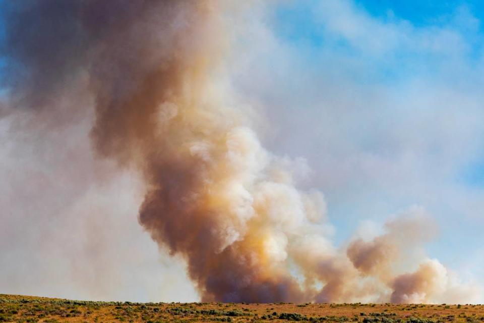
Wildfire: Relatively high
Although some of Idaho’s worst wildfires occur in less-populated areas of the state, it’s still rare for summer to go by without Ada County suffering from wildfires in the foothills and the plains south of Boise.
Last summer, roughly 4,500 acres of public land in the Boise Foothills were burned after intense heat and nearby artillery munition from the former Boise Army Barrack artillery range potentially caused a wildfire. FEMA predicts an annual loss of $25 million from wildfires for Ada County and gave the county a risk score of 99.5
Winter weather: Relatively high
Boiseans are accustomed to winter weather, with the city receiving around 20 inches of snow annually. This past winter, Boise saw 27.4 inches of snowfall, including 18.9 inches between Jan. 6 and 13.
FEMA forecasts that Ada County spends about $413,000 on winter weather events yearly, giving the county a risk score of 91.2.

